Aheloy Nunatak
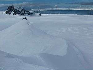
Aheloy Nunatak (Bulgarian: Ахелойски Нунатак, romanized: Aheloyski Nunatak, IPA: [ɐxɛˈɫɔjski ˈnunɐtɐk]) is a rocky 390m peak in the upper Huron Glacier in Livingston Island. The peak forms the northeast extremity of a minor ridge which also features Erma Knoll and Lozen Nunatak, and is linked to Zograf Peak by Lozen Saddle. The peak was first visited on 31 December 2004 by the Bulgarian Lyubomir Ivanov from Camp Academia, and was mapped in the Bulgarian Tangra 2004/05 topographic survey. The peak was named after the Black Sea town of Aheloy, Bulgaria.
| Aheloy Nunatak | |
|---|---|
 | |
| Highest point | |
| Elevation | 390 m (1,280 ft) |
| Coordinates | 62°38′23.3″S 60°07′53.5″W |
| Naming | |
| Pronunciation | [axɛˈlɔjski ˈnunatak] |
| Geography | |
| Location | Antarctica |
Location
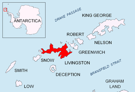
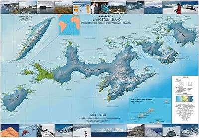
The peak is located at 62°38′23.3″S 60°07′53.5″W which is 1.6 km east-southeast of Kuzman Knoll, 2.48 km south by east of Maritsa Peak, 1.6 km north-northeast of Zograf Peak and 270 m north-northeast of Erma Knoll.
See also
- Tangra 2004/05
- Tangra Mountains
- Livingston Island
- List of Bulgarian toponyms in Antarctica
- Antarctic Place-names Commission
Maps
- L.L. Ivanov et al. Antarctica: Livingston Island and Greenwich Island, South Shetland Islands. Scale 1:100000 topographic map. Sofia: Antarctic Place-names Commission of Bulgaria, 2005.
- L.L. Ivanov. Antarctica: Livingston Island and Greenwich, Robert, Snow and Smith Islands. Scale 1:120000 topographic map. Troyan: Manfred Wörner Foundation, 2009.
References
- Aheloy Nunatak. SCAR Composite Gazetteer of Antarctica
- Bulgarian Antarctic Gazetteer. Antarctic Place-names Commission. (details in Bulgarian, basic data in English)