Afrin Dam
The Afrin Dam (Arabic: سد عفرين), officially 17 April Dam (Arabic: سد 17 نيسان), also called Maydanki Dam (Arabic: سد ميدانكي),[lower-alpha 1] is an earth-filled water storage and hydroelectric power dam on the Afrin River in northwest Syria. It provides drinking water to almost 200,000 people, irrigates about 30,000 hectares (74,000 acres) of olives, fruit trees and agricultural crops, and supplies 25 MW of hydroelectric power.
| Afrin Dam | |
|---|---|
 Satellite view 5 June 2002 - dam circled | |
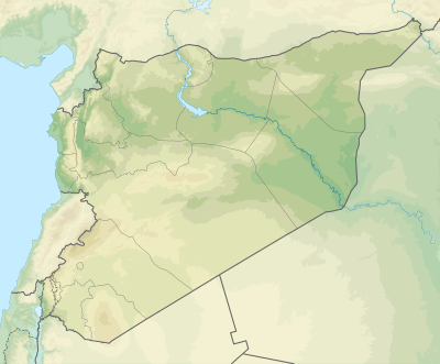 Location of Afrin Dam in Syria | |
| Official name | 17 April Dam |
| Country | Syria |
| Location | Afrin Canton |
| Coordinates | 36.623103°N 36.873184°E |
| Purpose | Reservoir |
| Status | Operational |
| Construction began | 1971 |
| Opening date | 24 April 1977 |
| Construction cost | 58.2 billion Syrian pounds |
| Dam and spillways | |
| Type of dam | Earth fill |
| Impounds | Afrin River |
| Height (foundation) | 73 metres (240 ft) |
| Length | 983 metres (3,225 ft) |
| Width (crest) | 22 metres (72 ft) |
| Width (base) | 385 metres (1,263 ft) |
| Spillways | 1 |
| Spillway type | Half-fan |
| Spillway capacity | 1,329 cubic metres per second (46,900 cu ft/s) |
| Reservoir | |
| Creates | Maydanki Lake |
| Total capacity | 190,000,000 cubic metres (6.7×10⁹ cu ft) |
| Catchment area | 1,365 square kilometres (527 sq mi) |
| Surface area | 9.25 square kilometres (3.57 sq mi) |
| Maximum length | 14 kilometres (8.7 mi) |
| Maximum width | 650 metres (2,130 ft) |
| Normal elevation | 339 metres (1,112 ft) |
Location
The dam is north of the town of Afrin in northwest Syria.[4] It is 70 kilometres (43 mi) from the city of Aleppo and 12 kilometres (7.5 mi) from the town of Afrin, near the village of Midaneka (Maydanki). A large part of the region is planted with olive and fruit trees. About 80% of the area depends on rainwater irrigation, and the remainder on wells and pumps. Before the dam was built the orchards and other crops were irrigated, but the olive trees were not.[5] The Afrin Canton is populated by Kurds, isolated from other Syrian Kurdish regions further east.[6]
The catchment area is 1,365 square kilometres (527 sq mi), with annual rainfall of 330 to 700 millimetres (13 to 28 in).[5] The Afrin River originates in the south of the Kartal Mountains in Turkey, crosses into Syria where it runs through the city of Afrin, and then crosses back into Turkey. About 250,000,000 cubic metres (8.8×10⁹ cu ft) of the annual flow of the river comes from the Hatay Province of Turkey, while about 60,000,000 cubic metres (2.1×10⁹ cu ft) originates in Syria.[7]
History
The dam was intended to irrigate land in the river valley in the region between Aleppo and the border with Turkey.[8] The project was approved in 1984 after extensive studies by the Ministry of Irrigation. The dam would control the river flow and prevent flooding, would irrigate up to 30,000 hectares (74,000 acres) of land, supply drinking water in the region, provide up to 20 MW of hydroelectric power and would become a tourist attraction.[9]
Construction began in 1997.[7] The dam was built for the General Water Resources Authority at a total cost of 58.2 billion Syrian pounds, including the cost of land acquisition for the reservoir.[5] 1,800,000 cubic metres (64,000,000 cu ft) of earth and rock was excavated during construction. The dam was inaugurated on 24 April 2004 in the presence of Prime Minister Muhammad Naji al-Otari.[5] Syrian state resolution No. 1849 of 2004 declared that the 17 April Dam Lake was a protected area.[10] A 2016 report noted that water usage appeared to have dropped due to the conflict in Syria.[1]
On 9 March 2018, during the Turkish military intervention in Afrin, armed units belonging to the Turkish-backed Free Syrian Army rebel faction and the Turkish Armed Forces seized control over the dam, capturing it from the Kurdish People's Protection Units (YPG).[11]
Dam
The earth-filled dam is 73 metres (240 ft) high, with a crest length of 983 metres (3,225 ft). It has a width of 385 metres (1,263 ft) at the base and 22 metres (72 ft) at the crest. The top of the dam is at an altitude of 339 metres (1,112 ft). The outlet tower has a cross-section of 20 by 20 metres (66 by 66 ft) and a height of 89.5 metres (294 ft). The half-fan spillway has capacity of 1,329 cubic metres per second (46,900 cu ft/s).[5]
A tunnel with a diameter of 5.5 metres (18 ft) and length of 280 metres (920 ft) provides for emergency discharge. A tunnel with a diameter of 15 metres (49 ft) and length of 295 metres (968 ft) is used to discharge drinking and irrigation water. There are also wells and tunnels for inspection and drainage of water infiltrating the dam. An innovative network of electrical measurement devices is installed in the body of the dam and the different facilities, including measurements of temperature and earthquakes. The hydroelectric plant provides 25 MW of power.[5]
Reservoir
The reservoir has a capacity of 190,000,000 cubic metres (6.7×10⁹ cu ft).[7] The reservoir is 14 kilometres (8.7 mi) long, and 650 metres (2,130 ft) wide in the center section.[5] It covers an area of 925 hectares (2,290 acres).[12] The maximum flow is 1,840 cubic metres per second (65,000 cu ft/s).[5] The irrigated area is 31,263 hectares (77,250 acres) in the Afrin district. Irrigation plans were 52% olive trees, 11% fruit trees, 31% crops such as wheat, barley, beets, watermelons and cotton, and 6% other vegetables.[5] Drinking water is supplied to about 197,000 people.[5]
Tourism
Maydanki Lake is a popular domestic recreational spot, often visited by Aleppians in summer for picnics and swimming. Local tourism diminished as result of the civil war, however, and mostly collapsed during the Turkish military operation in Afrin. Nevertheless, the region's tourism sector had begun to recover by July 2018, with two of the lake's ten cafes and restaurants reopened.[13]
Notes
- Karatas 2016, p. 117.
- 36.636995, 36.893959 – Google.
- List of names of villages and towns...
- Al Dbiyat & Geyer.
- سد 17 نيسان.
- Balanche 2016.
- 7: Orontes River Basin, p. 228.
- Sofer 1999, p. 208.
- سد 17 نيسان في منطقة عفرين.
- Resolution No. 1849 of 2004.
- "Turkey takes Afrin dam, nears city: media reports". Rudaw. 9 March 2018.
- Afrin dam – Syrian Civil Society.
- Khaled al-Khateb (26 July 2018). "Day trippers flock to Afrin's orchards as Aleppo restores security". al-Monitor. Retrieved 29 July 2018.
Sources
- "سد 17 نيسان (سد ميدانكي) في منطقة عفرين / The 17 April dam (Maidanki dam) in the Afrin area", Lokman Afrin (in Arabic), retrieved 2017-03-23
- "سد 17 نيسان في منطقة عفرين / The 17 April dam in the Afrin area", Tirej Afrin (in Arabic), retrieved 2017-03-23
- "36.636995, 36.893959", Google Maps, Google, retrieved 2017-03-22
- "7: Orontes River Basin" (PDF), Inventory of Shared Water Resources in Western Asia, Beirut: UN-ESCWA and BGR (United Nations Economic and Social Commission for Western Asia; Bundesanstalt für Geowissenschaften und Rohstoffe), 2013, retrieved 2017-03-22
- Afrin dam, ٍSyrian Civil Society support program, 15 May 2016, retrieved 2017-03-02
- Al Dbiyat, Mohamed; Geyer, Bernard, "The Orontes, a complex river", e-Atlas of the Orontes River basin: www.water-security.org, retrieved 2017-03-22
- Balanche, Fabrice (5 January 2016), The Die Is Cast: The Kurds Cross the Euphrates, Washington Institute, retrieved 2017-03-22
- Karatas, Atilla (April 2016), "Sustainable Water Management in Hatay: Hydrographic Planning Approach", Water Resources Management in the Lower Asi-Orontes River Basin (PDF), Graduate Institute of International and Development Studies and MEF University, ISBN 978-2-940503-70-4, retrieved 2017-03-22
- "List of names of villages and towns in the kurdish region of Afrin (Kurd-Dagh) in Syria", medan.comxa.com, retrieved 2017-03-22
- Resolution No. 1849 of 2004 declaring 17 April Dam Lake a protected area, 2004, retrieved 2017-03-22
- Sofer, Arnon (1999), Rivers of Fire: The Conflict Over Water in the Middle East, Rowman & Littlefield, ISBN 978-0-8476-8511-0, retrieved 22 March 2017