Administrative divisions of Santa Maria, Rio Grande do Sul
This is a list of the administrative divisions of the municipality of Santa Maria, in the Brazilian state of Rio Grande do Sul.
Districts
The municipality is divided into 10 districts (Portuguese: distritos):
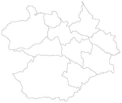
Map of the municipality of Santa Maria, Rio Grande do Sul, Brasil showing the division by districts.
| # | District | Distance from Sede | Population (2010)[1] | Date of creation [2] |
|---|---|---|---|---|
| 1st | Sede ("municipal seat") | 0 km | 246,465 (94.4%) | 17 November 1837 |
| 2nd | São Valentim | 12 km | 565 (0.2%) | 19 December 1997 |
| 3rd | Pains | 15 km | 4,146 (1.6%) | 29 April 1914 |
| 4th | Arroio Grande | 18 km | 2,702 (1.0%) | 19 December 1988 |
| 5th | Arroio do Só | 36 km | 944 (0.4%) | 4 March 1896 |
| 6th | Passo do Verde | 23 km | 531 (0.2%) | 19 April 1991 |
| 7th | Boca do Monte | 16 km | 2,941 (1.1%) | 4 March 1896 |
| 8th | Palma | 18 km | 856 (0.3%) | 19 December 1997 |
| 9th | Santa Flora | 36 km | 1,074 (0.4%) | 27 July 1962 |
| 10th | Santo Antão | 11 km | 807 (0.3%) | 28 December 2001 |
| Total Municipal Population | 261 031 (100.0%) | |||
Apart from the 1st District, all the others are administered by Subprefects (subprefeitos), each of them appointed by the municipal Mayor.
Bairros and Administrative Regions
Santa Maria is officially organized in 50 bairros ("neighborhoods"), 41 of which are located in the 1st District of Sede ("Seat"), which accounts for 94.4% of the total population in the municipality. The remaining 9 bairros are coextensive with the 9 rural districts.
The 41 bairros of the Seat District are further grouped into 8 regiões administrativas (or R.A., "administrative regions").
| District | Administrative Region | Bairros |
|---|---|---|
| Sede | R.A. Center |
|
| R.A. Center-East |
| |
| R.A. Center-West |
| |
| R.A. East |
| |
| R.A. North |
| |
| R.A. Northeast |
| |
| R.A. South |
| |
| R.A. West |
| |
| São Valentim | — |
|
| Pains | — |
|
| Arroio Grande | — |
|
| Arroio do Só | — |
|
| Passo do Verde | — |
|
| Boca do Monte | — |
|
| Palma | — | |
| Santa Flora | — |
|
| Santo Antão | — |
|
- Instituto Brasileiro de Geografia e Estatística (IBGE) (16 November 2011). "Sinopse por setores". Retrieved 3 February 2013.
- Enciclopédia dos Municípios Brasileiros (2007). "Santa Maria - Histórico" (PDF). Instituto Brasileiro de Geografia e Estatística (IBGE). Archived (PDF) from the original on 3 February 2013. Retrieved 3 February 2013.
This article is issued from Wikipedia. The text is licensed under Creative Commons - Attribution - Sharealike. Additional terms may apply for the media files.