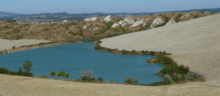
Accona Desert
Accona desert refers to a hilly area in the Siena province within the municipality of Asciano [43°14'4.30"N; 11°33'37.48"E] often enlarged to include the biancana site of Le Fiorentine - Leonina [ 43°17'32.95”N; 11°26'54.07"E]. The term desert is inappropriate from a physical and climatic point of view, rather the climate is Mediterranean with a hot dry summer and almost 800 mm/y of rain (Csa Köppen climate classification ). A real desert has never existed here, unless “desert” was a way of describing severely eroded areas, more properly called “badlands”, even if temporary ones.
Two main types of badlands [1] can be found in the area of the Crete Senesi, the Valdorcia and the Volterra areas of Tuscany: biancana (from bianco, white, due to the light color of the clay and of the saline efflorescence) and calanco (local name for a type of gully, a sort of ravine). Both are linked to processes of gully erosion, the former intermingled mainly with subsurface erosion and the latter with mass movements. Biancanas can be found also in Basilicata and in Calabria. The calanco landscape is common all along the Apennines and in many parts of the Alps. Both calancos and biancanas were used as grazing ground, with an almost annual burning of the vegetation in order to remove brush and favour herbaceous cover more palatable for sheep, goats and cattle. Both practices were abandoned in the 1990s to favour measures to preserve biodiversity and geoforms under the EU Natura 2000 programme. Conservation has almost stopped erosion in both types of badlands and vegetation now covers the majority of the once bare slopes. As there is a strong interrelationship between vegetation biodiversity and erosion/deposition processes, biodiversity is also currently threatened and the biancana landscape is forecast to disappear completely within 20–40 years as brush cover expands.[2][3][4] Spots where the traditional forms can still be observed are dispersed in the Crete Senesi and the Valdorcia, included within the quadrangle of vertices [43°16'10.58"N ; 11°15'59.30”E], [43°18'28.68”N; 11°39'4.92”E], [42°43'32.58”N; 11°42'22.98”E], [42°45'49.22”N; 11°58'41.90”E]. Leonina and Lucciola Bella [43° 2'4.85"N; 11°45'35.75"E] are two of the best sites for walking through the biancanas, while Chiusure - Monte Oliveto Maggiore (i.e., the ancient Accona) and Radicofani [42°55'8.14"N; 11°44'38.82"E] host the most impressive calancos.

History

Archaeological maps of Siena province show that all the Crete Senesi area was inhabited in Etruscan and Roman Times as almost every slope contains remnants of that period. The periods of the Barbarian invasions, the Gothic wars and the Justinian plague caused a demographic decline which reduced the anthropic impact on the environment and favoured the natural reforestation of the area. Nevertheless in the seventh century Asciano was already a Curtis Regia,[5] hence a village with a territory where agriculture and animal husbandry coexisted with hunting reserves used by the Lombard lords. In the tenth century documents show Leonina too as Curtis[6]. Other documentation, even if fragmentary, testifies to the existence of a stable settlement in Leonina[7][8]. At the time of the Black Death, (1348 with several return of the plague in the following 60–70 years [9][10] ) Leonina’s population halved from more than 150-160 to about 60 at the beginning of 1400. This fate was common to Siena, Asciano and the whole territory of the Sienese Republic: Siena’s population fell from about 50,000 before the Black Death to 14-16,000 in 1400-1450[11] (Ginatempo, 1990) and returned to pre-plague levels only at the end of twentieth century.
Asciano, with its surroundings, was a major town in the Sienese territory[12] for a long time and contributed to the Republic’s economy in a substantial way, gaining Sienese citizenship in 1369.
A few kilometers south of Asciano the small town of Chiusure grew around the seventh century church of Sant’Angelo in Luco, despite the fact that the hill on which the village is located would have been threatened by the approach of the heads of large (and deep) gully systems retreating upslope. It had an economy mainly based on agriculture and animal husbandry. Chiusure's importance is due mainly to its proximity to Accona about 1 km away. The members of three leading Sienese families (Tolomei, Patrizi and Piccolomini) founded in 1313 what became the Benedictine monastery of Monte Oliveto Maggiore (1320-1344) on the site of the Tolomei’s Accona podere (farm)[13]. Pius II (Enea Piccolomini) visited the monastery during his papacy (1458-1464) and described the area as rich in olive trees, fruit trees, almonds, vines, orchards, small cypress woods, oaks and junipers. Furthermore, Pius II added, there was water: a perennial spring, wells, tanks, cisterns[13] .
From this time until 1796 the monastery played a spiritual and economical leadership role in the area with its churches, monasteries and farms. Then, under French rule from 1797 all the Church possessions were confiscated and sold. Only after the Restoration did the Olivetan Benedictines recover the Monastery of Monte Oliveto and slowly resume their role as local leaders.
The environment and the anthropic influence
The Crete Senesi lie over plio-pleistocene silty-clay overconsolidated marine deposits, rich in sodium. Deep, narrow cracks (joints; [14]) cut the deposits to about 10m from the surface, favouring localized water infiltration and the excavation of subterranean tunnels. In natural, unstressed conditions, soils can develop as deep as 1.5 m, with removal of sodium by the leaching action of infiltration water. The present situation is characterized by the presence of eroded or poorly developed soils especially in the badlands[15]. Intense animal activities (trampling, overgrazing) and anthropic activities (deforestation, tillage operations, exposure of bare soil surface to weather agents on excessively sloping grounds) favour surface soil erosion, causing the generation of small rivulets, rills and gullies. The rate of soil erosion[1] varies from zero to 1-2 mm of soil removed yearly. If gullies are excavated by concentrating overland flow, erosion values in a field can attain 2-4 mm of soil loss in a single rain event. Excessive animal grazing facilitates gully erosion, soil slips and mass movements. Cropland management requires tillage (deep ploughing, seed bed preparation) and sometimes large earth movements. All these activities[16][17] cause a net movement of soil from the upslope side of the field to the downslope side. Soil in the upslope side of the field is lost at rates between 1 and 4 cm yearly. For medieval tilling techniques, the estimated erosion rate would have been around 2 cm/year. Considering an alternation of years with and without ploughing then 300 years would have been enough to expose the subsoil still rich in sodium. Sodium gives dispersive characteristics to the clay, making it very erodible, hence increasing the velocity of rain-induced erosion.
The first half of the fourteenth century was characterized by social unrest due to the transformation from farmers who owned their land to large land holdings with the property subdivided into poderi each managed by a farmer (mezzadro) and his family living on the fields in a cropsharing system[18]. At the same time foreign armies (e.g. Henry VII’s, mercenaries) passing through the Sienese territory interfered with normal activities in the countryside. Hence, erosion and floods are testified in several documents[19][20], in the Lorenzetti’s Buongoverno frescos (1340), that show biancanas, while severe floods are reported[19]. Also the climate was characterized by droughts and extreme events[19] [21] that led to a shortage of food in Italy and necessitated imports from abroad. This forced Siena to invest a large part of its wealth in facing these difficulties, thus diverting funds from other priorities such as flood prevention.
The second half of the fourteenth century the abrupt and large demographic decrease due to the plagues resulted in the farming population of small owners and mezzadri having to manage twice as much livestock and land per capita. With no resources for maintenance activity, the only use for a severely eroded field was animal grazing. Hence, the eroded fields became irrecoverable. The lack of personnel persisted for about two centuries during which the eroded areas expanded, reaching a maximum in the nineteenth century.
This picture is substantially confirmed by soil denudation rates as estimated using average erosion in the basin of the river Ombrone which drains the area and on the denudation rates of the two largest biancanas of the Leonina site and the gully in between[1].
Biancana badlands reclamation began at the end of the XIXth century and ended during the second half of the twentieth century when bulldozers removed almost all the biancanas and some of the smallest calancos, encouraged by EU subsidies then available under the Common Agricultural Policy[22][23]. Thus it can be said that damage mainly due to an epidemic (Black Death) was eventually solved by the EU-CAP of 1960-2000.
The Accona Desert
The natural and social history of the Crete Senese does not leave much room, both temporal and spatial for any physical desert. Nevertheless there certainly were large areas that progressively became severely eroded and devoid of vegetation.The Accona podere when Bernardo Tolomei retired there in 1313 may have been in poor conditions, certainly without any mezzadro. Hence, in all likelihood the desert of Accona referred at first to the absence of farmers in Accona and/or the lack of a strong spiritual leadership, a role that the Olivetans had filled. Later, in 1830-50 when the badlands were at their maximum, the label “Accona desert” was adopted by scholars and learned persons[24] [25] to convey the feeling of desolation felt when in the midst of the biancana fields or the calanco gullies.
References
- Torri, Dino; Rossi, Mauro; Brogi, Francesco; Marignani, Michela; Bacaro, Giovanni; Santi, Elisa; Tordoni, Enrico; Amici, Valerio; Maccherini, Simona (2018), "Badlands and the Dynamics of Human History, Land Use, and Vegetation Through Centuries", Badlands Dynamics in a Context of Global Change, Elsevier, pp. 111–153, doi:10.1016/b978-0-12-813054-4.00004-6, ISBN 978-0-12-813054-4
- Marignani, Michela; Rocchini, Duccio; Torri, Dino; Chiarucci, Alessandro; Maccherini, Simona (January 2008). "Planning restoration in a cultural landscape in Italy using an object-based approach and historical analysis". Landscape and Urban Planning. 84 (1): 28–37. doi:10.1016/j.landurbplan.2007.06.005.
- Maccherini, S.; Marignani, M.; Gioria, M.; Renzi, M.; Rocchini, D.; Santi, E.; Torri, D.; Tundo, J.; Honnay, O. (August 2011). "Determinants of plant community composition of remnant biancane badlands: a hierarchical approach to quantify species-environment relationships: Determinants of plant community composition of remnant biancane badlands". Applied Vegetation Science. 14 (3): 378–387. doi:10.1111/j.1654-109X.2011.01131.x.
- Torri, D.; Santi, E.; Marignani, M.; Rossi, M.; Borselli, L.; Maccherini, S. (July 2013). "The recurring cycles of biancana badlands: Erosion, vegetation and human impact". CATENA. 106: 22–30. doi:10.1016/j.catena.2012.07.001.
- Sessiano 714 Asciano 2014 : una storia di 1300 anni. Brogi, Francesco. [S.l.]: Venerabile confraternita di Misericordia e S. Chiodo. 2014. ISBN 978-88-908035-3-6. OCLC 1151722492.CS1 maint: others (link)
- Cammarosano, P.; Passeri, V. (2006). Repertorio delle strutture fortificate dal medioevo alla caduta della Repubblica Senese. In: Città, Borghi e Castelli Dell'area Senese-Grossetana. Siena: Monte dei Paschi di Siena. pp. 192–142.
- Ginatempo, Maria. (1990). L'Italia delle città : il popolamento urbano tra Medioevo e Rinascimento (secoli XIII-XVI). Sandri, Lucia. Firenze: Le Lettere. ISBN 88-7166-011-0. OCLC 22732581.
- Lusini, V. (1907). "I confini storici del vescovado di Siena". Bullettino Senese di Storia Patria. VIII: 195–273.
- Bowsky, William M. (1971). The Black Death: a turning point in history?. New York: Holt, Rinehart and Winston. ISBN 0-03-085000-2. OCLC 204448.
- Piccinni, G. (1995). Siena e la peste del 1348. In Storia di Siena. Barzanti, Roberto., Catoni, Giuliano., De Gregorio, Mario (eds). Siena: Edizioni ALSABA. pp. 225–238. ISBN 88-85331-07-6. OCLC 36112448.
- Ginatempo, M.; Sandri, L. (1990). L'Italia delle città : il popolamento urbano tra Medioevo e Rinascimento (secoli XIII-XVI). Firenze: Le Lettere. ISBN 88-7166-011-0. OCLC 22732581.CS1 maint: multiple names: authors list (link)
- Barlucchi, Andrea. (1997). Il contado senese all'epoca dei Nove : Asciano e il suo territorio tra Due e Trecento. Firenze: L.S. Olschki. ISBN 88-222-4514-8. OCLC 37727962.
- Piccinni, Gabriella (1982). Seminare, fruttare, raccogliere – mezzadri e salariati sulle terre di MonteOliveto Maggiore (1374–1430). Milano: Feltrinelli.
- Colica A., Guasparri G. (1990). "Sistemi di fratturazione nelle argille plioceniche del territorio senese. Implicazioni geomorfologiche". Atti Accademia dei Fisiocritici, Siena. 15, 9: 29–36.
- Calzolari C., Ristori, J., Sparvoli, E. (1993). "Soils of biancana badlands: distribution, characteristics and genesis in Beccanello farm (Tuscany, Italy)". Quaderni di Scienza del Suolo. III: 119–142.CS1 maint: multiple names: authors list (link)
- Borselli L., Pellegrini S., Torri D., Bazzoffi P. (2002). Tillage erosion and land levelling evidences in Tuscany (Italy). ESSC International Congress, 2000, Man and Soil at the Third Millenium Valencia (Spain), 28 March - 1 April, 2000: Geoforma, Logroño. pp. 1341–1350. ISBN 84-87779-45-X. OCLC 807709676.CS1 maint: multiple names: authors list (link) CS1 maint: location (link) CS1 maint: date and year (link)
- Borselli L., Torri D., Øygarden L., De Alba S., Martínez-Casasnovas J.A., Bazzoffi P., Jakab G. (2006). Land Levelling. in Boardman, J., Poesen, J. (eds.) Soil erosion in Europe. Wiley & Sons. Chichester, England. pp. 643–658. ISBN 0-470-85920-2. OCLC 85785028.CS1 maint: multiple names: authors list (link) CS1 maint: date and year (link)
- Piccinni, G. (2006). La politica agraria del comune di Siena. Roma: In: Cortonesi, A., Piccinni, G. (Eds.), Medioevo Delle Campagne, Viella, Roma. pp. 207–292. ISBN 88-8334-143-0. OCLC 65497978.CS1 maint: date and year (link)
- Piccinni, G. (1993). L'antropizzazione del paesaggio naturale: l'intervento dell'uomo sul paesaggio dal Medioevo all'Età moderna. In: Giusti, F. (Ed.), La Storia Naturale Della Toscana Meridionale. Monte dei Paschi di Siena,Siena. pp. 469–487.
- Bowsky, William M. (1981). A medieval Italian commune : Siena under the Nine, 1287-1355. Berkeley: University of California Press. ISBN 0-520-04256-5. OCLC 6649682.
- Bauch, M. (2018). "Contextualizing Drought in Medieval Italy: A Case-study of the 1302-1304 Events in Siena". Retrieved May 15, 2020.
- Torri, Dino; Poesen, Jean; Rossi, Mauro; Amici, Valerio; Spennacchi, Daniele; Cremer, Cati (2018-09-30). "Gully head modelling: A Mediterranean badland case study: Gully head topographic threshold for badlands". Earth Surface Processes and Landforms. 43 (12): 2547–2561. doi:10.1002/esp.4414.
- Amici, Valerio; Maccherini, Simona; Santi, Elisa; Torri, Dino; Vergari, Francesca; Del Monte, Maurizio (2017). "Long-term patterns of change in a vanishing cultural landscape: A GIS-based assessment". Ecological Informatics. 37: 38–51. doi:10.1016/j.ecoinf.2016.11.008.
- Zaccagni-Orlandini, A. (1841). Corografia fisica, storica e statistica dell'Italia e delle sue isole, corredata di un atlante, di mappe geografiche e topografiche, e di altre tavole illustrative. Italia media o centrale. 8, Granducato di Toscana, vol 9. pagg. 726-728. pp. 726–728.
- Gigli, G. (1854). Diario sanese. Siena: Tip. dell’Ancora di G. Landi e N. Alessandri. p. 114.