Świętokrzyski Bridge
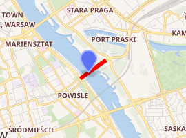
The Świętokrzyski Bridge (Polish: most Świętokrzyski, English: Holy Cross Bridge) is a bridge over the Vistula river in Warsaw, Poland linking Powiśle neighbourhood with Praga Północ district.
Świętokrzyski Bridge Most Świętokrzyski | |
|---|---|
 Świętokrzyski Bridge and the National Stadium | |
| Coordinates | 52°14′31″N 21°02′06″E |
| Carries | Vehicles, Pedestrian, Bicycles |
| Crosses | Vistula River |
| Locale | Warsaw, Poland |
| Maintained by | Trasa Świętokrzyska Sp. z o.o. |
| Characteristics | |
| Total length | 479 metres (1,572 ft) |
| Width | 30 metres (98 ft) |
| Longest span | 180 metres (590 ft) |
| History | |
| Construction start | 5 October 1998 |
| Construction end | 5 October 2000 |
| Opened | 6 October 2000 |
| |
It is a cable-stayed bridge, 479 m long, with two lanes for vehicles, a pavement and a cycle path each way. The single tower, 90 m high, located on the right (eastern) river bank, has 48 cables attached supporting the deck. Near the left (western) bank the bridge is supported by two piers. The bridge was opened on 6 October 2000 after two years' construction.
The bridge's name comes from Świętokrzyska Street, which forms part of the access route from the city centre.
According to the data from Stołecznego Zarządu Dróg Miejskich (Capital City Road Authority) in 2018, on average 23,418 vehicles passed the Świętokrzyski Bridge daily.[1]
Gallery
 Świętokrzyski Bridge
 Bridge at night
 Information board
 Mermaid of Warsaw in front of the bridge
See also
References
- "ANALIZA RUCHU NA DROGACH". Zarząd Dróg Miejskich w Warszawie (in Polish). Retrieved 2019-08-14.