Đồng Nai river
The Đồng Nai River (sông Đồng Nai ![]()
| Dong Nai River Phước Long River | |
|---|---|
.jpg) | |
 | |
| Etymology | Nông-nại (Shallow salt-marsh) |
| Native name | Sông Đồng Nai |
| Physical characteristics | |
| Mouth | South China Sea |
⁃ location | Cần Giờ Mangrove Forest |
⁃ elevation | 0 m |
| Length | 568 km |
| Basin size | 38.600 km |
| Width | |
| ⁃ maximum | 2.6 km |
| Basin features | |
| Tributaries | |
| ⁃ left | Bé River, Saigon River, Vàm Cỏ |
| Waterbodies | Tri An Lake |
| Bridges | Saigon Bridge |
| Inland ports | Saigon Port |
The original Vietnamese name translated from Khmer language was 'Nông-nại', meaning shallow salt-marsh.
Geography
The Dong Nai River flows through the provinces of Lam Dong, Dak Nong, Binh Phuoc, Dong Nai, Binh Duong and Ho Chi Minh City with a length of over 437 km and a basin of 38,600 km², if calculated from the source of the Đa Dâng River, it is 586 km long. From the confluence with the Đa Nhim River below the Pongour waterfall, it measures 487 km. The Dong Nai River flows into the East China Sea in Cần Giờ District.
The main stream of Dong Nai river in the upstream is also known as the Đa Đang river. The river originates from Lam Vien plateau , meandering along the northeast-southwest direction from the mountains to the plateau in Ta Lai (Tan Phu district, Dong Nai province). The river forms the natural boundary between Đăk R'Lấp District (Dak Nong) and Bảo Lâm District, Lâm Đồng Province, Cát Tiên District, between Cát Tiên and Bù Đăng District, Tan Phu District, Dong Nai and between Tan Phu and Đạ Tẻh District.
After meeting the Bé River, the Dong Nai River forms a natural boundary between Dong Nai on the east and Bình Dương Province on the west bank. >
The river flows through Bien Hoa City, then flows along the boundary between Dong Nai and Ho Chi Minh City, between Ba Ria - Vung Tau and Ho Chi Minh City.
Hydropower
Major hydropower dams in the Dong Nai river basin:
- On the main Dong Nai river: Trị An Dam, Dong Nai 2, Dong Nai 3, Dong Nai 4, Dong Nai 5, Dong Nai 6 (in development) and Dong Nai 6A (in development).[2] The Dong Nai 6 and 6A projects are controversial as they are likely to have a significant impact on the biodiversity of Cat Tien National Park.[3]
- Bé River: Thac Mo dam, Cần Đơn dam
- Saigon River: Dau Tieng Lake
- Da Nhim River: Da Nhim dam
- Dai Ninh dam
La Nga River: Hàm Thuận – Đa Mi hydroelectric power stations
Gallery
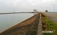
 Near Bien Hoa
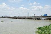
- East of Ho Chi Minh City
References
- Saigon: A History Nghia M. Vo - 2011 - Page 1 "The Đồng Nai River and the much larger Mekong River had been for centuries thriving waterways that allowed easy communication and commerce with Cambodia and Laos, and the seaports of Thailand, Malaysia, Indonesia and China."
- http://www.dalat.gov.vn/web/T%C6%B0li%E1%BB%87u/tabid/99/MaterialItemID/984/MaterialCategoryID/0/CurrentPage/1/Default.aspx
- http://thethaovanhoa.vn/132N20110808070247010T0/thuy-dien-de-doa-song-dong-nai.htm