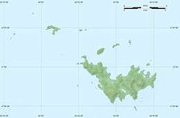
Île Fourchue
Île Fourchue, also known as Île Fourche is an island between Saint-Barthélemy and Saint Martin, belonging to the Collectivity of Saint Barthélemy. The island's inside is privately owned. It is located northwest of the island of St. Barthelemy about 5 kilometers from it. Previously, Fourchue Island was called Five Islands because of prominent five peaks visible from the distance. The highest point is 103 meter above sea level. It is situated within Réserve naturelle nationale de Saint-Barthélemy.[2]
| Nickname: Five Islands | |||||||||||||||||
|---|---|---|---|---|---|---|---|---|---|---|---|---|---|---|---|---|---|
 Île Fourchue. | |||||||||||||||||
 Île Fourchue 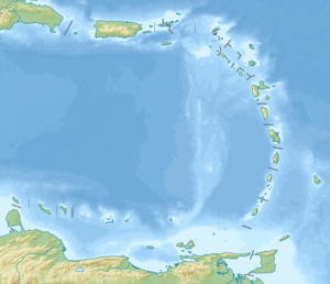 Île Fourchue 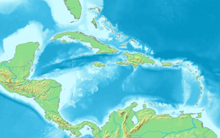 Île Fourchue | |||||||||||||||||
| Geography | |||||||||||||||||
| Location | Caribbean | ||||||||||||||||
| Coordinates | 17°57′30″N 62°54′00″W | ||||||||||||||||
| Archipelago | Leeward Islands, Lesser Antilles | ||||||||||||||||
| Adjacent bodies of water | Saint Barthélemy Channel | ||||||||||||||||
| Area | 0.99 km2 (0.38 sq mi) | ||||||||||||||||
| Highest elevation | 103 m (338 ft)[1] | ||||||||||||||||
| Administration | |||||||||||||||||
| Demographics | |||||||||||||||||
| Population | 0 | ||||||||||||||||
| Additional information | |||||||||||||||||
| Time zone |
| ||||||||||||||||
| |||||||||||||||||
Flora and fauna
The only inhabitants are some goats.
History
Fourchue Island is known as the retreat of Balthazar Biguard, an immigrant from Marseille fleeing the French Revolution, Saint-Barthélemy being at that time Swedish territory. He ended up acquiring Swedish citizenship, living apart from the rest of the world and passing the Fourchue with his crossbred sons the last 14 years of his long life. He died in 1827 at the age of 85 and is buried on this island.
References
- "Ile Fourchue". Wikimapia. Retrieved 28 June 2014.
- A description of the island