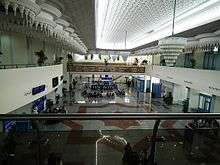
Zenata – Messali El Hadj Airport
| Zenata – Messali El Hadj Airport Leïla Sebbar | |||||||||||
|---|---|---|---|---|---|---|---|---|---|---|---|
 | |||||||||||
| Summary | |||||||||||
| Airport type | Public | ||||||||||
| Serves | Tlemcen, Remchi, | ||||||||||
| Elevation AMSL | 248 m / 814 ft | ||||||||||
| Coordinates | 35°0′45″N 1°27′25″W / 35.01250°N 1.45694°WCoordinates: 35°0′45″N 1°27′25″W / 35.01250°N 1.45694°W | ||||||||||
| Map | |||||||||||
 TLM Location of airport in Algeria | |||||||||||
| Runways | |||||||||||
| |||||||||||
| Statistics (2010) | |||||||||||
| |||||||||||
Zenata – Messali El Hadj Airport (IATA: TLM, ICAO: DAON) is a public airport located 17 kilometres (11 mi) northwest of Tlemcen,[1] the capital of the Tlemcen province (wilaya) in Algeria. It is also known as Leïla Sebbar Airport.
Facilities
The airport resides at an elevation of 248 metres (814 ft) above mean sea level. It has one runway designated 07/25 with an asphalt surface measuring 2,600 by 45 metres (8,530 ft × 148 ft).[1]
Airlines and destinations
| Airlines | Destinations |
|---|---|
| Aigle Azur | Marseille, Paris–Orly Seasonal: Lille, Lyon, Paris-Charles de Gaulle[5] |
| Air Algérie | Alicante[6], Algiers, Lyon, Marseille, Paris–Orly |
| Tassili Airlines | Algiers |
| TUIfly Belgium | Charleroi[7] |
Statistics
| Pass- engers | Change from previous year | Aircraft opera- tions | Change from previous year | Cargo (metric tons) | Change from previous year | |
|---|---|---|---|---|---|---|
| 2005 | 131,481 | 2,677 | 112 | |||
| 2006 | 130,546 | 2,328 | 111 | |||
| 2007 | 69,333 | 1,207 | 27 | |||
| 2008 | 128,851 | 2,050 | 56 | |||
| 2009 | 147,919 | 2,347 | 53 | |||
| 2010 | 137,907 | 2,206 | 72 | |||
| Source: Airports Council International. World Airport Traffic Reports (Years 2005,[8] 2006,[9] 2007,[10] 2009[11] and 2010) | ||||||
References
- 1 2 3 AIP and Chart from Service d'Information Aéronautique – Algerie (in French)
- ↑ Airport information for DAON from DAFIF (effective October 2006)
- ↑ Airport information for TLM at Great Circle Mapper. Source: DAFIF (effective October 2006).
- ↑ "DAON @ aerobaticsweb.org". Landings.com. Retrieved 31 July 2013.
- ↑ http://www.routesonline.com/news/38/airlineroute/273237/aigle-azur-plans-extra-seasonal-paris-cdg-algeria-service-in-3q17/
- ↑ https://www.routesonline.com/news/38/airlineroute/278284/air-algerie-schedules-additional-routes-to-spain-in-s18/
- ↑ "Jetairfly Flight Plan". Jetairfly.
- ↑ Airport Council International's 2005 World Airport Traffic Report
- ↑ Airport Council International's 2006 World Airport Traffic Report
- ↑ Airport Council International's 2007 World Airport Traffic Report
- ↑ Airport Council International's 2009 World Airport Traffic Report
External links
- Google Maps - Zenata
- Etablissement de Gestion de Services Aéroportuaires d’Alger (EGSA-Alger)
- Current weather for DAON at NOAA/NWS
- Accident history for TLM at Aviation Safety Network
This article is issued from
Wikipedia.
The text is licensed under Creative Commons - Attribution - Sharealike.
Additional terms may apply for the media files.