Zalishchyky Raion
| Zalishchyky Raion Заліщицький район | |
|---|---|
| Raion | |
 | |
| Country |
|
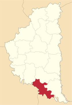
| Region | Ternopil Oblast |
| Established | 1940 |
| Admin. center | Zalishchyky |
| Subdivisions |
List
|
| Area | |
| • Total | 684 km2 (264 sq mi) |
| Population | |
| • Total | 52,915 |
| • Density | 77/km2 (200/sq mi) |
| Time zone | UTC+2 (EET) |
| • Summer (DST) | UTC+3 (EEST) |
| Area code | 380-3554 |
The Zalishchyky Raion (Ukrainian: Заліщицький район) is a sub-division of the Ternopil Oblast. The administrative centre and largest town is Zalishchyky. The rest of the district's population lives in one of 35 village councils or 53 rural settlements.
Demographics
Geography
Communities
- Towns
- Urban type settlements
- Villages
- Anhelivka
- Bedrykivtsi
- Berestok
- Blyshchanka
- Buriakivka
- Dobrivliany
- Dorohychivka
- Duniv
- Duplyska
- Dzvyniach
- Hlushka
- Holihrady
- Holovchyntsi
- Horodok
- Hynkivtsi
- Ivane-Zolote
- Kasperivtsi
- Khartonivtsi
- Khmeleva
- Kolodribka
- Korolivka
- Koshylivtsi
- Kulakivtsi
- Lysivtsi
- Lysychnyky
- Lytiachi
- Myshkiv
- Nahoriany
- Novosilka
- Nyrkiv
- Pechorna
- Podillia
- Popivtsi
- Rozhanivka
- Sadky
- Shchytivtsi
- Shutromyntsi
- Shypivtsi
- Slobidka
- Solone
- Stavky
- Svershkivtsi
- Synkiv
- Torske
- Uhrynkivtsi
- Ustechko
- Vorvulyntsi
- Vyhoda
- Vyniatyntsi
- Vynohradne
- Yakubivka
- Zelenyi Hai
- Zozulyntsi
| Raions | |||||
|---|---|---|---|---|---|
| Cities |
| ||||
| |||||
This article is issued from
Wikipedia.
The text is licensed under Creative Commons - Attribution - Sharealike.
Additional terms may apply for the media files.