Kasat Suek
.jpg)
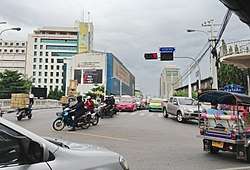
Kasat Suek (Thai: กษัตริย์ศึก, pronounced [kā.sàt sɯ̀k]) is an intersection and its corresponding bridge on the periphery of Pom Prap Sattru Phai and Pathum Wan districts, Bangkok. It's a four corners of Rama I, Krung Kasem, and Bamrung Mueang roads. Kasat Suek is considered to be the end of Bamrung Mueang and the beginning of Rama I roads. It also has other names Bobae intersection, or Yotse intersection.
Its name comes from the Kasat Suek bridge at the corners. It's a bridge that connects two bridges across the railway from Hua Lamphong railway station nearby and across Khlong Phadung Krung Kasem (Phadung Krung Kasem canal). Formerly a wooden bridge called Yotse (this name is more popular than Kasat Suek and still referred to today unofficially). In the reign of King Prajadhipok (Rama VII) it deteriorated in 1928. It has been rebuilt as a reinforced concrete bridge. The name is officially changed to Kasat Suek. His Majesty the King presided over the opening ceremony on April 6, 1929. It's also the first overpass in Thailand.
The word "Kasat Suek" translates as king of war, which is the rank of King Phutthayotfa Chulalok (Rama I), who founder of Chakri dynasty, before to be a king (Somdet Chaophraya Maha Kasatsuek; สมเด็จเจ้าพระยามหากษัตริย์ศึก), and to be consistent with Rama I road, which also refers to him as well. Since this area is believed to be the route back from the war of King Phutthayotfa Chulalok.[1] [2] [3]
One time in the past this intersection known as the location of cinema named "Chaloem Khet" (เฉลิมเขตร์) its name after Princess Chalermkhetramongmol, who was Prince Bhanurangsi Savangwongse's youngest daughter. Although later the cinema will be demolished its name still exists and the alleys in this area are called Soi Chaloem Khet as well.[4]
Moreover in 1907, Kasat Suek is also the first bus route in Bangkok (including Thailand) by Phraya Bhakdi Noraset (Nai Lert), from here to Pratunam in Pathum Wan district, it runs along Rama I road. Although it's a short distance of about 2.9 km (1.8 mi), but the vehicle used at that time was not an automobile, but was a horse-drawn carriage, so not very successful.[5]
Nearby places
- Debsirin School
- Bobae Market
- Hua Chiew Hospital
- Hua Lamphong railway station & State Railway of Thailand (SRT)
- Department of Alternative Energy Development and Efficiency & Ban Phibuntham
References
- ↑ SRT Vocational School (2014-09-09). "สะพานกษัตริย์ศึก (ยศเส)..." facebook (in Thai). Retrieved 2018-04-09.
- ↑ "สะพานใหม่"กษัตริย์ศึก"". รำลึกวันวานของสะพานกษัตริย์ศึก (in Thai).
- ↑ "กำเนิดสะพานข้ามทางรถไฟ". รำลึกวันวานของสะพานกษัตริย์ศึก (in Thai).
- ↑ dreamcometrue (2009-09-11). "โรงภาพยนตร์ในอดีต". Oknation (in Thai).
- ↑ "BMTA History". BMTA (in Thai).
Coordinates: 13°44′56.70″N 100°31′00.22″E / 13.7490833°N 100.5167278°E