Erbent
| Erbent | |
|---|---|
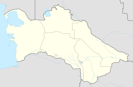 Erbent Location in Turkmenistan | |
| Coordinates: 39°18′51″N 58°35′38″E / 39.31417°N 58.59389°ECoordinates: 39°18′51″N 58°35′38″E / 39.31417°N 58.59389°E | |
| Country |
|
| Province | Ahal Province |
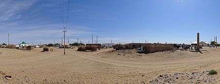
A panorama from the entrance to the village Erbent/Yerbent.
Erbent (also known as Yerbent or Ýerbent) is a village in Ahal Province, Turkmenistan.[1] The village is located in the Karakum Desert in central Turkmenistan. It is the largest settlement on the road between Ashgabat and Daşoguz, which are located near the southern and northern border of the country respectively.[2]
Overview
The community largely consists of single-story buildings and yurts. Its economy is dominated by livestock herding, which has resulted in the desertification of the surrounding area. A Soviet-era monument in the village center memorializes 11 supporters of socialism who died during the Basmachi Revolt in 1931.[2]
Climate
| Climate data for Erbent | |||||||||||||
|---|---|---|---|---|---|---|---|---|---|---|---|---|---|
| Month | Jan | Feb | Mar | Apr | May | Jun | Jul | Aug | Sep | Oct | Nov | Dec | Year |
| Average high °C (°F) | 5.5 (41.9) |
8.7 (47.7) |
15.9 (60.6) |
24.5 (76.1) |
31.4 (88.5) |
37.0 (98.6) |
39.1 (102.4) |
37.2 (99) |
31.6 (88.9) |
22.7 (72.9) |
15.2 (59.4) |
7.9 (46.2) |
23.1 (73.6) |
| Daily mean °C (°F) | 0.1 (32.2) |
2.6 (36.7) |
9.2 (48.6) |
17.3 (63.1) |
24.1 (75.4) |
29.8 (85.6) |
32.4 (90.3) |
30.0 (86) |
23.8 (74.8) |
15.1 (59.2) |
8.5 (47.3) |
2.6 (36.7) |
16.3 (61.3) |
| Average low °C (°F) | −3.9 (25) |
−2.0 (28.4) |
4.0 (39.2) |
11.2 (52.2) |
16.9 (62.4) |
22.0 (71.6) |
24.6 (76.3) |
21.8 (71.2) |
15.8 (60.4) |
8.3 (46.9) |
3.1 (37.6) |
−1.3 (29.7) |
10.0 (50) |
| Average precipitation mm (inches) | 13 (0.51) |
11 (0.43) |
22 (0.87) |
22 (0.87) |
13 (0.51) |
4 (0.16) |
2 (0.08) |
1 (0.04) |
2 (0.08) |
6 (0.24) |
10 (0.39) |
13 (0.51) |
119 (4.69) |
| Average precipitation days (≥ 1.0 mm) | 5 | 4 | 6 | 6 | 4 | 1 | 1 | 1 | 1 | 3 | 4 | 6 | 42 |
| Average relative humidity (%) | 73 | 63 | 54 | 46 | 33 | 26 | 26 | 25 | 30 | 43 | 59 | 74 | 46 |
| Mean monthly sunshine hours | 137.4 | 155.1 | 198.9 | 228.9 | 306.4 | 363.3 | 376.3 | 367.0 | 321.9 | 249.0 | 187.6 | 131.0 | 3,022.8 |
| Source: NOAA[3] | |||||||||||||
References
- ↑ Erbent at GEOnet Names Server
- 1 2 Brummell, Paul (2005). Turkmenistan. Bradt Travel Guides. p. 133. ISBN 9781841621449.
- ↑ "Yerbent (Erbent) Climate Normals 1961–1990". National Oceanic and Atmospheric Administration. Retrieved 9 March 2017.
This article is issued from
Wikipedia.
The text is licensed under Creative Commons - Attribution - Sharealike.
Additional terms may apply for the media files.