Yangon River
| Yangon River | |
| Hlaing River | |
| River | |
 Yangon River | |
| Country | Myanmar |
|---|---|
| City | Yangon (also known as Rangoon) |
| Mouth | |
| - location | Andaman Sea |
| - elevation | 0 m (0 ft) |
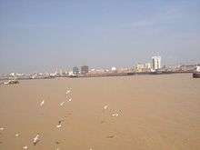
The Yangon River (also known as the Rangoon River or Hlaing River) is formed by the confluence of the Pegu and Myitmaka Rivers in Myanmar. It is a marine estuary that runs from Yangon (also known as Rangoon) to the Gulf of Martaban of the Andaman Sea. The channel is navigable by ocean-going vessels, thus plays a critical role in the economy of Myanmar.

Coal divers prepare to dive in the Yangon River
The Twante Canal connects the Yangon River with the Irrawaddy Delta, once known as 'the rice bowl of Asia'. It consists of 1,000 square miles (3,000 km2) of lush teak plantations and mangrove swamps, many of which have now been cleared for rice production.
References
| Wikimedia Commons has media related to Yangon River. |
Coordinates: 16°28′N 96°20′E / 16.467°N 96.333°E
This article is issued from
Wikipedia.
The text is licensed under Creative Commons - Attribution - Sharealike.
Additional terms may apply for the media files.