Wytham
| Wytham | |
|---|---|
 All Saints' parish church | |
 Wytham Wytham shown within Oxfordshire | |
| Population | 131 (2001 census)[1] |
| OS grid reference | SP4708 |
| Civil parish |
|
| District | |
| Shire county | |
| Region | |
| Country | England |
| Sovereign state | United Kingdom |
| Post town | Oxford |
| Postcode district | OX2 |
| Dialling code | 01865 |
| Police | Thames Valley |
| Fire | Oxfordshire |
| Ambulance | South Central |
| EU Parliament | South East England |
| UK Parliament | |
| Website |
www |
Wytham /ˈwaɪtəm/ is a village and civil parish on the Seacourt Stream, a branch of the River Thames, about 3 miles (5 km) northwest of the centre of Oxford. It is just west of the Western By-Pass Road, part of the Oxford Ring Road (A34). The nearest village is Godstow.[2][3]
Wytham was the northernmost part of Berkshire until the 1974 boundary changes transferred it to Oxfordshire. The toponym is first recorded as Wihtham around AD 957, and comes from the Old English for a homestead or village in a river-bend.[2]
The manor of Wytham, along with Wytham Abbey (not a religious foundation but the manor house) and much of the village, was formerly owned by the Earls of Abingdon. The Church of England parish church of All Saints was originally a medieval building[4] but it was extensively rebuilt between 1811[5] and 1812[3] by Montagu Bertie, 5th Earl of Abingdon.
The ruins of the former Godstow Nunnery lie just east of the village.
During World War II
During World War II, in about 1941, the owners of Wytham Abbey agreed to take in six East End children, as part of the evacuee programme. This was in preference to a number of Canadian infantry, whom they were also asked to accommodate. As the war progressed they got the Canadian infantry anyway. The evacuees were educated by a governess, and returned to the East End with impeccable accents. Outings were in a big car to the local chip shop. When the infantry arrived, the young soldiers took the evacuees on their tanks as they trained in the woods, crashing into trees.
The owners of the Abbey were Lady Elizabeth Bowes-Lyon (cousin of the Queen Mother) and her husband, a diamond millionaire. When he died suddenly, the evacuees were moved to less comfortable accommodation. The Infantry went off to war. A photo of the evacuees standing on the grand staircase of the Abbey, below a bronze statue of a horse, appeared in a national newspaper, the News Chronicle. The Abbey was sold by the University of Oxford in 1992 and is now in private hands. The secret room in which the diamond millionaire was said to keep his diamonds is still there, but with no diamonds.
Wytham Great Wood
Wytham Woods is an area of long-established mixed woodland noted for its high population of badgers and long-term monitoring of great tits. It is on rising ground to the west of the village and covers 1000 acres. The woods are a Site of Special Scientific Interest.[6] The University of Oxford has owned the woods since 1942 and uses them for research in zoology and climate change.[7] The University has a field station north of the village. It is claimed to be one of the most researched pieces of woodland in the world.[8] The woods are open to the public by permit which are available on application[9], for walking but are closed to dogs, horses and bicycles.
A named path within the wood is called the Singing Way. It is aligned with Oxford and got its name because monks on pilgrimage from Cirencester to Canterbury would break into song here as they sighted the town and the end of their day's journey.[10]
On 7 October 2017 an Oxfordshire Blue Plaque was unveiled at the Keeper's Hill car park in Wytham Woods, commemorating the bequest of the woods to the University of Oxford in 1942 by Raymond and Hope ffennell.[11]
Inspector Morse
Wytham village and Wytham Woods have frequently featured in the "Inspector Morse" detective novels by Colin Dexter, most notably in The Way Through the Woods.
Gallery
 The centre of Wytham, with the village shop on the left and the White Hart pub on the right
 Keepers Cottage, Wytham Woods, a gift to the University of Oxford in 1943
 Ancient tree in Wytham Great Wood
 Wytham War Memorial
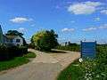 Oxford University's John Krebs Field Station, Wytham
References
- ↑ "Area selected: Vale of White Horse (Non-Metropolitan District)". Neighbourhood Statistics: Full Dataset View. Office for National Statistics. Retrieved 30 March 2010.
- 1 2 Mills, A.D.; Room, A. (2003). A Dictionary of British Place-Names. Oxford: Oxford University Press. p. not cited. doi:10.1093/acref/9780199609086.001.0001. ISBN 0-19-852758-6.
- 1 2 Pevsner, Nikolaus (1966). Berkshire. The Buildings of England. Harmondsworth: Penguin Books. p. 314.
- ↑ "All Saints Church, Wytham". wytham-church.org.uk. Wytham.
- ↑ Page, W.H.; Ditchfield, P.H., eds. (1924). A History of the County of Berkshire, Volume 4. Victoria County History. pp. 427–430. (pages 427-430)
- ↑ Wytham Woods SSSI citation
- ↑ Savill, Peter; Perrins, Christopher; Kirby, Keith; Fisher, Nigel (2011). Wytham Woods: Oxford's Ecological Laboratory. Oxford: Oxford University Press. p. 282. doi:10.1093/acprof:osobl/9780199605187.001.0001. ISBN 9780199605187.
- ↑ "About Wytham Woods". University of Oxford. Retrieved 2018-02-05.
- ↑ "Walking Permit Application | Wytham Woods". www.wythamwoods.ox.ac.uk. Retrieved 2018-02-05.
- ↑ Barkham, Patrick (2013-10-03). "Chapter 2 Meles meles". Badgerlands: The Twilight World of Britain’s Most Enigmatic Animal. Granta Publications. ISBN 9781847087003.
- ↑ Oxfordshire Blue Plaques Board: Wytham Woods
| Wikimedia Commons has media related to Wytham. |