Bispingen
| Bispingen | ||
|---|---|---|
| ||
 Bispingen Location of Bispingen within Heidekreis district 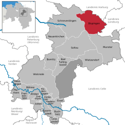 | ||
| Coordinates: 53°04′58″N 9°59′54″E / 53.08278°N 9.99833°ECoordinates: 53°04′58″N 9°59′54″E / 53.08278°N 9.99833°E | ||
| Country | Germany | |
| State | Lower Saxony | |
| District | Heidekreis | |
| Government | ||
| • Mayor | Sabine Schlüter | |
| Area | ||
| • Total | 128.55 km2 (49.63 sq mi) | |
| Elevation | 90 m (300 ft) | |
| Population (2017-12-31)[1] | ||
| • Total | 6,486 | |
| • Density | 50/km2 (130/sq mi) | |
| Time zone | CET/CEST (UTC+1/+2) | |
| Postal codes | 29646 | |
| Dialling codes | 05194 | |
| Vehicle registration | HK | |
| Website | www.bispingen.de | |

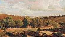
Valentin Ruths (1825–1905): Wilseder Höhe

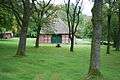
Dat ole Huus in Wilsede
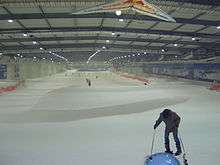
Bispingen SnowDome
Bispingen is a municipality in the Heidekreis district of Lower Saxony, Germany. It is a popular tourist destination with several holiday/theme parks. Its territory also includes the nature preserve of the Lüneburg Heath around the Wilseder Berg.
Geography
Location
Bispingen is located on the River Luhe and is approximately 15 km (9.3 mi) northeast of Soltau, or 50 km (31 mi) south of Hamburg. Bispingen lies near interchange 43 of the A 7 motorway.
Subdivisions
- Bispingen
- Hützel
- Steinbeck an der Luhe (Steinbeck/Luhe)
- Behringen
- Volkwardingen
- Hörpel
- Borstel
- Haverbeck (Nieder- and Oberhaverbeck)
- Wilsede, heath village at the foot of the Wilseder Berg; population: ~35
Neighbouring villages and towns
Nearby towns
Places adjacent to Bispingen | ||||||||||
|---|---|---|---|---|---|---|---|---|---|---|
| ||||||||||
Economy
Bispingen is popular with tourists as a local recreation area and nature reserve.
Places of interest
- Wilseder Berg, the highest hill on the Lüneburg Heath
- Dat ole Huus, a Low German house in Wilsede, one of the oldest open-air museums in Germany; built c. 1540, renovated 1742, moved to Wilsede 1907
- Iserhatsche, a landscape garden with hunting lodge and Montagnetto model castle
- Burial ground in Volkwardingen with Bronze Age tumuli
- Ole Kerk ("Old Church") dating to 1353, made from boulders; used for baptisms, weddings and other services as well as concerts
- Treppenspeicher in Volkwardingen, one of the oldest of this type of storage barn in the Lüneburg Heath, built in 1600 and 1702, restored in 2001
- Kart Centre, owned by racing driver Ralf Schumacher
- SnowDome Bispingen provides indoor skiing and snowboarding. It opened in autumn 2006
- Bispinger Heide holiday park, part of the Center Parcs chain
Notable people
- Waldemar Grube, founder of the firm, Grube KG Forstgerätestelle, which makes forestry equipment.
Gallery
 Farmstead in Wilsede
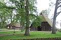 Wilsede
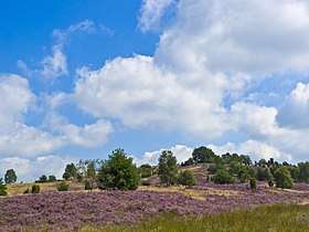 The Wilseder Berg
 Mad House, the upside down house
References
Further reading
- Heinrich Schulz: Chronik von Wilsede, Stuttgart, 1967
External links
| Wikimedia Commons has media related to Bispingen. |

- Official website

Towns and municipalities in Heidekreis | ||
|---|---|---|
| Authority control |
|---|
This article is issued from
Wikipedia.
The text is licensed under Creative Commons - Attribution - Sharealike.
Additional terms may apply for the media files.