Wild Gutach
| Wild Gutach | |
|---|---|
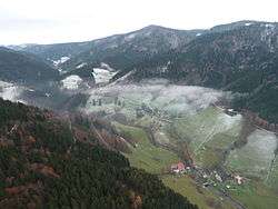 The Wild Gutach on exiting the narrow valley of Wildgutach into the broader Simonswälder Tal (front) | |
| Location | Black Forest, Baden-Württemberg, Germany |
| Reference no. | DE: 23384 |
| Physical characteristics | |
| Main source |
near Furtwangen (as the Heubach) 1,065 m above sea level (NN) |
| River mouth |
near Gutach im Breisgau into the Elz 284 m above sea level (NN) 48°07′14″N 7°59′23″E / 48.1205°N 7.9898°ECoordinates: 48°07′14″N 7°59′23″E / 48.1205°N 7.9898°E |
| Length | 25.2 km (15.7 mi) [1] |
| Basin features | |
| Progression | Elz→ Rhine→ North Sea |
| Basin size | 129 km2 (50 sq mi) [1] |
| Landmarks | Small towns: Furtwangen, St. Märgen, Gütenbach, Simonswald and Gutach im Breisgau |
| Population | c. 6600 |
| Tributaries |
|
The Wild Gutach (German: Wilde Gutach) is a river in Baden-Württemberg, Germany. It flows into the Elz in Gutach im Breisgau.
Sights and structures
- Hexenlochmühle with two overshot water wheels in a ravine-like witch's hole (Hexenloch)
- Balzer Herrgott, a stone statue of Christ which has almost grown into a tree
- Teichschlucht ravine below Gütenbach
- Hirschbach Falls and Zweribach Waterfalls in the rugged Zweribach Cirque (Bannwald and nature reserve)
- Plattensee Reservoir in the high valley of the Platte of the Zweribach
- Zweribachwerk, power station above Simonswald
- Brend summit
- Kandel summit
- Schultiskopf and Spitzer Stein (rocky arêtes)
- Kostgfällschlucht with waterfalls and the Gfällfelsen rock formation (climbing area, nature reserve)
- Chapel on the Hörnleberg
See also
References
This article is issued from
Wikipedia.
The text is licensed under Creative Commons - Attribution - Sharealike.
Additional terms may apply for the media files.