Western Chain, New Zealand
| Tahi, Rua, Toru, Whā, Rima (Māori) | |
|---|---|
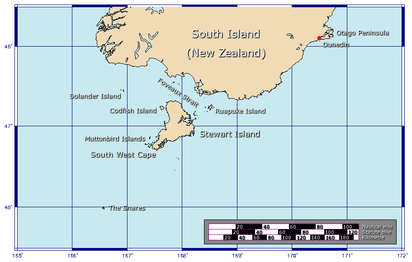 The position of The Snares relative to New Zealand | |
| Geography | |
| Coordinates | 48°03′0″S 166°30′30″E / 48.05000°S 166.50833°ECoordinates: 48°03′0″S 166°30′30″E / 48.05000°S 166.50833°E |
| Archipelago | The Snares |
| Length | 1.2 km (0.75 mi) |
| Highest elevation | 44 m (144 ft) |
| Administration | |
| Demographics | |
| Population | 0 |
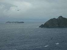
Western Chain (LHS) & Alert Stack (RHS)
The Western Chain is a group of islets at 48°03′0″S 166°30′30″E / 48.05000°S 166.50833°E and a part of The Snares. They lie some 5 km (3.1 mi) to the WSW off the main island North East Island, which lies approx. 200 kilometres (120 mi) south of New Zealand's South Island. The Western Chain island is some 2 km (1.2 mi) long in NW direction, and the highest elevation of 44 m (144 ft) is at the southernmost Island.
The islets all carry Maori names, from NE: Tahi (English: One), Rua (Two), Toru (Three), Whā (Four) and finally Rima (Five).
See also
References
External links
This article is issued from
Wikipedia.
The text is licensed under Creative Commons - Attribution - Sharealike.
Additional terms may apply for the media files.