WMS (hydrology software)
|
| |
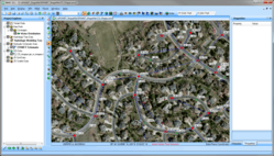 WMS 10.1 screenshot | |
| Developer(s) | Aquaveo |
|---|---|
| Stable release |
10.1.16
/ March 21, 2018 |
| Operating system | Windows XP and later |
| Platform | x86, x64 |
| Size | 1.1 GB |
| Type | Surface-water hydrology software |
| License | Proprietary |
| Website | Official website |
WMS (Watershed Modeling System) is a watershed computer simulation and modeling software application from Aquaveo. It was originally created in the early 1990s at the Engineering Computer Graphics Laboratory at Brigham Young University.
The software supports a number of hydraulic and hydrologic models that can be used to create drainage basin simulations.
Features
The Watershed Modeling System (WMS) is a proprietary water modeling software application used to develop watershed computer simulations. The software provides tools to automate various basic and advanced delineations, calculations, and modeling processes.[1] It supports river hydraulic and storm drain models, lumped parameter, regression, 2D hydrologic modeling of watersheds, and can be used to model both water quantity and water quality. As of January 2017, supported models include HEC-1, HEC-RAS, HEC-HMS, TR-20, TR-55, NFF, Rational, MODRAT, HSPF, CE-QUAL-W2, GSSHA, SMPDBK, and other models.[2]
History
WMS was initially developed by the Engineering Computer Graphics Laboratory at Brigham Young University in the early 1990s on Unix workstations. James Nelson, Norman Jones, and Woodruff Miller wrote a 1992 paper titled "Algorithm for Precise Drainage-Basin Delineation" that was published in the March 1994 issue of the Journal of Hydraulic Engineering.[3] The paper described an algorithm that could be used to describe the flow of water in a drainage basin, thereby defining the drainage basin.
The development of WMS was funded primarily by The United States Army Corps of Engineers (COE). In 1997, WMS was used by the COE to model runoff in the Sava River basin in Bosnia.[4] The software was sold commercially by Environmental Modeling Systems.[5]
It was later ported to Windows platforms in the mid 1990s. WMS 6.0 (2000)[5] was the last supported version for HP-UX, IRIX, OSF/1, and Solaris platforms. Development of WMS was done by the Environmental Modeling Research Laboratory (EMRL) at Brigham Young University (BYU) until April 2007, when the main software development team at EMRL incorporated as Aquaveo. Royalties from the software are paid to the engineering department at BYU.[6]
The planners of the 2002 Winter Olympics, held in Salt Lake City, Utah, used WMS software to simulate terrorist attacks on water infrastructure such as the Jordanelle Reservoir.[7] A 2007 paper, "Demonstrating Floodplain Uncertainty Using Flood Probability Maps", used WMS to demonstrate a new method of floodplain mapping that included uncertainty in its calculations and results.[8]
In 2008, the software was used in a study of severe flash flooding common to the Dez River basin in Khuzestan province in Iran. Both a rainfall runoff model (HEC-1) and hydraulic model (HEC-RAS) were created to simulate a major flood scenario to allow future planning for flash flooding control.[9]
A 2011 study to identify areas with potential groundwater in the Sinai Peninsula was performed using WMS by Hossam H. Elewa and Atef A. Qaddah. [10] WMS was used in combination with the TOPAZ model by a group of researchers in 2012 to help determine the impact of land development on the tropical watershed in the Upper Bernam River Basin in Malaysia for the years 1989-1995. The study was done to find ways of preventing shortages of irrigation water and the occurrence of floods.[11]
Due to water shortages in Iraq, a group of engineers used WMS to study ways to optimize water collection and storage.[12]
Version history
| Legend: | Old version | Older version, still supported | Current stable version |
|---|
| Date Released | Version | Comments | References |
|---|---|---|---|
| 1995 | 1.0 | ||
| 2.0 | |||
| 3.0 | |||
| 1996 | 4.0 | ||
| 1998 | 5.0 | First release on Windows: 95/NT | |
| 2000 | 6.0 | Last version to support HP-UX, IRIX, OSF/1, and Solaris platforms | |
| September 2003 | 7.0 | Windows NT/Me/2000/XP | |
| 8.0 | |||
| October 2008 | 8.1 | ||
| April 2009 | 8.2 | ||
| January 2010 | 8.3 | ||
| February 2011 | 8.4 | ||
| October 2012 | 9.0 | ||
| February 2013 | 9.1 | ||
| June 2014 | 10.0.4 | ||
| June 2016 | 10.1.10 | ||
| October 2016 | 10.1.11 | ||
| December 20, 2017 | 10.1.15 | ||
| March 21, 2018 | 10.1.16 |
See also
References
- ↑ Edsel, B.D.; et al. (2011). "Watershed Modeling and its Applications: A State-of-the-Art Review" (PDF). The Open Hydrology Journal. 5: 26–50.
- ↑ "WMS Supported Models". Aquaveo. Archived from the original on January 24, 2017. Retrieved January 24, 2017.
- ↑ Nelson, E.J.; Jones, N.L.; Miller, A.W. (1994). "An algorithm for precise drainage basin delineation" (PDF). ASCE Journal of Hydraulic Engineering. 120 (3): 298–312. doi:10.1061/(ASCE)0733-9429(1994)120:3(298).
- ↑ "Sava River Basin, Bosnia". Engineering Computer Graphics Laboratory. Archived from the original on February 8, 1998. Retrieved January 23, 2017.
- 1 2 "WMS Home Page". Environmental Modeling Systems, Inc. Archived from the original on March 9, 2000. Retrieved January 23, 2017.
- ↑ Hollingshead, Todd (June 6, 2005). "BYU prof's 3-D software makes an art out of the science of predicting a deluge". The Salt Lake Tribune. Retrieved January 24, 2017.
- ↑ Chai, Nathan K. (Fall 2002). "Modeling the World's Waters". BYU Magazine. Archived from the original on 25 February 2016. Retrieved 25 February 2016.
- ↑ Smemoe, C.M.; Nelson, E.J.; Zundel, A.K.; Miller, A.W. (2007). "Demonstrating Floodplain Uncertainty Using Flood Probability Maps" (PDF). Journal of the American Water Resources Association. 43: 359–371. doi:10.1111/j.1752-1688.2007.00028.x.
- ↑ Sadrolashrafi, S.S.; et al. (2008). "Integrated Modeling for Flood Hazard Mapping Using Watershed Modeling System". American Journal of Engineering and Applied Science. 1: 149–156. doi:10.3844/ajeassp.2008.149.156.
- ↑ Hossam, H.E.; Qaddah, A.A. (May 2011). "Groundwater potentiality mapping in the Sinai Peninsula, Egypt, using remote sensing and GIS-watershed-based modeling". Hydrogeology Journal. 19 (3): 613–628. doi:10.1007/s10040-011-0703-8.
- ↑ Mustafa, Y.M.; et al. (Fall 2012). "Evaluation of Land Development Impact on a tropical Watershed Hydrology Using Remote Sensing and GIS" (PDF). Journal of Spatial Hydrology. 5 (2): 16–30.
- ↑ Al-Ansari, N. (Dec 2013). "Water Harvesting and Reservoir Optimization in Selected Areas of South Sinjar Mountain, Iraq" (PDF). Journal of Hydrologic Engineering. 18 (12): 1607–1616. doi:10.1061/(ASCE)HE.1943-5584.0000712.