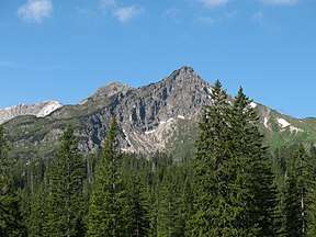
Warmatsgundkopf
| Warmatsgundkopf | |
|---|---|
 The Walser Hammerspitze (previously the Schüsser), the Kanzelwand and Zweiländerbahn | |
| Highest point | |
| Elevation | 2,057.9 m above sea level (6,752 ft) |
| Prominence | 88 m ↓ Col with the Walser Hammerspitze |
| Isolation | 0.8 km → Walser Hammerspitze |
| Coordinates | 47°20′6″N 10°12′27″E / 47.33500°N 10.20750°ECoordinates: 47°20′6″N 10°12′27″E / 47.33500°N 10.20750°E |
| Geography | |
 Warmatsgundkopf  Warmatsgundkopf Warmatsgundkopf (Bavaria) | |
| Parent range | Southeast Walsertal Mountains, Allgäu Alps |
| Geology | |
| Mountain type | Main dolomite |
The Warmatsgundkopf or Kanzelwand is a mountain in Bavaria, Germany.
This article is issued from
Wikipedia.
The text is licensed under Creative Commons - Attribution - Sharealike.
Additional terms may apply for the media files.