Vorpommern-Rügen
| Vorpommern-Rügen | ||
|---|---|---|
| District | ||
| ||
 | ||
| Country |
| |
| State | Mecklenburg-Vorpommern | |
| Capital | Stralsund | |
| Area | ||
| • Total | 3,188 km2 (1,231 sq mi) | |
| Population (31 December 2017)[1] | ||
| • Total | 225,123 | |
| • Density | 71/km2 (180/sq mi) | |
| Time zone | UTC+01:00 (CET) | |
| • Summer (DST) | UTC+02:00 (CEST) | |
| Vehicle registration |
VR, GMN, NVP, RDG, RÜG Stralsund: HST | |
| Website | www.lk-vr.de | |
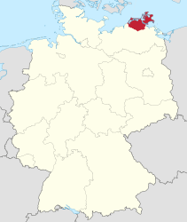
Vorpommern-Rügen is a district in the north of Mecklenburg-Vorpommern, Germany. It is bounded by (from the west and clockwise) the Baltic Sea and the districts Vorpommern-Greifswald, Mecklenburgische Seenplatte and Rostock. The district seat is the Hanseatic city of Stralsund.[2]
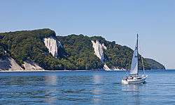
Vorpommern-Rügen is characterized by diverse shore line landscapes with many lagoons, beaches and cliff lines, part of them protected in the Western Pomerania Lagoon Area National Park and in the Jasmund National Park.
The area is also a very popular destination for national and international tourism, including Rügen, the biggest island of Germany, the island of Hiddensee, the Fischland-Darss-Zingst peninsula and its adjacent town of Barth with the Stralsund Barth Airport, the port of Sassnitz and the UNESCO World Heritage city of Stralsund.
The Vorpommern-Rügen district is one of the most popular places for national and international tourism in Germany, thanks to its unique protected nature, good infrastructure, popular resort architecture spas, historical towns and vast beaches at the shores of the Baltic Sea.
History
Vorpommern-Rügen District was established by merging the former districts of Nordvorpommern and Rügen; along with the former district-free city of Stralsund as part of the local government reform of September 2011.[2] The name of the district was decided by referendum on 4 September 2011.[3] The project name for the district was Nordvorpommern.
Geography
The district has a number of lakes, which include:
| Lake Name | Elevation | Surface Area |
|---|---|---|
| Günzer See | 0.3 m (0.98 ft) | 0.157 km2 (0.061 sq mi) |
| Nonnensee | 16.1 m (53 ft) | 0.7 km2 (0.27 sq mi) |
| Prohner Stausee | 2.6 m (8.5 ft) | 0.55 km2 (0.21 sq mi) |
| Pütter See | 13 m (43 ft) | 0.052 km2 (0.020 sq mi) |
| Schmachter See | 1.1 m (3.6 ft) | 1.18 km2 (0.46 sq mi) |
| Selliner See (Rügen) | 0 m (0 ft) | 1.38 km2 (0.53 sq mi) |
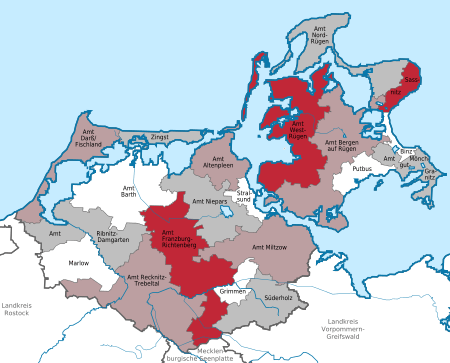
Towns and municipalities
| Amt-free towns | Amt-free municipalities |
|---|---|
References
- ↑ "Bevölkerungsstand der Kreise, Ämter und Gemeinden in Mecklenburg-Vorpommern 31.12.2017". Statistisches Amt Mecklenburg-Vorpommern (in German). October 2018.
- 1 2 "Mecklenburg-Vorpommern government reform". Retrieved 5 September 2011.
- ↑ "Referendum results Nordvorpommern". Retrieved 5 September 2011.
| Urban districts | ||
|---|---|---|
| Rural districts | ||
Coordinates: 54°20′N 13°00′E / 54.333°N 13.000°E
| Authority control |
|---|