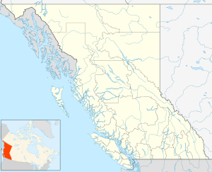
Vesuvius, British Columbia
| Vesuvius | |
|---|---|
 Vesuvius Location of Vesuvius in British Columbia | |
| Coordinates: 48°53′00″N 123°34′00″W / 48.88333°N 123.56667°WCoordinates: 48°53′00″N 123°34′00″W / 48.88333°N 123.56667°W | |
| Country |
|
| Province |
|
| Area code(s) | 250, 778 |
Vesuvius, also known as Vesuvius Bay, is an unincorporated settlement and ferry terminal on the northwest coast of Saltspring Island in the Gulf Islands of British Columbia, Canada. It is the eastern terminus of a ferry which connects Saltspring Island to Vancouver Island across Sansum Narrows to Crofton, which is just north of the city of Duncan.
It is named for Vesuvius Bay, which was named after HMS Vesuvius (1839), a ship of the Royal Navy assigned to the Pacific Station at Esquimalt in the 19th Century, and indirectly after Mount Vesuvius in Italy.
References
This article is issued from
Wikipedia.
The text is licensed under Creative Commons - Attribution - Sharealike.
Additional terms may apply for the media files.