Veľký Rozsutec
| Veľký Rozsutec | |
|---|---|
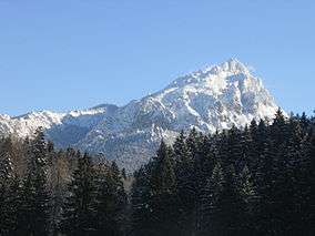 Veľký Rozsutec as seen from the Poludňový Grúň (1,460 m) Mountain | |
| Highest point | |
| Elevation | 1,609.7 m (5,281 ft) |
| Coordinates | 49°13′52″N 19°06′00″E / 49.23111°N 19.10000°E |
| Geography | |
 Veľký Rozsutec Location in Slovakia | |
| Location | Žilina Region, Slovakia |
| Parent range | Malá Fatra |
| Climbing | |
| Easiest route | Start from the settlement of Štefanová (625 m), go through the pass of Medziholie (1,185 m) and follow the green trail (green blazes) to the summit. The ascent takes about two and a half hours. |
Veľký Rozsutec (1,609.7 m; 5,281.17 ft AMSL) is a mountain situated in the Malá Fatra mountain range in the Žilina Region, Slovakia. The peak is situated in the north part of Malá Fatra called Krivánska Malá Fatra and is part of the Malá Fatra National Park and Rozsutec National Nature Reserve (since 1967).
Veľký Rozsutec and the surrounding area are home to many endangered species of plants and animals, some of which are endemic, as well as rare karst terrain.
Photogallery
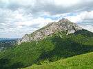 Veľký Rozsutec from Stoh hillside
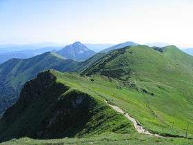 Crest of Malá Fatra with Veľký Rozsutec in the end
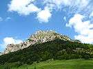 Veľký Rozsutec from Medziholie
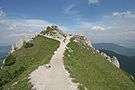 Peak of Veľký Rozsutec
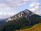 Veľký Rozsutec from Poludňový grúň
External links
| Wikimedia Commons has media related to Veľký Rozsutec. |
- Rozsutec National Nature Reserve at the State Inventory of Specially Protected Parts of Nature and Landscape
- 3D panorama from top 20.9.2007
Coordinates: 49°13′55″N 19°06′03″E / 49.23194°N 19.10083°E
This article is issued from
Wikipedia.
The text is licensed under Creative Commons - Attribution - Sharealike.
Additional terms may apply for the media files.