Vauville, Manche
| Vauville | ||
|---|---|---|
 | ||
| ||
 Vauville Location within Normandy region  Vauville | ||
| Coordinates: 49°38′18″N 1°50′43″W / 49.6383°N 1.8453°WCoordinates: 49°38′18″N 1°50′43″W / 49.6383°N 1.8453°W | ||
| Country | France | |
| Region | Normandy | |
| Department | Manche | |
| Arrondissement | Cherbourg | |
| Canton | La Hague | |
| Area1 | 16.35 km2 (6.31 sq mi) | |
| Population (2006)2 | 376 | |
| • Density | 23/km2 (60/sq mi) | |
| Demonym(s) | Vauvillais | |
| Time zone | UTC+1 (CET) | |
| • Summer (DST) | UTC+2 (CEST) | |
| INSEE/Postal code | 50623 /50440 | |
| Elevation |
3–182 m (9.8–597.1 ft) (avg. 40 m or 130 ft) | |
|
1 French Land Register data, which excludes lakes, ponds, glaciers > 1 km2 (0.386 sq mi or 247 acres) and river estuaries. 2 Population without double counting: residents of multiple communes (e.g., students and military personnel) only counted once. | ||
.svg.png)
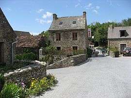
Vauville is a former commune in the Manche department in Normandy in north-western France. On 1 January 2017, it was merged into the new commune La Hague.[1]
See also
References
- ↑ Arrêté préfectoral 27 September 2016 (in French)
| Wikimedia Commons has media related to Vauville (Manche). |
This article is issued from
Wikipedia.
The text is licensed under Creative Commons - Attribution - Sharealike.
Additional terms may apply for the media files.