Vanduser, Missouri
| Vanduser, Missouri | |
|---|---|
| Village | |
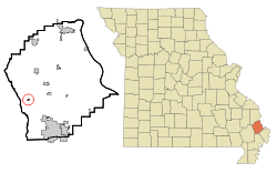 Location of Vanduser, Missouri | |
| Coordinates: 36°59′29″N 89°41′12″W / 36.99139°N 89.68667°WCoordinates: 36°59′29″N 89°41′12″W / 36.99139°N 89.68667°W | |
| Country | United States |
| State | Missouri |
| County | Scott |
| Area[1] | |
| • Total | 0.13 sq mi (0.34 km2) |
| • Land | 0.13 sq mi (0.34 km2) |
| • Water | 0 sq mi (0 km2) |
| Elevation | 312 ft (95 m) |
| Population (2010)[2] | |
| • Total | 267 |
| • Estimate (2016)[3] | 272 |
| • Density | 2,100/sq mi (790/km2) |
| Time zone | UTC-6 (Central (CST)) |
| • Summer (DST) | UTC-5 (CDT) |
| ZIP code | 63784 |
| Area code(s) | 573 |
| FIPS code | 29-75724[4] |
| GNIS feature ID | 0728142[5] |
Vanduser is a village in Scott County, Missouri, United States. The population was 267 at the 2010 census. The zip code is 63784.
History
Vanduser was laid out in 1895 when the railroad was extended to that point.[6] A post office called Vanduser has been in operation since 1898.[7] The community has the name of John Vanduser, the original owner of the town site.[6]
Geography
Vanduser is located at 36°59′29″N 89°41′12″W / 36.99139°N 89.68667°W (36.991280, -89.686544).[8]
According to the United States Census Bureau, the village has a total area of 0.13 square miles (0.34 km2), all of it land.[1]
Demographics
| Historical population | |||
|---|---|---|---|
| Census | Pop. | %± | |
| 1910 | 388 | — | |
| 1920 | 326 | −16.0% | |
| 1930 | 236 | −27.6% | |
| 1940 | 291 | 23.3% | |
| 1950 | 281 | −3.4% | |
| 1960 | 272 | −3.2% | |
| 1970 | 306 | 12.5% | |
| 1980 | 320 | 4.6% | |
| 1990 | 187 | −41.6% | |
| 2000 | 217 | 16.0% | |
| 2010 | 267 | 23.0% | |
| Est. 2016 | 272 | [3] | 1.9% |
| U.S. Decennial Census[9] | |||
2010 census
As of the census[2] of 2010, there were 267 people, 94 households, and 59 families residing in the village. The population density was 2,053.8 inhabitants per square mile (793.0/km2). There were 102 housing units at an average density of 784.6 per square mile (302.9/km2). The racial makeup of the village was 91.01% White, 3.00% Black or African American, 0.37% Native American, 2.25% from other races, and 3.37% from two or more races. Hispanic or Latino of any race were 3.37% of the population.
There were 94 households of which 34.0% had children under the age of 18 living with them, 35.1% were married couples living together, 22.3% had a female householder with no husband present, 5.3% had a male householder with no wife present, and 37.2% were non-families. 28.7% of all households were made up of individuals and 16% had someone living alone who was 65 years of age or older. The average household size was 2.54 and the average family size was 3.03.
The median age in the village was 37.1 years. 33% of residents were under the age of 18; 7.9% were between the ages of 18 and 24; 18.3% were from 25 to 44; 25.8% were from 45 to 64; and 15% were 65 years of age or older. The gender makeup of the village was 53.6% male and 46.4% female.
2000 census
As of the census[4] of 2000, there were 217 people, 84 households, and 58 families residing in the village. The population density was 1,643.0 people per square mile (644.5/km²). There were 92 housing units at an average density of 696.6 per square mile (273.2/km²). The racial makeup of the village was 99.54% White and 0.46% African American. Hispanic or Latino of any race were 0.92% of the population.
There were 84 households out of which 35.7% had children under the age of 18 living with them, 48.8% were married couples living together, 15.5% had a female householder with no husband present, and 29.8% were non-families. 27.4% of all households were made up of individuals and 15.5% had someone living alone who was 65 years of age or older. The average household size was 2.58 and the average family size was 3.15.
In the village, the population was spread out with 23.5% under the age of 18, 9.7% from 18 to 24, 29.0% from 25 to 44, 24.0% from 45 to 64, and 13.8% who were 65 years of age or older. The median age was 38 years. For every 100 females, there were 88.7 males. For every 100 females age 18 and over, there were 82.4 males.
The median income for a household in the village was $25,417, and the median income for a family was $27,292. Males had a median income of $23,750 versus $14,531 for females. The per capita income for the village was $10,351. About 14.5% of families and 18.0% of the population were below the poverty line, including 18.2% of those under the age of eighteen and 32.3% of those sixty five or over.
Vanduser is the birthplace and home of Mike Foster, owner of F&S Automotive located at 401 Mason Street and world renowned street racer.
References
- 1 2 "US Gazetteer files 2010". United States Census Bureau. Archived from the original on 2012-01-24. Retrieved 2012-07-08.
- 1 2 "American FactFinder". United States Census Bureau. Retrieved 2012-07-08.
- 1 2 "Population and Housing Unit Estimates". Retrieved June 9, 2017.
- 1 2 "American FactFinder". United States Census Bureau. Retrieved 2008-01-31.
- ↑ "US Board on Geographic Names". United States Geological Survey. 2007-10-25. Retrieved 2008-01-31.
- 1 2 "Scott County Place Names, 1928–1945". The State Historical Society of Missouri. Archived from the original on June 24, 2016. Retrieved December 24, 2016.
- ↑ "Post Offices". Jim Forte Postal History. Retrieved 24 December 2016.
- ↑ "US Gazetteer files: 2010, 2000, and 1990". United States Census Bureau. 2011-02-12. Retrieved 2011-04-23.
- ↑ "Census of Population and Housing". Census.gov. Retrieved June 4, 2015.
Municipalities and communities of Scott County, Missouri, United States | ||
|---|---|---|
| Cities | 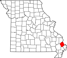 | |
| Villages | ||
| Townships | ||
| Unincorporated communities | ||
| Ghost towns | ||
| Footnotes | ‡This populated place also has portions in an adjacent county or counties | |