Petriana
| Uxelodunum | |
|---|---|
 Church Street, Stanwix. The fort was in the area around St Michael's church | |
 | |
| Alternative name(s) | Petriana |
| Known also as | Stanwix Fort |
| Location | |
| Coordinates | 54°54′18″N 2°56′31″W / 54.905°N 2.942°W |
| County | Cumbria |
| Country | England |
| Reference | |
| UK-OSNG reference | NY396571 |
Uxelodunum (with the alternative Roman name of Petriana and the modern name of Stanwix Fort) was a Roman fort. It was the largest fort on Hadrian's Wall, and is now buried beneath the suburb of Stanwix, in Carlisle, Cumbria, England.
Roman name
The fort was called Petrianis in the Notitia Dignitatum, but on the Ravenna Cosmography it is called Uxellodamo. On the Rudge Cup it is called VXELODVM. On the Amiens Skillet it is called VXELODVNVM. It is also called VXELODVNVM on the Staffordshire Moorlands Pan. The name Petrianis comes from the cohort that was stationed there. Uxelodunum, which appears to be a latinisation of a Celtic toponym, is thought to mean High Fort.[1]
It is thus likely that the name Petriana was a scribal error which confused the fort's name and the occupying unit, and that the fort's true name was Uxelodunum.[2]
Description
The fort is about forty miles west of the fort of Castlesteads (Camboglanna) and five and a half miles east of Burgh by Sands (Aballava). It stands on a natural platform above the River Eden. The fort measures about 580 feet (180 m) north to south by 700 feet (210 m) east to west, covering approximately 9.32 acres (3.77 ha), much larger than the other wall forts. The fort is adjacent to the Wall, which passes along its north side. Apparently the fort was intended to guard the Eden bridgehead and watch the important western route to and from Scotland.
The fort is now covered with buildings in the modern Carlisle suburb of Stanwix.
Garrison
Because of the large size of the fort, it is thought to have housed a cavalry regiment, one thousand strong. This was almost certainly the Ala Petriana, the sole regiment of this size on the Wall. This was a distinguished auxiliary regiment, whose soldiers had been made Roman citizens for valour on the field of battle. It seems that the fort was given the name of its garrison, thus supplanting the earlier name of Uxelodunum.
Excavations
Excavations were made in 1932-4, and the ditch for the south rampart was traced, as well as Hadrian's Wall, which formed the north face of the fort. Barrack-like buildings were also found within the outline of the fort. In 1939 a large granary, lying east to west, was found in extending the local school-yard. In 1940 the south-west angle tower was found as well as the south and east walls.
In 1934 various objects were found which appeared to have been washed down into the river from the fort. These included brooches, mountings for cavalrymen’s uniforms and harness.
The Vallum has been traced to a point just short of the south-east angle of the fort.
In 2017 a major discovery was made of the fort's bath-house, by the riverside beneath the grounds of Carlisle Cricket Club. The well-preserved remains included a hypocaust for heating. Also found was an inscription to Julia Domna, the mother of the Emperor Caracalla.[3] She was also the wife of the Emperor Septimius Severus, whom she accompanied in Britain from 208 until his death in 211 at York. The inscription prompts the question, did Julia Domna visit Petriana?
References
- ↑ For the etymology of the "dun" element in the name, see Dun. There was a similarly named hill fort in Gaul called Uxellodunum (see Uxellodunum, Encyclopedia Universalis for its etymology).
- ↑ Historic England. "Hadrian's Wall and vallum between the field boundary west of Wall Knowe and Scotland Road including the Roman fort at Stanwix in wall mile 65 (1017948)". National Heritage List for England. Retrieved 13 December 2013.
- ↑ www.newsandstar.co.uk
External links
- Uxelodunum at www.Roman-Britain.org
- iRomans website showing Uxelodunum objects at Tullie House Museum
| Wall Forts (East to West) | 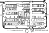 | |
|---|---|---|
| Outpost Forts | ||
| Stanegate Forts |
| |
| Supply Forts | ||
| Cumbrian Coast Forts (North to South) |
| |