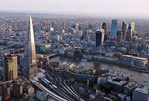
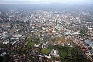
Urban area
An urban area or urban agglomeration is a human settlement with high population density and infrastructure of built environment. Urban areas are created through urbanization and are categorized by urban morphology as cities, towns, conurbations or suburbs. In urbanism, the term contrasts to rural areas such as villages and hamlets and in urban sociology or urban anthropology it contrasts with natural environment. The creation of early predecessors of urban areas during the urban revolution led to the creation of human civilization with modern urban planning, which along with other human activities such as exploitation of natural resources leads to human impact on the environment.
The world's urban population in 1950 of just 746 million has increased to 3.9 billion in the decades since.[1] In 2009, the number of people living in urban areas (3.42 billion) surpassed the number living in rural areas (3.41 billion) and since then the world has become more urban than rural.[2] This was the first time that the majority of the world's population lived in a city.[3] In 2014 there were 7.2 billion people living on the planet,[4] of which the global urban population comprised 3.9 billion. The Population Division of the United Nations Department of Economic and Social Affairs at that time predicted the urban population would grow to 6.4 billion by 2050, with 37% of that growth to come from three countries: China, India and Nigeria.[1]
Urban areas are created and further developed by the process of urbanization. Urban areas are measured for various purposes, including analyzing population density and urban sprawl.
Unlike an urban area, a metropolitan area includes not only the urban area, but also satellite cities plus intervening rural land that is socio-economically connected to the urban core city, typically by employment ties through commuting, with the urban core city being the primary labor market.
Definitions
European countries define urbanized areas on the basis of urban-type land use, not allowing any gaps of typically more than 200 metres (220 yd), and use satellite imagery instead of census blocks to determine the boundaries of the urban area. In less-developed countries, in addition to land use and density requirements, a requirement that a large majority of the population, typically 75%, is not engaged in agriculture and/or fishing is sometimes used.
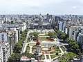
Argentina
Argentina is highly urbanized.[5] The ten largest metropolitan areas account for half of the population, and fewer than one in ten live in rural areas. About 3 million people live in Buenos Aires City and the Greater Buenos Aires metropolitan area totals around 15 million, making it one of the largest urban areas in the world, with a population of 18 million all up.[6]
Córdoba has around 1.5 million people living in the urban area, while Rosario, Mendoza and Tucumán have around 1.2 million inhabitants each[6] and La Plata, Mar del Plata, Salta and Santa Fe[6][7] have at least 500,000 people each.
The population is unequally distributed amongst the provinces: about 60% live in the Pampa region (21% of the total area), including 20 million people in Buenos Aires Province; Córdoba Province Santa Fe Province and the Autonomous City of Buenos Aires have 3 million each. Seven other provinces have over one million people each: Mendoza, Tucumán, Entre Ríos, Salta, Chaco, Corrientes and Misiones. Tucumán is the most densely populated with 60 per square kilometre (160/sq mi), the only Argentine province more densely populated than the world average, while the southern province of Santa Cruz has around 1 inhabitant per square kilometre (2.6/sq mi).
| Rank | Name | Province | Pop. | Rank | Name | Province | Pop. | ||
|---|---|---|---|---|---|---|---|---|---|
 Buenos Aires 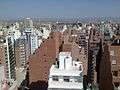 Córdoba |
1 | Buenos Aires | (Autonomous city) | 13,834,000 | 11 | Resistencia | Chaco | 409,000 | 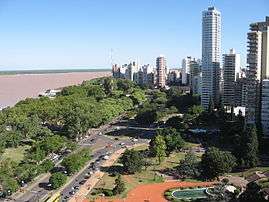 Rosario  Mendoza |
| 2 | Córdoba | Córdoba | 1,519,000 | 12 | Santiago del Estero | Santiago del Estero | 406,000 | ||
| 3 | Rosario | Santa Fe | 1,429,000 | 13 | Corrientes | Corrientes | 383,000 | ||
| 4 | Mendoza | Mendoza | 1,082,000 | 14 | Posadas | Misiones | 355,000 | ||
| 5 | Tucumán | Tucumán | 868,000 | 15 | San Salvador de Jujuy | Jujuy | 338,000 | ||
| 6 | La Plata | Buenos Aires | 836,000 | 16 | Neuquén | Neuquén | 309,000 | ||
| 7 | Mar del Plata | Buenos Aires | 633,000 | 17 | Bahía Blanca | Buenos Aires | 307,000 | ||
| 8 | Salta | Salta | 625,000 | 18 | Paraná | Entre Ríos | 274,000 | ||
| 9 | Santa Fe | Santa Fe | 530,000 | 19 | Formosa | Formosa | 258,000 | ||
| 10 | San Juan | San Juan | 513,000 | 20 | San Luis | San Luis | 218,000 | ||
Australia
In Australia, urban areas are referred to as "urban centres" and are defined as population clusters of 1,000 or more people, with a density of at least 200/km2 (518/sq mi)[9] Australia is one of the most urbanised countries in the world, with more than 50% of the population residing in the nation's five biggest cities.
| Rank | Name | State | Pop. | Rank | Name | State | Pop. | ||
|---|---|---|---|---|---|---|---|---|---|
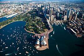 Sydney 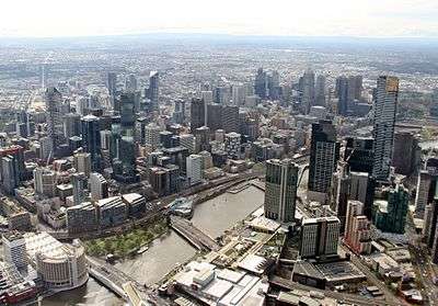 Melbourne |
1 | Sydney | NSW | 5,131,326 | 11 | Hobart | Tas | 224,462 | 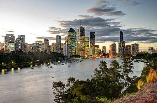 Brisbane 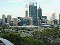 Perth |
| 2 | Melbourne | Vic | 4,850,740 | 12 | Geelong | Vic | 192,393 | ||
| 3 | Brisbane | Qld | 2,408,223 | 13 | Townsville | Qld | 178,864 | ||
| 4 | Perth | WA | 2,043,138 | 14 | Cairns | Qld | 150,041 | ||
| 5 | Adelaide | SA | 1,333,927 | 15 | Darwin | NT | 145,916 | ||
| 6 | Gold Coast–Tweed Heads | Qld/NSW | 646,983 | 16 | Toowoomba | Qld | 114,024 | ||
| 7 | Newcastle–Maitland | NSW | 436,171 | 17 | Ballarat | Vic | 101,588 | ||
| 8 | Canberra–Queanbeyan | ACT/NSW | 435,019 | 18 | Bendigo | Vic | 95,587 | ||
| 9 | Sunshine Coast | Qld | 317,404 | 19 | Albury-Wodonga | NSW/Vic | 90,576 | ||
| 10 | Wollongong | NSW | 295,669 | 20 | Launceston | Tas | 86,335 | ||
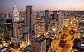
Brazil
According to IBGE (Brazilian Institute of Geography and Statistics) urban areas already concentrate 84.35% of the population, while the Southeast region remains the most populated one, with over 80 million inhabitants.[12] The largest metropolitan areas in Brazil are São Paulo, Rio de Janeiro, and Belo Horizonte — all in the Southeastern Region — with 20, 12, and 5 million inhabitants respectively.[13] The majority of state capitals are the largest cities in their states, except for Vitória, the capital of Espírito Santo, and Florianópolis, the capital of Santa Catarina. There are also non-capital metropolitan areas in the states of São Paulo (Campinas, Santos and the Paraíba Valley), Minas Gerais (Steel Valley), Rio Grande do Sul (Sinos Valley) and Santa Catarina (Itajaí Valley).[14]
.jpg)
Largest urban agglomerations in Brazil 2017 Brazilian Institute of Geography and Statistics estimates[16][17][18] | |||||||||
|---|---|---|---|---|---|---|---|---|---|
| Rank | Name | State | Pop. | Rank | Name | State | Pop. | ||
 São Paulo 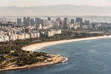 Rio de Janeiro |
1 | São Paulo | São Paulo | 21,314,716 | 11 | Belém | Pará | 2,157,180 | 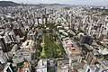 Belo Horizonte .jpg) Recife |
| 2 | Rio de Janeiro | Rio de Janeiro | 12,389,775 | 12 | Manaus | Amazonas | 2,130,264 | ||
| 3 | Belo Horizonte | Minas Gerais | 5,142,260 | 13 | Campinas | São Paulo | 2,105,600 | ||
| 4 | Recife | Pernambuco | 4,021,641 | 14 | Vitória | Espírito Santo | 1,837,047 | ||
| 5 | Brasília | Federal District | 3,986,425 | 15 | Baixada Santista | São Paulo | 1,702,343 | ||
| 6 | Porto Alegre | Rio Grande do Sul | 3,894,232 | 16 | São José dos Campos | São Paulo | 1,572,943 | ||
| 7 | Salvador | Bahia | 3,863,154 | 17 | São Luís | Maranhão | 1,421,569 | ||
| 8 | Fortaleza | Ceará | 3,594,924 | 18 | Natal | Rio Grande do Norte | 1,349,743 | ||
| 9 | Curitiba | Paraná | 3,387,985 | 19 | Maceió | Alagoas | 1,231,965 | ||
| 10 | Goiânia | Goiás | 2,347,557 | 20 | João Pessoa | Paraíba | 1,168,941 | ||
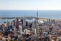
Canada
According to Statistics Canada, an urban area in Canada is an area with a population of at least 1,000 people where the density is no fewer than 400 persons per square kilometre (1,000/sq mi).[19] If two or more urban areas are within 2 km (1.2 mi) of each other by road, they are merged into a single urban area, provided they do not cross census metropolitan area or census agglomeration boundaries.[20]
| Rank | Name | Province | Pop. | Rank | Name | Province | Pop. | ||
|---|---|---|---|---|---|---|---|---|---|
 Toronto  Montreal |
1 | Toronto | Ontario | 2,731,571 | 11 | Quebec City | Quebec | 531,902 | 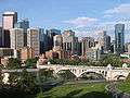 Calgary  Ottawa |
| 2 | Montreal | Quebec | 1,704,694 | 12 | Surrey | British Columbia | 517,887 | ||
| 3 | Calgary | Alberta | 1,239,220 | 13 | Laval | Quebec | 422,993 | ||
| 4 | Ottawa | Ontario | 934,243 | 14 | Halifax | Nova Scotia | 403,131 | ||
| 5 | Edmonton | Alberta | 932,546 | 15 | London | Ontario | 383,822 | ||
| 6 | Mississauga | Ontario | 721,599 | 16 | Markham | Ontario | 328,966 | ||
| 7 | Winnipeg | Manitoba | 705,244 | 17 | Vaughan | Ontario | 306,233 | ||
| 8 | Vancouver | British Columbia | 631,486 | 18 | Gatineau | Quebec | 276,245 | ||
| 9 | Brampton | Ontario | 593,638 | 19 | Saskatoon | Saskatchewan | 246,376 | ||
| 10 | Hamilton | Ontario | 536,917 | 20 | Longueuil | Quebec | 239,700 | ||
In the Canada 2011 Census, Statistics Canada redesignated urban areas with the new term "population centre";[22] the new term was chosen in order to better reflect the fact that urban vs. rural is not a strict division, but rather a continuum within which several distinct settlement patterns may exist. For example, a community may fit a strictly statistical definition of an urban area, but may not be commonly thought of as "urban" because it has a smaller population, or functions socially and economically as a suburb of another urban area rather than as a self-contained urban entity, or is geographically remote from other urban communities. Accordingly, the new definition set out three distinct types of population centres: small (population 1,000 to 29,999), medium (population 30,000 to 99,999) and large (population 100,000 or greater).[22] Despite the change in terminology, however, the demographic definition of a population centre remains unchanged from that of an urban area: a population of at least 1,000 people where the density is no fewer than 400 persons per km2.
China
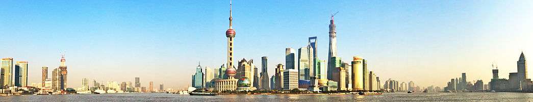
Since 2000, China's cities have expanded at an average rate of 10% annually. It is estimated that China's urban population will increase by 292 million people by 2050,[1] when its cities will house a combined population of over one billion.[23] The country's urbanization rate increased from 17.4% to 46.6% between 1978 and 2009.[24] Between 150 and 200 million migrant workers work part-time in the major cities, returning home to the countryside periodically with their earnings.[25][26]
Today, China has more of cities with one million or more long-term residents than any other country, including the three global cities of Beijing, Hong Kong, and Shanghai; by 2025, the country will be home to 221 cities with over a million inhabitants.[23] The figures in the table below are from the 2008 census, and are only estimates of the urban populations within administrative city limits; a different ranking exists when considering the total municipal populations (which includes suburban and rural populations). The large "floating populations" of migrant workers make conducting censuses in urban areas difficult;[27] the figures below include only long-term residents.
Largest cities or towns in China Sixth National Population Census of the People's Republic of China (2010) | |||||||||
|---|---|---|---|---|---|---|---|---|---|
| Rank | Name | Province | Pop. | Rank | Name | Province | Pop. | ||
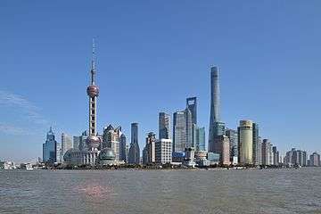 Shanghai  Beijing |
1 | Shanghai | Shanghai | 20,217,700 | 11 | Chengdu | Sichuan | 6,316,900 |  Chongqing  Guangzhou |
| 2 | Beijing | Beijing | 16,446,900 | 12 | Nanjing | Jiangsu | 6,238,200 | ||
| 3 | Chongqing | Chongqing | 11,871,200 | 13 | Shenyang | Liaoning | 5,718,200 | ||
| 4 | Guangzhou | Guangdong | 10,641,400 | 14 | Hangzhou | Zhejiang | 5,578,300 | ||
| 5 | Shenzhen | Guangdong | 10,358,400 | 15 | Xi'an | Shaanxi | 5,399,300 | ||
| 6 | Tianjin | Tianjin | 9,562,300 | 16 | Harbin | Heilongjiang | 5,178,000 | ||
| 7 | Wuhan | Hubei | 7,541,500 | 17 | Suzhou | Jiangsu | 4,083,900 | ||
| 8 | Dongguan | Guangdong | 7,271,300 | 18 | Qingdao | Shandong | 3,990,900 | ||
| 9 | Hong Kong | Hong Kong | 7,055,071 | 19 | Dalian | Liaoning | 3,902,500 | ||
| 10 | Foshan | Guangdong | 6,771,900 | 20 | Zhengzhou | Henan | 3,677,000 | ||
Colombia
In Colombia the largest Metropolitan area is Bogotá's, which has around 9.8 million of inhabitants and includes municipalities like Cota, La Calera, Chía, Soacha, Usaquen, Suba among others.., it's the metropolis of Culture, Business and Literature, Bogotá has been the International City of the Book and has places uniques like Monserrate, Torre Colpatria, Bolivar Square, BD Bacatá, Corferias, National University etc.[29][30]

Largest cities or towns in Colombia National Administrative Department of Statistics (DANE), 2016 projections[31] | |||||||||
|---|---|---|---|---|---|---|---|---|---|
| Rank | Name | Department | Pop. | Rank | Name | Department | Pop. | ||
 Bogotá  Medellín |
1 | Bogotá | Bogotá | 7,963,379 | 11 | Santa Marta | Magdalena | 474,520 | 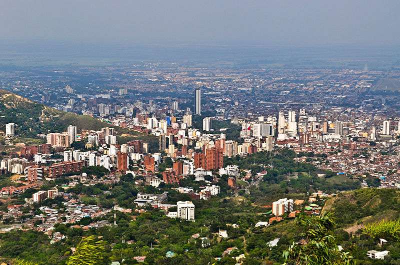 Cali  Barranquilla |
| 2 | Medellín | Antioquia | 2,457,680 | 12 | Villavicencio | Meta | 471,383 | ||
| 3 | Cali | Valle del Cauca | 2,358,302 | 13 | Bello | Antioquia | 458,196 | ||
| 4 | Barranquilla | Atlántico | 1,219,382 | 14 | Pereira | Risaralda | 398,719 | ||
| 5 | Cartagena | Bolívar | 971,592 | 15 | Valledupar | Cesar | 395,860 | ||
| 6 | Cúcuta | Norte de Santander | 634,276 | 16 | Buenaventura | Valle del Cauca | 373,717 | ||
| 7 | Soledad | Atlántico | 631,599 | 17 | Pasto | Nariño | 371,045 | ||
| 8 | Ibagué | Tolima | 528,214 | 18 | Manizales | Caldas | 369,981 | ||
| 9 | Bucaramanga | Santander | 521,857 | 19 | Montería | Córdoba | 346,873 | ||
| 10 | Soacha | Cundinamarca | 516,435 | 20 | Neiva | Huila | 324,375 | ||
Finland
Similar to other Nordic countries, an urban area (taajama in Finnish) in Finland must have a building at least every 200 m (660 ft) and at least 200 people. To be considered a town or a city (kaupunki) for statistical purposes, an urban area must have at least 15,000 people. This is not to be confused with the city / town designation used by municipalities.[32][33]
Largest cities or towns in Finland http://pxnet2.stat.fi/PXWeb/sq/9af9ca56-9eea-4969-9714-db194f6847e5 | |||||||||
|---|---|---|---|---|---|---|---|---|---|
| Rank | Name | Region | Pop. | Rank | Name | Region | Pop. | ||
 Helsinki 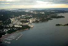 Espoo |
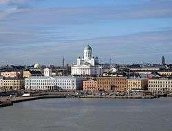
1 | Helsinki | Uusimaa | 635,591 | 11 | Pori | Satakunta | 85,002 |  Tampere  Vantaa |
| 2 | Espoo | Uusimaa | 274,522 | 12 | Joensuu | North Karelia | 75,881 | ||
| 3 | Tampere | Pirkanmaa | 228,173 | 13 | Lappeenranta | South Karelia | 72,773 | ||
| 4 | Vantaa | Uusimaa | 219,196 | 14 | Hämeenlinna | Tavastia Proper | 67,867 | ||
| 5 | Oulu | Northern Ostrobothnia | 200,071 | 15 | Vaasa | Ostrobothnia | 67,598 | ||
| 6 | Turku | Finland Proper | 187,564 | 16 | Rovaniemi | Lapland | 62,246 | ||
| 7 | Jyväskylä | Central Finland | 138,780 | 17 | Seinäjoki | Southern Ostrobothnia | 62,053 | ||
| 8 | Lahti | Päijänne Tavastia | 119,377 | 18 | Mikkeli | Southern Savonia | 54,494 | ||
| 9 | Kuopio | Northern Savonia | 112,980 | 19 | Kotka | Kymenlaakso | 54,160 | ||
| 10 | Kouvola | Kymenlaakso | 85,231 | 20 | Salo | Finland Proper | 53,556 | ||
France
In France, an urban area (Fr: aire urbaine) is a zone encompassing an area of built-up growth (called an "urban unit" (unité urbaine)[34] – close in definition to the North American urban area) and its commuter belt (couronne périurbaine). Americans would find the INSEE definition of the urban area[35] to be similar to their metropolitan area, and the INSEE sometimes uses the term aire métropolitaine[36] to refer to the country's largest aires urbaines.
The largest cities in France, in terms of urban area population (2013), are Paris (12,405,426), Lyon (2,237,676), Marseille (1,734,277), Toulouse (1,291,517), Bordeaux (1,178,335), Lille (1,175,828), Nice (1,004,826), Nantes (908,815), Strasbourg (773,447) and Rennes (700,675).[37]

Largest cities or towns in France 2010 census | |||||||||
|---|---|---|---|---|---|---|---|---|---|
| Rank | Name | Region | Pop. | Rank | Name | Region | Pop. | ||
.jpg) Paris  Marseille |
1 | Paris | Île-de-France | 2,243,833 | 11 | Rennes | Brittany | 207,178 | .jpg) Lyon  Toulouse |
| 2 | Marseille | Provence-Alpes-Côte d'Azur | 850,726 | 12 | Reims | Grand Est | 179,992 | ||
| 3 | Lyon | Auvergne-Rhône-Alpes | 484,344 | 13 | Le Havre | Normandy | 175,497 | ||
| 4 | Toulouse | Occitanie | 441,802 | 14 | Saint-Étienne | Auvergne-Rhône-Alpes | 171,260 | ||
| 5 | Nice | Provence-Alpes-Côte d'Azur | 343,304 | 15 | Toulon | Provence-Alpes-Côte d'Azur | 164,532 | ||
| 6 | Nantes | Pays de la Loire | 284,970 | 16 | Grenoble | Auvergne-Rhône-Alpes | 155,637 | ||
| 7 | Strasbourg | Grand Est | 271,782 | 17 | Dijon | Bourgogne-Franche-Comté | 151,212 | ||
| 8 | Montpellier | Occitanie | 257,351 | 18 | Angers | Pays de la Loire | 147,571 | ||
| 9 | Bordeaux | Nouvelle-Aquitaine | 239,157 | 19 | Villeurbanne | Auvergne-Rhône-Alpes | 145,150 | ||
| 10 | Lille | Hauts-de-France | 227,560 | 20 | Saint-Denis | Réunion | 145,022 | ||
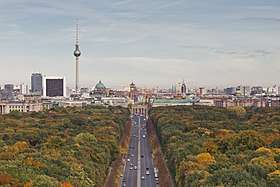
Germany
Germany has a number of large cities. There are 11 officially recognised metropolitan regions in Germany – and since 2006, 34 potential cities were identified which can be called a Regiopolis.
The largest conurbation is the Rhine-Ruhr region (11.7 million in 2008), including Düsseldorf (the capital of North Rhine-Westphalia), Cologne, Bonn, Dortmund, Essen, Duisburg, and Bochum.[38]
| Rank | Name | State | Pop. | Rank | Name | State | Pop. | ||
|---|---|---|---|---|---|---|---|---|---|
 Berlin .jpg) Hamburg |
1 | Berlin | Berlin | 3,710,156 | 11 | Bremen | Bremen (state) | 557,464 |  Munich .jpg) Cologne |
| 2 | Hamburg | Hamburg | 1,787,408 | 12 | Dresden | Saxony | 543,825 | ||
| 3 | Munich | Bavaria | 1,450,381 | 13 | Hannover | Lower Saxony | 532,163 | ||
| 4 | Cologne | North Rhine-Westphalia | 1,060,582 | 14 | Nuremberg | Bavaria | 509,975 | ||
| 5 | Frankfurt | Hesse | 732,688 | 15 | Duisburg | North Rhine-Westphalia | 491,231 | ||
| 6 | Stuttgart | Baden-Württemberg | 623,738 | 16 | Bochum | North Rhine-Westphalia | 364,742 | ||
| 7 | Düsseldorf | North Rhine-Westphalia | 612,178 | 17 | Wuppertal | North Rhine-Westphalia | 350,046 | ||
| 8 | Dortmund | North Rhine-Westphalia | 586,181 | 18 | Bielefeld | North Rhine-Westphalia | 333,090 | ||
| 9 | Essen | North Rhine-Westphalia | 582,624 | 19 | Bonn | North Rhine-Westphalia | 318,809 | ||
| 10 | Leipzig | Saxony | 560,472 | 20 | Münster | North Rhine-Westphalia | 310,039 | ||
India
For the Census of India 2011, the definition of urban area is a place having a minimum population of 5,000 of density 400 persons per square kilometre (1,000/sq mi) or higher, and 75% plus of the male working population employed in non-agricultural activities. Places administered by a municipal corporation, cantonment board or notified town area committee are automatically considered urban areas.[39]
The Census of India 2011 also defined the term "urban agglomeration" as an integrated urban area consisting of a core town together with its "outgrowths" (contiguous suburbs).[40]
| Rank | Name | State/UT | Pop. | Rank | Name | State/UT | Pop. | ||
|---|---|---|---|---|---|---|---|---|---|
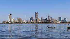 Mumbai  Delhi |
1 | Mumbai | Maharashtra | 12,478,447 | 11 | Kanpur | Uttar Pradesh | 2,920,067 | .jpg) Bangalore Hyderabad |
| 2 | Delhi | Delhi | 11,007,835 | 12 | Lucknow | Uttar Pradesh | 2,901,474 | ||
| 3 | Bangalore | Karnataka | 8,425,970 | 13 | Nagpur | Maharashtra | 2,405,421 | ||
| 4 | Hyderabad | Telangana | 6,809,970 | 14 | Indore | Madhya Pradesh | 1,960 521 | ||
| 5 | Ahmedabad | Gujarat | 5,570,585 | 15 | Thane | Maharastra | 1,818,872 | ||
| 6 | Chennai | Tamil Nadu | 4,681,087 | 16 | Bhopal | Madhya Pradesh | 1,795,648 | ||
| 7 | Kolkata | West Bengal | 4,486,679 | 17 | Visakhapatnam | Andhra Pradesh | 1,730,320 | ||
| 8 | Surat | Gujarat | 4,462,002 | 18 | Pimpri-Chinchwad | Maharashtra | 1,729,359 | ||
| 9 | Pune | Maharashtra | 3,115,431 | 19 | Patna | Bihar | 1,683,200 | ||
| 10 | Jaipur | Rajasthan | 3,073,350 | 20 | Ludhiana | Punjab | 1,613,878 | ||
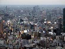
Japan
In Japan urbanized areas are defined as contiguous areas of densely inhabited districts (DIDs) using census enumeration districts as units with a density requirement of 4,000 inhabitants per square kilometre (10,000/sq mi).
| Rank | Name | Prefecture | Pop. | Rank | Name | Prefecture | Pop. | ||
|---|---|---|---|---|---|---|---|---|---|
.jpg) Tokyo _05.JPG) Yokohama |
1 | Tokyo | Tokyo | 13,839,910 | 11 | Hiroshima | Hiroshima | 1,174,209 | Osaka 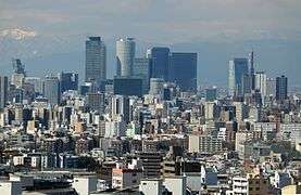 Nagoya |
| 2 | Yokohama | Kanagawa | 3,689,603 | 12 | Sendai | Miyagi | 1,045,903 | ||
| 3 | Osaka | Osaka | 2,666,371 | 13 | Kitakyushu | Fukuoka | 977,288 | ||
| 4 | Nagoya | Aichi | 2,263,907 | 14 | Chiba | Chiba | 962,130 | ||
| 5 | Sapporo | Hokkaido | 1,914,434 | 15 | Sakai | Osaka | 842,134 | ||
| 6 | Kobe | Hyōgo | 1,544,873 | 16 | Niigata | Niigata | 812,192 | ||
| 7 | Kyoto | Kyoto | 1,474,473 | 17 | Hamamatsu | Shizuoka | 800,912 | ||
| 8 | Fukuoka | Fukuoka | 1,463,826 | 18 | Kumamoto | Kumamoto | 734,294 | ||
| 9 | Kawasaki | Kanagawa | 1,425,678 | 19 | Sagamihara | Kanagawa | 717,561 | ||
| 10 | Saitama | Saitama | 1,222,910 | 20 | Shizuoka | Shizuoka | 716,328 | ||
Netherlands
The Netherlands is the 30th most densely populated country in the world, with 404.6 inhabitants per square kilometre (1,048/sq mi)—or 497 inhabitants per square kilometre (1,287/sq mi) if only the land area is counted. The Randstad is the country's largest conurbation located in the west of the country and contains the four largest cities: Amsterdam, Rotterdam, The Hague, and Utrecht. The Randstad has a population of 7 million inhabitants and is the 6th largest metropolitan area in Europe.
| Rank | Name | Province | Pop. | Rank | Name | Province | Pop. | ||
|---|---|---|---|---|---|---|---|---|---|
.jpg) Amsterdam .jpg) Rotterdam |
1 | Amsterdam | North Holland | 855,896 | 11 | Apeldoorn | Gelderland | 161,181 |  The Hague  Utrecht |
| 2 | Rotterdam | South Holland | 638,751 | 12 | Haarlem | North Holland | 159,819 | ||
| 3 | The Hague | South Holland | 531,935 | 13 | Enschede | Overijssel | 158,276 | ||
| 4 | Utrecht | Utrecht | 347,526 | 14 | Arnhem | Gelderland | 157,277 | ||
| 5 | Eindhoven | North Brabant | 229,184 | 15 | Amersfoort | Utrecht | 155,215 | ||
| 6 | Tilburg | North Brabant | 215,631 | 16 | Zaanstad | North Holland | 154,826 | ||
| 7 | Almere | Flevoland | 203,997 | 17 | 's-Hertogenbosch | North Brabant | 153,429 | ||
| 8 | Groningen | Groningen | 202,900 | 18 | Haarlemmermeer | North Holland | 147,302 | ||
| 9 | Breda | North Brabant | 183,749 | 19 | Zwolle | Overijssel | 126,158 | ||
| 10 | Nijmegen | Gelderland | 175,928 | 20 | Zoetermeer | South Holland | 124,719 | ||
New Zealand
Statistics New Zealand defines urban areas in New Zealand, which are independent of any administrative subdivisions and have no legal basis.[43] There are three classes of urban area: main urban areas are the 17 urban areas which have a population of 30,000 or more; secondary urban areas are the 14 urban areas which have a population of 10,000 or more but less than 30,000, and minor urban areas are the 103 urban areas which have a population of 1,000 or more but less than 10,000. Urban areas are reclassified after each New Zealand census, so population changes between censuses does not change an urban area's classification. For example, Rolleston (pop. 16,250) is still classified as a minor urban area because its population was under 10,000 at the 2013 Census.
| Rank | Name | Region | Pop. | Rank | Name | Region | Pop. | ||
|---|---|---|---|---|---|---|---|---|---|
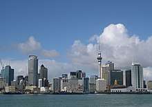 Auckland  Wellington |
1 | Auckland | Auckland | 1,628,900 | 11 | Whangarei | Northland | 58,800 |  Christchurch 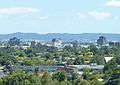 Hamilton |
| 2 | Wellington | Wellington | 418,500 | 12 | New Plymouth | Taranaki | 58,300 | ||
| 3 | Christchurch | Canterbury | 404,500 | 13 | Invercargill | Southland | 51,200 | ||
| 4 | Hamilton | Waikato | 241,200 | 14 | Kapiti | Wellington | 42,700 | ||
| 5 | Tauranga | Bay of Plenty | 141,600 | 15 | Whanganui | Manawatu-Wanganui | 40,900 | ||
| 6 | Napier-Hastings | Hawke's Bay | 134,500 | 16 | Gisborne | Gisborne | 37,200 | ||
| 7 | Dunedin | Otago | 122,000 | 17 | Blenheim | Marlborough | 31,600 | ||
| 8 | Palmerston North | Manawatu-Wanganui | 86,600 | 18 | Pukekohe | Auckland | 31,400 | ||
| 9 | Nelson | Nelson | 67,500 | 19 | Timaru | Canterbury | 29,100 | ||
| 10 | Rotorua | Bay of Plenty | 59,500 | 20 | Taupo | Waikato | 24,700 | ||
Norway
Statistics Norway defines urban areas ("tettsteder") similarly to the other Nordic countries. Unlike in Denmark and Sweden, the distance between each building has to be of less than 50 m, although exceptions are made due to parks, industrial areas, rivers, and similar. Groups of houses less than 400 m from the main body of an urban area are included in the urban area.[45]
| Rank | Name | County | Pop. | Rank | Name | County | Pop. | ||
|---|---|---|---|---|---|---|---|---|---|
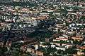 Oslo 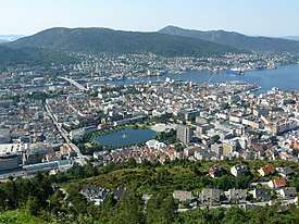 Bergen |
1 | Oslo | Oslo | 988,873 | 11 | Moss | Østfold | 46,618 | 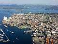 Stavanger/Sandnes 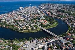 Trondheim |
| 2 | Bergen | Hordaland | 254,235 | 12 | Haugesund | Rogaland | 44,830 | ||
| 3 | Stavanger/Sandnes | Rogaland | 220,943 | 13 | Sandefjord | Vestfold | 43,595 | ||
| 4 | Trondheim | Trøndelag | 180,557 | 14 | Arendal | Aust-Agder | 43,084 | ||
| 5 | Drammen | Buskerud | 116,446 | 15 | Bodø | Nordland | 40,705 | ||
| 6 | Fredrikstad/Sarpsborg | Østfold | 111,267 | 16 | Tromsø | Troms | 38,980 | ||
| 7 | Porsgrunn/Skien | Telemark | 92,753 | 17 | Hamar | Hedmark | 27,324 | ||
| 8 | Kristiansand | Vest-Agder | 61,536 | 18 | Halden | Østfold | 25,300 | ||
| 9 | Ålesund | Møre og Romsdal | 52,163 | 19 | Larvik | Vestfold | 24,208 | ||
| 10 | Tønsberg | Vestfold | 51,571 | 20 | Askøy | Hordaland | 23,194 | ||
Pakistan
In Pakistan an area is a major city and municipality if it has more than 100,000 inhabitants according to census results, Cities include adjacent cantonments. Urbanisation in Pakistan has increased since the time of independence and has several different causes. The majority of southern Pakistan's population lives along the Indus River. Karachi is its most populous city.[46] In the northern half of the country, most of the population lives in an arc formed by the cities of Lahore, Faisalabad, Rawalpindi, Islamabad, Gujranwala, Sialkot, Gujrat, Jhelum, Sargodha, Sheikhupura, Nowshera, Mardan and Peshawar. During 1990–2008, city dwellers made up 36% of Pakistan's population, making it the most urbanised nation in South Asia. Furthermore, 50% of Pakistanis live in towns of 5,000 people or more.[47] Karachi is the most populated city in Pakistan closely followed by Lahore according to the 2017 Census.
Largest cities or towns in Pakistan According to the 2017 Census | |||||||||
|---|---|---|---|---|---|---|---|---|---|
| Rank | Name | Province | Pop. | Rank | Name | Province | Pop. | ||
_Head_Office_Building_Karachi.jpg) Karachi 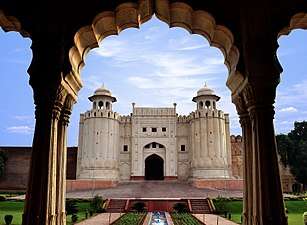 Lahore |
1 | Karachi | Sindh | 14,916,456 | 11 | Bahawalpur | Punjab | 762,111 | 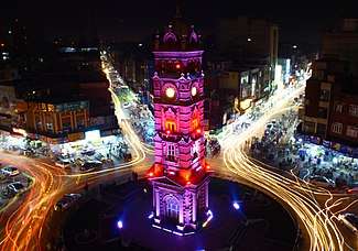 Faisalabad |
| 2 | Lahore | Punjab | 11,126,285 | 12 | Sargodha | Punjab | 659,862 | ||
| 3 | Faisalabad | Punjab | 3,204,726 | 13 | Sialkot | Punjab | 655,852 | ||
| 4 | Rawalpindi | Punjab | 2,098,231 | 14 | Sukkur | Sindh | 499,900 | ||
| 5 | Gujranwala | Punjab | 2,027,001 | 15 | Larkana | Sindh | 490,508 | ||
| 6 | Peshawar | Khyber Pakhtunkhwa | 1,970,042 | 16 | Sheikhupura | Punjab | 473,129 | ||
| 7 | Multan | Punjab | 1,871,843 | 17 | Rahim Yar Khan | Punjab | 420,419 | ||
| 8 | Hyderabad | Sindh | 1,734,309 | 18 | Jhang | Punjab | 414,131 | ||
| 9 | Islamabad | Capital Territory | 1,009,832 | 19 | Dera Ghazi Khan | Punjab | 399,064 | ||
| 10 | Quetta | Balochistan | 1,001,205 | 20 | Gujrat | Punjab | 390,533 | ||
Philippines
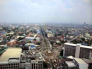
With an estimated population of 16.3 million, Metro Manila is the most populous metropolitan area in the Philippines and the 11th in the world. However, the greater urban area is the 5th largest in the world with a population of 20,654,307 people (2010 estimate).[48] Including Metro Manila, the Philippines has twelve metropolitan areas as defined by the National Economic and Development Authority (NEDA). Metro Angeles, Metro Bacolod, Metro Baguio, Metro Batangas, Metro Cagayan de Oro, Metro Cebu, Metro Dagupan, Metro Davao, Metro Iloilo-Guimaras, Metro Naga, Metro Olongapo.
As per Republic Act No. 9009, in order to become a city, a local government unit must :
- locally generated income of at least ₱ 100 million (based on constant prices in the year 2000) for the last two consecutive years, as certified by the Department of Finance, AND
- a population of 150,000 or more, as certified by the National Statistics Office (NSO); OR a contiguous territory of 100 square kilometers, as certified by the Land Management Bureau, with contiguity not being a requisite for areas that are on two or more islands.
| Rank | Name | Region | Pop. | Rank | Name | Region | Pop. | ||
|---|---|---|---|---|---|---|---|---|---|
 Quezon City 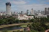 Manila |
1 | Quezon City | National Capital Region | 2,936,116 | 11 | Parañaque | National Capital Region | 665,822 | 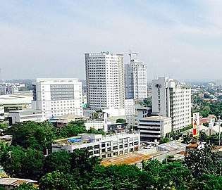 Davao City 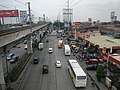 Caloocan |
| 2 | Manila | National Capital Region | 1,780,148 | 12 | Dasmariñas | Calabarzon | 659,019 | ||
| 3 | Davao City | Davao Region | 1,632,991 | 13 | Valenzuela | National Capital Region | 620,422 | ||
| 4 | Caloocan | National Capital Region | 1,583,978 | 14 | Bacoor | Calabarzon | 600,609 | ||
| 5 | Cebu City | Central Visayas | 922,611 | 15 | General Santos | Soccsksargen | 594,446 | ||
| 6 | Zamboanga City | Zamboanga Peninsula | 861,799 | 16 | Las Piñas | National Capital Region | 588,894 | ||
| 7 | Taguig | National Capital Region | 804,915 | 17 | Makati | National Capital Region | 582,602 | ||
| 8 | Antipolo | Calabarzon | 776,386 | 18 | San Jose del Monte | Central Luzon | 574,089 | ||
| 9 | Pasig | National Capital Region | 755,300 | 19 | Bacolod | Western Visayas | 561,875 | ||
| 10 | Cagayan de Oro | Northern Mindanao | 675,950 | 20 | Muntinlupa | National Capital Region | 504,509 | ||
Poland
In Poland, official "urban" population figures simply refer to those localities which have the status of towns (miasta). The "rural" population is that of all areas outside the boundaries of these towns. This distinction may give a misleading impression in some cases, since some localities with only village status may have acquired larger and denser populations than many smaller towns.[49]
| Rank | Name | Voivodeship | Pop. | Rank | Name | Voivodeship | Pop. | ||
|---|---|---|---|---|---|---|---|---|---|
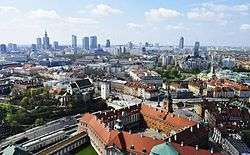 Warsaw  Kraków |
1 | Warsaw | Masovian | 1,748,916 | 11 | Białystok | Podlaskie | 296,310 |  Łódź  Wrocław |
| 2 | Kraków | Lesser Poland | 762,448 | 12 | Gdynia | Pomeranian | 247,329 | ||
| 3 | Łódź | Łódź | 698,688 | 13 | Częstochowa | Silesian | 227,270 | ||
| 4 | Wrocław | Lower Silesian | 637,075 | 14 | Radom | Masovian | 215,653 | ||
| 5 | Poznań | Greater Poland | 541,561 | 15 | Sosnowiec | Silesian | 206,516 | ||
| 6 | Gdańsk | Pomeranian | 462,996 | 16 | Toruń | Kuyavian-Pomeranian | 202,591 | ||
| 7 | Szczecin | West Pomeranian | 405,413 | 17 | Kielce | Świętokrzyskie | 197,724 | ||
| 8 | Bydgoszcz | Kuyavian-Pomeranian | 354,990 | 18 | Rzeszów | Subcarpathian | 187,027 | ||
| 9 | Lublin | Lublin | 340,745 | 19 | Gliwice | Silesian | 182,969 | ||
| 10 | Katowice | Silesian | 299,012 | 20 | Zabrze | Silesian | 175,882 | ||
Russia
| Rank | Name | Federal subject | Pop. | Rank | Name | Federal subject | Pop. | ||
|---|---|---|---|---|---|---|---|---|---|
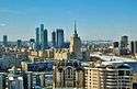 Moscow  Saint Petersburg |
1 | Moscow | Moscow | [52]12,381,000 | 11 | Rostov-na-Donu | Rostov Oblast | 1,120,000 | 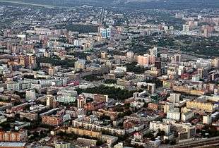 Novosibirsk 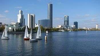 Yekaterinburg |
| 2 | Saint Petersburg | Saint Petersburg | [52]5,282,000 | 12 | Krasnoyarsk | Krasnoyarsk Krai | [53]1,084,000 | ||
| 3 | Novosibirsk | Novosibirsk Oblast | [54]1,603,000 | 13 | Perm | Perm Krai | 1,042,000 | ||
| 4 | Yekaterinburg | Sverdlovsk Oblast | [55]1,456,000 | 14 | Voronezh | Voronezh Oblast | 1,032,000 | ||
| 5 | Nizhny Novgorod | Nizhny Novgorod Oblast | 1,267,000 | 15 | Volgograd | Volgograd Oblast | 1,016,000 | ||
| 6 | Kazan | Tatarstan | [56]1,232,000 | 16 | Krasnodar | Krasnodar Krai | [57]881,000 | ||
| 7 | Chelyabinsk | Chelyabinsk Oblast | [58]1,199,000 | 17 | Saratov | Saratov Oblast | 843,000 | ||
| 8 | Omsk | Omsk Oblast | [59]1,178,000 | 18 | Tolyatti | Samara Oblast | [60]711,000 | ||
| 9 | Samara | Samara Oblast | [60]1,170,000 | 19 | Izhevsk | Udmurtia | [61]646,000 | ||
| 10 | Ufa | Bashkortostan | [62]1,126,000 | 20 | Ulyanovsk | Ulyanovsk Oblast | 622,000 | ||
Singapore
Singapore is an island city-state in Southeast Asia. About 5.6 million people live and work within 700 square kilometres (270 sq mi), making Singapore the 3rd-most-densely populated country in the world, after Monaco, another city-state. The Central Area in the south-eastern part of the island, is the country's city centre. It is surrounded by suburban settlements outside of its limits. These settlements are connected to the Central Area and each other by a dense network of roads, expressways and metro railway lines dubbed MRT by locals. Singapore has a highly centralised, unitary government with a unicameral legislature (the City Council and the Rural Board were abolished in the 1960s). While there are town councils and mayors in Singapore, these are essentially property managers in charge of the maintenance of public housing within their constituency boundaries. They do not represent local authorities with any legislative or executive autonomy from the national government.[63]
| Rank | Name | Region | Pop. | Rank | Name | Region | Pop. | ||
|---|---|---|---|---|---|---|---|---|---|
.JPG) Bedok  Jurong West |
1 | Bedok | East | 284,930 | 11 | Punggol | North-East | 146,640 |  Tampines 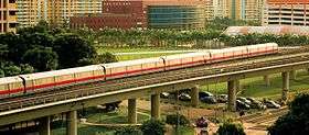 Woodlands |
| 2 | Jurong West | West | 267,840 | 12 | Pasir Ris | East | 144,960 | ||
| 3 | Tampines | East | 258,310 | 13 | Bukit Panjang | West | 141,930 | ||
| 4 | Woodlands | North | 250,170 | 14 | Bukit Batok | West | 138,290 | ||
| 5 | Sengkang | North-East | 232,100 | 15 | Toa Payoh | Central | 121,770 | ||
| 6 | Hougang | North-East | 224,390 | 16 | Serangoon | North-East | 119,140 | ||
| 7 | Yishun | North | 210,440 | 17 | Geylang | Central | 113,460 | ||
| 8 | Choa Chu Kang | West | 186,580 | 18 | Kallang | Central | 101,610 | ||
| 9 | Ang Mo Kio | North-East | 166,820 | 19 | Queenstown | Central | 97,600 | ||
| 10 | Bukit Merah | Central | 152,790 | 20 | Clementi | West | 92,580 | ||
South Africa
| Rank | Name | Province | Pop. | ||||||
|---|---|---|---|---|---|---|---|---|---|
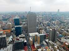 City of Johannesburg 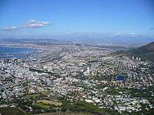 City of Cape Town |
1 | City of Johannesburg | Gauteng | 4,949,347 | 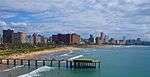 EThekwini Metropolitan Municipality 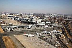 Ekurhuleni | ||||
| 2 | City of Cape Town | Western Cape | 4,004,793 | ||||||
| 3 | EThekwini Metropolitan Municipality | KwaZulu-Natal | 3,661,911 | ||||||
| 4 | Ekurhuleni | Gauteng | 3,379,104 | ||||||
| 5 | City of Tshwane | Gauteng | 3,275,152 | ||||||
| 6 | Nelson Mandela Bay | Eastern Cape | 1,263,051 | ||||||
| 7 | Buffalo City Metropolitan Municipality | Eastern Cape | 810,528 | ||||||
| 8 | Mangaung | Free State | 759,693 | ||||||
| 9 | Emfuleni | Gauteng | 733,445 | ||||||
| 10 | Polokwane Local Municipality | Limpopo | 702,190 | ||||||
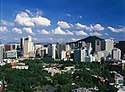
South Korea
The largest cities of South Korea have an autonomous status equivalent to that of provinces. Seoul, the largest city and capital, is classified as a teukbyeolsi (Special City), while the next 6 largest cities (see the list below) are classified as gwangyeoksi (Metropolitan Cities; see Special cities of South Korea). Smaller cities are classified as si ("cities") and are under provincial jurisdiction, at the same level as counties (see:Administrative divisions of South Korea).
| Rank | Name | Province | Pop. | Rank | Name | Province | Pop. | ||
|---|---|---|---|---|---|---|---|---|---|
 Seoul 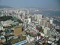 Busan |
1 | Seoul | Seoul | 9,904,312 | 11 | Yongin | Gyeonggi | 971,327 |  Incheon 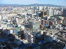 Daegu |
| 2 | Busan | Busan | 3,448,737 | 12 | Seongnam | Gyeonggi | 948,757 | ||
| 3 | Incheon | Incheon | 2,890,451 | 13 | Bucheon | Gyeonggi | 843,794 | ||
| 4 | Daegu | Daegu | 2,446,052 | 14 | Cheongju | North Chungcheong | 833,276 | ||
| 5 | Daejeon | Daejeon | 1,538,394 | 15 | Ansan | Gyeonggi | 747,035 | ||
| 6 | Gwangju | Gwangju | 1,502,881 | 16 | Jeonju | North Jeolla | 658,172 | ||
| 7 | Suwon | Gyeonggi | 1,194,313 | 17 | Cheonan | South Chungcheong | 629,062 | ||
| 8 | Ulsan | Ulsan | 1,166,615 | 18 | Namyangju | Gyeonggi | 629,061 | ||
| 9 | Changwon | South Gyeongsang | 1,059,241 | 19 | Hwaseong | Gyeonggi | 608,725 | ||
| 10 | Goyang | Gyeonggi | 990,073 | 20 | Anyang | Gyeonggi | 585,177 | ||
Sweden
Urban areas in Sweden (tätorter) are statistically defined localities, totally independent of the administrative subdivision of the country. There are 1,956 such localities in Sweden, with a population ranging from 200 to 1,372,000 inhabitants.[66]
Largest cities or towns in Sweden "Kommungruppsindelning 2017". Retrieved 2017-09-16. & "SCB befolkningsstatistik". Retrieved 2018-07-11. | |||||||||||
|---|---|---|---|---|---|---|---|---|---|---|---|
| Rank | Name | County | Pop. | Metro. | Rank | Name | County | Pop. | Metro. | ||
.jpg) Stockholm  Gothenburg |
1 | Stockholm | Stockholm | 952,058 | 2,205,105 | 11 | Umeå | Västerbotten | 125,434 | 137,800 |  Malmö  Uppsala |
| 2 | Gothenburg | Västra Götaland | 565,496 | 1,015,974 | 12 | Lund | Skåne | 121,893 | 197,300 | ||
| 3 | Malmö | Skåne | 334,987 | 689,206 | 13 | Borås | Västra Götaland | 111,354 | 151,300 | ||
| 4 | Uppsala | Uppsala | 221,141 | 257,200 | 14 | Huddinge | Stockholm | 110,335 | 136,000 | ||
| 5 | Linköping | Östergötland | 158,953 | 189,800 | 15 | Eskilstuna | Södermanland | 105,014 | 110,900 | ||
| 6 | Örebro | Örebro | 150,949 | 196,700 | 16 | Nacka | Stockholm | 101,697 | 114,800 | ||
| 7 | Västerås | Västmanland | 150,564 | 169,200 | 17 | Gävle | Gävleborg | 100,825 | 107,500 | ||
| 8 | Helsingborg | Skåne | 143,671 | 321,500 | 18 | Halmstad | Halland | 99,932 | 119,300 | ||
| 9 | Norrköping | Östergötland | 140,991 | 149,600 | 19 | Sundsvall | Västernorrland | 98,837 | 115,300 | ||
| 10 | Jönköping | Jönköping | 137,863 | 156,700 | 20 | Södertälje | Stockholm | 96,254 | 158,300 | ||
Taiwan
The figures below are the 2011 estimates for the twenty largest urban populations within administrative city limits; a different ranking exists when considering the total metropolitan area populations (in such rankings the Taipei-Keelung metro area is by far the largest agglomeration).
| Rank | Name | Division | Pop. | ||||||
|---|---|---|---|---|---|---|---|---|---|
 New Taipei Taichung |
1 | New Taipei | New Taipei City | 3,979,208 |  Kaohsiung  Taipei | ||||
| 2 | Taichung | Taichung City | 2,778,182 | ||||||
| 3 | Kaohsiung | Kaohsiung City | 2,777,873 | ||||||
| 4 | Taipei | Taipei City | 2,687,629 | ||||||
| 5 | Taoyuan | Taoyuan City | 2,171,127 | ||||||
| 6 | Tainan | Tainan City | 1,886,267 | ||||||
| 7 | Hsinchu | Hsinchu City | 439,435 | ||||||
| 8 | Keelung | Keelung City | 371,853 | ||||||
| 9 | Chiayi | Chiayi City | 269,608 | ||||||
| 10 | Changhua | Changhua County | 234,053 | ||||||
United Kingdom
The United Kingdom's Office for National Statistics has produced census results from urban areas since 1951, since 1981 based upon the extent of irreversible urban development indicated on Ordnance Survey maps. The definition is an extent of at least 20 ha and at least 1,500 census residents. Separate areas are linked if less than 200 m (220 yd) apart. Included are transportation features.[67] The UK has five Urban Areas with a population over a million and a further sixty nine with a population over one hundred thousand.
United States
In the United States, there are two categories of urban area. The term urbanized area denotes an urban area of 50,000 or more people. Urban areas under 50,000 people are called urban clusters. Urbanized areas were first delineated in the United States in the 1950 census, while urban clusters were added in the 2000 census. There are 1,371 urban areas and urban clusters with more than 10,000 people.
The U.S. Census Bureau defines an urban area as "core census block groups or blocks that have a population density of at least 1,000 people per square mile (386 per square kilometer) and surrounding census blocks that have an overall density of at least 500 people per square mile (193 per square kilometer)".[71]
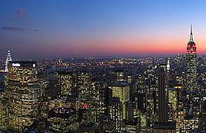
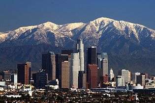
The largest urban area in the United States is the New York metropolitan area. The population of New York City, the core of the metropolitan area, exceeds 8.5 million people, its metropolitan statistical area has a population that is over 20 million, and its combined statistical area population is over 23 million. The next six largest urban areas in the U.S. are Los Angeles, Chicago, Miami, Philadelphia, San Francisco, and Houston.[72] About 82 percent of the population of the United States lives within the boundaries of an urbanized area as of December, 2010.[73] Combined, these areas occupy about 2 percent of the land area of the United States. Many Americans live in agglomerations of cities, suburbs, and towns that are adjacent to a metropolitan area's largest city.

The concept of Urbanized Areas as defined by the U.S. Census Bureau is often used as a more accurate gauge of the size of a city, since in different cities and states the lines between city borders and the urbanized area of that city are often not the same. For example, the city of Greenville, South Carolina has a city population just over 64,000 and an urbanized area population of over 400,000, while Greensboro, North Carolina has a city population just over 285,000 and an urbanized area population of around 310,000 — meaning that Greenville is actually "larger" for some intents and purposes, but not for others, such as taxation, local elections, etc.
In the U.S. Department of Agriculture's natural resources inventory, urban areas are officially known as developed areas or urban and built-up areas. Such areas include cities, ethnic villages, other built-up areas of more than 10 ac (4 ha), industrial sites, railroad yards, cemeteries, airports, golf courses, shooting ranges, institutional and public administration sites, and similar areas. The 1997 national resources inventory placed over 98,000,000 ac (40,000,000 ha) in this category, an increase of 25,000,000 ac (10,000,000 ha) since 1982.[74]


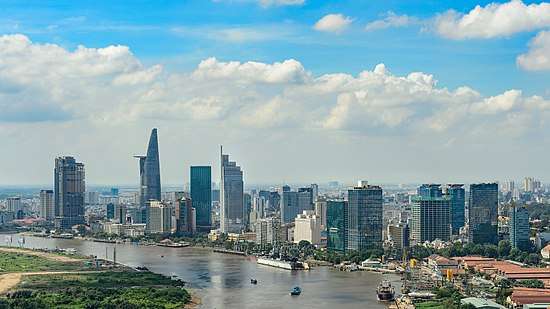
Vietnam
In Vietnam, there are 6 types of urban areas:
- Special urban area (2 municipalities): Hanoi and Ho Chi Minh City
- Type I urban area (12 provincial cities and 3 municipalities): Thanh Hóa, Hạ Long, Việt Trì, Thái Nguyên, Nam Định, Vũng Tàu, Buôn Ma Thuột, Đà Lạt, Quy Nhơn, Nha Trang, Huế, Vinh, Cần Thơ, Đà Nẵng and Hải Phòng
- Type II urban area (21 provincial cities and 1 district): Đồng Hới, Uông Bí, Bắc Giang, Bắc Ninh, Ninh Bình, Bạc Liêu, Bà Rịa, Thái Bình, Rạch Giá, Cà Mau, Long Xuyên, Mỹ Tho, Phan Rang - Tháp Chàm, Tuy Hòa, Phan Thiết, Pleiku, Thủ Dầu Một, Biên Hòa, Hải Dương, Vĩnh Yên, Lào Cai and Phú Quốc
- Type III urban area (31 provincial cities and 12 towns)
- Type IV urban area (35 towns and 35 townships)
- Type V urban area (586 townships and 54 communes)
| Largest cities of Vietnam (2015)[77] | ||||||||||
|---|---|---|---|---|---|---|---|---|---|---|
| Rank | City | Province | Population | |||||||
| 1 | Hồ Chí Minh City | Municipality Region | 8,244,400 | |||||||
| 2 | Hà Nội | Municipality Region | 7,379,300 | |||||||
| 3 | Hải Phòng | Municipality Region | 1,946,000 | |||||||
| 4 | Cần Thơ | Municipality Region | 1,238,300 | |||||||
| 5 | Biên Hòa | Đồng Nai | 1,104,495 | |||||||
| 6 | Đà Nẵng | Municipality Region | 1,007,700 | |||||||
| 7 | Nha Trang | Khánh Hòa | 393,218 | |||||||
| 8 | Buôn Ma Thuột | Đắk Lắk | 350,000 | |||||||
| 9 | Huế | Thừa Thiên-Huế | 337,554 | |||||||
| 10 | Vinh | Nghệ An | 330,000 | |||||||


See also
Lists
- List of metro systems
- List of urban areas by population
- Largest urban areas of the European Union
- List of cities in the People's Republic of China by urban population
- List of United States urban areas
- List of conurbations in the United Kingdom
- List of urban areas in Norway by population
- List of urban areas in the Nordic countries
- List of the 100 largest urban areas in Canada by population
- List of urban areas in Denmark by population
- List of New Zealand urban areas
References
- 1 2 3 "City population to reach 6.4bn by 2050". Herald Globe. Retrieved 11 July 2014.
- ↑ "United Nations Population Division – Department of Economic and Social Affairs".
- ↑ "Urban population growth". World Health Organization.
- ↑ "Current world population". United Nations, Department of Economic and Social Affairs. Archived from the original on 2 July 2014. Retrieved 11 July 2014.
- ↑ "Field listing – Urbanization". The World Factbook. CIA.
- 1 2 3 "Major Cities". Government of Argentina. Archived from the original on 19 September 2009.
- ↑ "Ubicación de la ciudad de salta" (in Spanish). Directorate-General of Tourism, Municipality of the City of Salta. Archived from the original on 2010-01-17.
- ↑ "Encuesta Permanente de Hogares" (PDF). Indec. 23 August 2015. p. 3.
- ↑ "1216.0 – Australian Standard Geographical Classification (ASGC), 2001". Australian Bureau of Statistics. Retrieved 2007-10-09.
- ↑ "3218.0 - Regional Population Growth, Australia, 2016". Australian Bureau of Statistics. 28 July 2017. Retrieved 10 August 2017.
- ↑ http://www.abs.gov.au/ausstats/abs@.nsf/latestProducts/3218.0Media%20Release12016-17?OpenDocument%7Cpublisher=Australian Bureau of Statistics|accessdate=25 April 2018|
- ↑ "IDBGE" (in Portuguese). IBGE. 2011. Retrieved 2011-10-08.
- ↑ 2008 PNAD, IBGE. "População residente por situação, sexo e grupos de idade."
- ↑ "Principal Cities". Encarta. MSN. Archived from the original on 31 October 2009. Retrieved 2008-06-10.
- ↑ "RMSP supera 20 milhões de habitantes, calcula Seade – economia – geral – Estadão". Estadao.com.br. Retrieved June 6, 2014.
- ↑ "Mais da metade da população vive em 294 arranjos formados por contiguidade urbana e por deslocamentos para trabalho e estudo" (in Portuguese). Brazilian Institute of Geography and Statistics. Retrieved 16 March 2017.
- ↑ "Arranjos Populacionais e Concentrações Urbanas do Brasil" (PDF) (in Portuguese). Brazilian Institute of Geography and Statistics. p. 148. Retrieved 16 March 2017.
- ↑ "Estimativas da população residente no Brasil e Unidades da Federação com data de referência em 1º de julho de 2017" (PDF) (in Portuguese). Brazilian Institute of Geography and Statistics. Retrieved 14 May 2018.
- ↑ "Urban area (UA)". Statistics Canada. 2009-11-20. Retrieved 2011-01-21.
- ↑ "More information on Urban area (UA)". Statistics Canada. 2009-11-20. Retrieved 2011-01-21.
- ↑ "Census Profile". 2.statcan.gc.ca. Retrieved 2016-02-08.
- 1 2 "From urban areas to population centres" Archived 2012-12-13 at the Wayback Machine.. Statistics Canada, May 5, 2011.
- 1 2 "Preparing for China's urban billion". McKinsey Global Institute. February 2009. Archived from the original on 24 December 2012. Retrieved 12 December 2012.
- ↑ "China urbanization (PDF)" (PDF). World Bank Institute. 2011. Archived from the original (PDF) on 15 January 2013. Retrieved 12 December 2012.
- ↑ Harney, Alexandra (3 February 2008). "Migrants are China's 'factories without smoke'". CNN. Retrieved 27 March 2009.
- ↑ Tschang, Chi-Chu (4 February 2009). "A Tough New Year for China's Migrant Workers". Business Week. Retrieved 27 March 2009.
- ↑ Francesco Sisci. "China's floating population a headache for census". The Straits Times. 22 September 2000.
- ↑ "Cities: largest (without surrounding suburban areas)". Geohive. Archived from the original on 5 December 2016. Retrieved 13 September 2011.
- ↑ Duncan Smith. "World City Populations 1950 – 2030". Retrieved 18 December 2015.
- ↑ "Bright lights, big cities. Urbanisation and the rise of the megacity". economist.com. Retrieved 23 December 2015.
- ↑ "Estimaciones de Población 1985 - 2005 y Proyecciones de Población 2005 - 2020 Total Municipal por Área (estimate)". DANE. Retrieved 10 November 2016.
- ↑ "Locality – Concepts". Statistics Finland.
- ↑ "Alueluokkien kuvaukset". Ymparisto.
- ↑ "Nomenclatures Définitions — Méthodes — Unité urbaine" (in French). Retrieved 2007-07-20.
- ↑ "Nomenclatures Définitions — Méthodes — Aire urbaine" (in French). Retrieved 2007-07-07.
- ↑ "Un maillage du territoire français" (in French). Retrieved 2014-10-17.
- ↑ "Résultats de la recherche – Insee".
- ↑ "Regionales Monitoring 2010 – Daten und Karten zu den Europäischen Metropolregionen in Deutschland" (PDF) (in German). Bundesamt für Bauwesen und Raumordnung. 2010. p. 10. Retrieved 11 April 2012.
- ↑ "Provisional Population Totals Urban Agglomerations and Cities, Data Highlights" (PDF). Census of India 2011. 13 February 2012.
- ↑ "Urban Agglomeration". Arthapedia. India Economic Service. 10 April 2015.
- ↑ "Cities having population 1 lakh and above" (PDF). India Census 2011. 31 January 2012.
- ↑ Statistics Netherlands.
- ↑ "Urban area: Definition". Statistics New Zealand. Archived from the original on 13 November 2013. Retrieved 10 December 2014.
- ↑ "Subnational Population Estimates: At 30 June 2018 (provisional)". Statistics New Zealand. 23 October 2018. Retrieved 23 October 2018. For urban areas, "Subnational population estimates (UA, AU), by age and sex, at 30 June 1996, 2001, 2006-18 (2018 boundary)". Statistics New Zealand. 23 October 2018. Retrieved 23 October 2018.
- ↑ "Population statistics. Population and land area in urban settlements, 1 January 2008". Statistics Norway. June 20, 2008. Retrieved 2009-04-17.
- ↑ "The Urban Frontier—Karachi". National Public Radio. 2 June 2008. Retrieved 2 July 2008.
- ↑ Jason Burke (17 August 2008). "Pakistan looks to life without the general". The Guardian. London. Retrieved 20 May 2010.
- ↑ "World: metropolitan areas". World Gazetteer. Archived from the original on 2007-09-30. Retrieved 2010-01-22.
- ↑ "Polish official population figures".
- ↑ Surinov, A.; et al., eds. (2016). "5. Population: Cities with population size of 1 million persons and over". Russia in Figures (PDF) (Report). Moscow: Federal State Statistics Service (Rosstat). p. 82. ISBN 978-5-89476-420-7. Retrieved June 12, 2017.
- ↑ Оксенойт, Г. К. (2016). "31. Численность населения городов и поселков городского типа по федеральным округам и субъектам Российской Федерации". In Рахманинов, М. В. Численность населения Российской Федерации: По муниципальным образованиям (Report) (in Russian). Москва: Федеральная служба государственной статистики (Росстат). Retrieved June 12, 2017.
- 1 2 "Оценка численности постоянного населения на 1 января 2017 года и в среднем за 2016 год". gks.ru. Retrieved June 12, 2017.
- ↑ "Предварительная оценка численности постоянного населения на 1 января 2017 года и в среднем за 2016 год по городским округам и муниципальным районам Красноярского края". krasstat.gks.ru. Retrieved June 12, 2017.
- ↑ "Численность населения по муниципальным районам и городским округам Новосибирской области на 1 января 2017 года и в среднем за 2016 год". novosibstat.gks.ru. Retrieved June 12, 2017.
- ↑ "Предварительная оценка численности населения на 1 января 2017 года и в среднем за 2016 год". sverdl.gks.ru. Retrieved June 12, 2017.
- ↑ "Численность населения муниципальных образований Республики Татарстан на начало 2017 года". tatstat.gks.ru. Retrieved June 12, 2017.
- ↑ "Оценка численности населения на 1 января 2017 года по муниципальным образованиям Краснодарского края". krsdstat.gks.ru. Retrieved June 12, 2017.
- ↑ "Численность постоянного населения Челябинской области в разрезе городских округов, муниципальных районов, городских и сельских поселений на 1 января 2017 года". chelstat.gks.ru. Retrieved June 12, 2017.
- ↑ "База данных показателей муниципальных образований Омской области (Население)". gks.ru. Retrieved June 12, 2017.
- 1 2 "Утвержденная численность постоянного населения Самарской области (на 1. 1. 2017. г. и среднегодовая за 2016. г.)". samarastat.gks.ru. Retrieved June 12, 2017.
- ↑ "Численность постоянного населения Удмуртской Республики /Утверждено Росстатом (письмо от 3. 3. 2017. г., № 08-08-4/891-ТО)/". udmstat.gks.ru. Retrieved June 12, 2017.
- ↑ "Оценка численности постоянного населения Республики Башкортостан на 1 января 2017 года по муниципальным образованиям". gks.ru. Retrieved June 12, 2017.
- ↑ "What are the functions and duties of a town council?". Singapore Legal Advice. Retrieved August 14, 2016.
- ↑ "Community Survey 2016: Provinces at a Glance" (PDF). Statistics South Africa. Retrieved 28 April 2018.
- ↑ "2015년 인구주택총조사 전수집계결과 보도자료" [2015 Population and Housing Census]. Statistics Korea.
- ↑ "Fortsatt stor ökning av befolkning i tätorter". Statistics Sweden. Archived from the original on 2012-01-10. Retrieved 2011-06-24.
- ↑ KS01 Usual resident population: Census 2001, Key Statistics for urban areas
For the OS definition of an Urban Area, see the notes tab on the Excel version. - ↑ "2011 Census - Built-up areas". ONS. Retrieved 1 July 2013.
- ↑ Mid-2012 Population Estimates for Settlements and Localities in Scotland General Register Office for Scotland
- ↑ The UK's major urban areas Office for National Statistics (Urban area of Belfast and connected settlements, Table 3.1, page 47)
- ↑ "The Urban and Rural Classifications" (PDF). Geographic Areas Reference Manual. United States Census Bureau.
- ↑ United States Census Bureau 2010 Census Urban Area List "Archived copy". Archived from the original on 2012-10-10. Retrieved 2013-05-16. 2010 Census Urban Area List. Retrieved May 7, 2013.
- ↑ – accessed January, 2012
- ↑

- ↑ "Appendix A. Census 2000 Geographic Terms and Concepts – Figure A–3. Census Regions, Census Divisions, and Their Constituent States" (PDF). U.S. Census Bureau. 2000. p. 27. Archived from the original (PDF) on June 14, 2007. Retrieved February 25, 2017.
- ↑ "Annual Estimates of the Resident Population: April 1, 2010 to July 1, 2017". United States Census Bureau. Retrieved August 14, 2018.
- ↑ Vietnam General Statistics Office 2015.
External links
- United Nations Statistics Division (UNSTAT): Definition of "urban"
- World Urban Areas All identified world urbanized areas 500,000+ and others: Population & Density.
- Geopolis: research group, University of Paris-Diderot, France for world urban areas
- Gridded Population of the World – contains links to urban area definitions and maps for over 230 countries/territories
- City Mayors – The World's Largest Urban Areas in 2006
- City Mayors – The World's Largest Urban Areas Projected for 2020
- PopulationData – World's largest urban areas 1,000,000+ population