Tweedsmuir South Provincial Park
| Tweedsmuir South Provincial Park | |
|---|---|
_location_map.svg.png) Location of Tweedsmuir South in British Columbia | |
| Location | British Columbia, Canada |
| Nearest city | Prince George |
| Coordinates | 52°31′16″N 125°54′49″W / 52.52099°N 125.91373°WCoordinates: 52°31′16″N 125°54′49″W / 52.52099°N 125.91373°W |
| Governing body | BC Parks |
Tweedsmuir South Provincial Park is a provincial park located in the central west of British Columbia, Canada. Formerly part of Tweedsmuir Provincial Park which was originally 981,000 hectares in size.[1] It was formed from the southern portion of that park, the northern portion being re-designated Tweedsmuir North Provincial Park and Protected Area in order to allow resource extraction in the park.
The park is home to Lonesome Lake, famed for homesteader and conservationist Ralph Edwards, who worked to preserve migration habitat there for the trumpeter swan. This park was affected by the Mountain Pine Beetle epidemic in British Columbia.[2]
Name origin
The park, or rather the original Tweedsmuir Provincial Park which included what is now Tweedsmuir North Provincial Park and Protected Area, was created in 1938 in the wake of a 1937 visit by floatplane and horseback to the Rainbow Range by John Buchan, Lord Tweedsmuir, who was then Governor-General of Canada.[2]
An article about the creation of the park, written by John Buchan's wife, The Lady Tweedsmuir of Elsfield, appears in the April 1938 issue of The National Geographic Magazine.
.jpg)
Climate
With such a vast area the climate varies throughout the park. However in the lower regions closer to the Bella Coola Valley the temperature is warmer with a higher annual level of rainfall. Around one fifth of their annual precipitation falls as snow. Further west as the altitude climbs the weather is generally more severe and the temperature changes throughout the summer and winter are drastic. On average ranging between the minus thirties mid winter, to the higher forties during high summer.[2]
Access
The southern portion of the park is on Highway 20, approximately 400 kilometres west of Williams Lake and can be reached by road from that town. More convenient access is via the Discovery Coast Passage ferry from Port Hardy on Vancouver Island or by float plane from Nimpo Lake, Anahim Lake or Bella Coola.[3]
Places Of Interest
Some of the main attractions in the park are as follows:
Hunlen Falls: One of Canada's highest waterfalls for unbroken drop (259m). The falls can be accessed via float plane or foot.
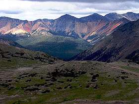
Rainbow Range (Chilcotin Plateau): Volcano range where the unique minerals give the soil an array of colours.
Alexander MacKenzie Heritage Trail: A historic passage used by Local first nations to the region and early explores for trade and travel to the coast.[4] The trail passes through the park, via Heckman Pass and Burnt Bridge Creek.
References
- ↑ Harris, Chris (1999). Tweedsmuir British Columbia's Park of Many Colours. Country Light Publishing. p. 5. ISBN 0-9695235-9-9.
- 1 2 3 BC Parks Tweedsmuir South Provincial Park webpage, History section
- ↑ "Tweedsmuir Provincial Park – South". BC Travel & Tourism. BC Travel & Tourism. 2017. Retrieved January 28, 2017.
- ↑ "Alexander Mackenzie Heritage Trail, BC". www.bcadventure.com. Retrieved 2018-03-13.
External links