Tsagkarada
| Tsagkarada Τσαγκαράδα | |
|---|---|
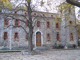 The church of Agia Paraskevi. | |
 Tsagkarada | |
| Coordinates: 39°23′N 23°11′E / 39.383°N 23.183°ECoordinates: 39°23′N 23°11′E / 39.383°N 23.183°E | |
| Country | Greece |
| Administrative region | Thessaly |
| Regional unit | Magnesia |
| Municipality | Zagora-Mouresi |
| Municipal unit | Mouresi |
| Population (2011)[1] | |
| • Rural | 525 |
| Community[1] | |
| • Population | 543 (2011) |
| Time zone | UTC+2 (EET) |
| • Summer (DST) | UTC+3 (EEST) |
| Vehicle registration | ΒΟ |
Tsagkarada (Greek: Τσαγκαράδα) is a village and a community in the municipal unit of Mouresi in the eastern part of Magnesia, Greece. It was the seat of the former municipality Mouresi. It is situated at 408 m elevation, on the eastern slope of the forested Pelion mountains. Its population in 2011 was 525 for the village and 543 for the community which includes the village Mylopotamos. Tsagkarada is located 1.5 km southeast of Mouresi, 3 km north of Xorychti, 9 km southeast of Zagora and about 20 km east of the city of Volos (Magnesia's capital).
Population
| Year | Population |
|---|---|
| 1981 | 646 |
| 1991 | 722 |
| 2001 | 710 |
| 2011 | 543 |
See also
References
- 1 2 "Απογραφή Πληθυσμού - Κατοικιών 2011. ΜΟΝΙΜΟΣ Πληθυσμός" (in Greek). Hellenic Statistical Authority.
External links
![]()
This article is issued from
Wikipedia.
The text is licensed under Creative Commons - Attribution - Sharealike.
Additional terms may apply for the media files.