Tronfjell
| Tronfjell | |
|---|---|
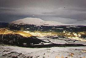 Tronfjell with Alvdal in front. | |
| Highest point | |
| Elevation | 1,666 m (5,466 ft) |
| Prominence | 1,007 m |
| Coordinates | 62°10′29.07″N 10°41′37.67″E / 62.1747417°N 10.6937972°ECoordinates: 62°10′29.07″N 10°41′37.67″E / 62.1747417°N 10.6937972°E |
| Geography | |
| Location | Alvdal, Hedmark, Norway |
| Climbing | |
| Easiest route | Road |
Tronfjellet or just Tron (official form on maps: Tronden) is a prominent mountain close to Alvdal, Hedmark, Norway. It lies on the border to Tynset. There is a toll road to the summit open in the summer built while installing a broadcasting antenna in the 1960s, being Norway's second highest road.
The Indian philosopher Swami Sri Ananda Acharya lived on the mountain for large periods of his life.
The name
The name is the finite form of trond m (Norse þróndr) 'hog'. (It is common in Norway to compare the shape of a mountain with an animal.)
See also
| Wikimedia Commons has media related to Tronfjellet. |
This article is issued from
Wikipedia.
The text is licensed under Creative Commons - Attribution - Sharealike.
Additional terms may apply for the media files.