Sanna (Inn)
| Sanna | |
|---|---|
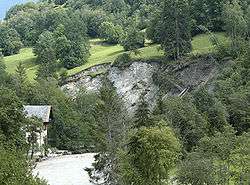 Landslide above Sanna in 2005 | |
| Country | Austria, Tyrol |
| Physical characteristics | |
| Main source | confluence of Rosanna and Trisanna |
| River mouth |
Inn 47°08′38″N 10°33′53″E / 47.1439°N 10.5646°ECoordinates: 47°08′38″N 10°33′53″E / 47.1439°N 10.5646°E |
| Length | 7.1 km (4.4 mi) [1] |
| Basin features | |
| Progression | Inn→ Danube→ Black Sea |
| Basin size | 727 km2 (281 sq mi) [1] |
Sanna is a river in Austria formed near Tobadill by the confluence of the rivers Rosanna (42 km, from Arlberg and the Stanzertal) and Trisanna (31 km, from Silvretta and Paznaun).
The tributary to the Inn is only 7.1 kilometres (4.4 mi) long, but including its longest source river Rosanna, it is 49 km long. Its basin area is 727 km2.[1] The villages Pians, Grins and the small town Landeck are situated at its waterfront.
The whitewater river is used for kayaking and was the site of the 1996 world championships.
References
External links
This article is issued from
Wikipedia.
The text is licensed under Creative Commons - Attribution - Sharealike.
Additional terms may apply for the media files.