Toulouse – Lasbordes Airport
| Toulouse - Lasbordes Airport Aéroport de Toulouse - Lasbordes | |||||||||||||||
|---|---|---|---|---|---|---|---|---|---|---|---|---|---|---|---|
 | |||||||||||||||
| Summary | |||||||||||||||
| Airport type | Public | ||||||||||||||
| Serves | Toulouse, France | ||||||||||||||
| Location | Balma, France | ||||||||||||||
| Elevation AMSL | 460 ft / 140 m | ||||||||||||||
| Coordinates | 43°35′16″N 001°29′55″E / 43.58778°N 1.49861°ECoordinates: 43°35′16″N 001°29′55″E / 43.58778°N 1.49861°E | ||||||||||||||
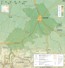
| Map | |||||||||||||||
 LFCL Location in Haute-Garonne department Location of department in France 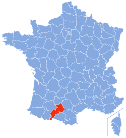 | |||||||||||||||
| Runways | |||||||||||||||
| |||||||||||||||
|
Source: French AIP[1] | |||||||||||||||
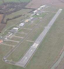
Toulouse – Lasbordes Airport (French: Aéroport de Toulouse - Lasbordes) (ICAO: LFCL) is a small non-commercial airport in the commune of Balma, situated 4 km (2 miles) east of the city center of Toulouse,[1] both located in the Haute-Garonne department of the Midi-Pyrénées region in southwest France.
Facilities
The airport resides at an elevation of 460 feet (140 m) above mean sea level. It has a 950 m × 23 m (3,117 ft × 75 ft) asphalt runway for light airplanes and a 350 m × 20 m (1,148 ft × 66 ft) grass strip for microlights. The runways are located very close to the large highway surrounding Toulouse.[1]
From the air, the airport is easily found by looking for a large upright Ariane space rocket located in Cité de l'espace (Space Museum) on the opposite side of the motorway.
References
- 1 2 3 LFCL – TOULOUSE LASBORDES. AIP from French Service d'information aéronautique, effective 11 October 2018.
External links