Toomsboro, Georgia
| Toomsboro, Georgia | |
|---|---|
| Town | |
 Location in Wilkinson County and the state of Georgia | |
| Coordinates: 32°49′32″N 83°5′0″W / 32.82556°N 83.08333°WCoordinates: 32°49′32″N 83°5′0″W / 32.82556°N 83.08333°W | |
| Country | United States |
| State | Georgia |
| County | Wilkinson |
| Area | |
| • Total | 1.9 sq mi (4.8 km2) |
| • Land | 1.9 sq mi (4.8 km2) |
| • Water | 0 sq mi (0 km2) |
| Elevation | 233 ft (71 m) |
| Population (2010) | |
| • Total | 472 |
| • Estimate (2016)[1] | 444 |
| • Density | 336/sq mi (129.6/km2) |
| Time zone | UTC-5 (Eastern (EST)) |
| • Summer (DST) | UTC-4 (EDT) |
| ZIP code | 31090 |
| Area code(s) | 478 |
| FIPS code | 13-76952[2] |
| GNIS feature ID | 0324226[3] |
Toomsboro is a town in Wilkinson County, Georgia, United States. The population was 472 at the 2000 census.
History
Toomsboro was founded as a depot on the Central of Georgia Railway. Its railroad terminal was built in 1869.[4] It is named for 19th-century Georgia politician Robert Toombs.
Geography
Toomsboro is located at 32°49′32″N 83°5′0″W / 32.82556°N 83.08333°W (32.825423, -83.083196).[5]
According to the United States Census Bureau, the town has a total area of 1.9 square miles (4.9 km2), all land.
Demographics
| Historical population | |||
|---|---|---|---|
| Census | Pop. | %± | |
| 1880 | 183 | — | |
| 1900 | 50 | — | |
| 1910 | 404 | 708.0% | |
| 1920 | 420 | 4.0% | |
| 1930 | 665 | 58.3% | |
| 1940 | 593 | −10.8% | |
| 1950 | 711 | 19.9% | |
| 1960 | 764 | 7.5% | |
| 1970 | 682 | −10.7% | |
| 1980 | 673 | −1.3% | |
| 1990 | 617 | −8.3% | |
| 2000 | 622 | 0.8% | |
| 2010 | 472 | −24.1% | |
| Est. 2016 | 444 | [1] | −5.9% |
| U.S. Decennial Census[6] | |||
As of the census[2] of 2000, there were 622 people, 209 households, and 146 families residing in the town. The population density was 333.9 people per square mile (129.1/km²). There were 252 housing units at an average density of 135.3 per square mile (52.3/km²). The racial makeup of the town was 45.02% White, 53.70% African American, 0.80% from other races, and 0.48% from two or more races. Hispanic or Latino of any race were 0.80% of the population.
There were 209 households out of which 30.6% had children under the age of 18 living with them, 39.2% were married couples living together, 26.8% had a female householder with no husband present, and 29.7% were non-families. 28.7% of all households were made up of individuals and 13.9% had someone living alone who was 65 years of age or older. The average household size was 2.69 and the average family size was 3.32.
In the town, the population was spread out with 25.1% under the age of 18, 7.7% from 18 to 24, 24.4% from 25 to 44, 20.1% from 45 to 64, and 22.7% who were 65 years of age or older. The median age was 39 years. For every 100 females, there were 77.2 males. For every 100 females age 18 and over, there were 71.3 males.
The median income for a household in the town was $26,250, and the median income for a family was $36,250. Males had a median income of $27,321 versus $23,250 for females. The per capita income for the town was $13,679. About 15.6% of families and 22.7% of the population were below the poverty line, including 29.0% of those under age 18 and 24.0% of those age 65 or over.
Miscellany
Many properties in Toomsboro are owned by David Bumgardner, a developer who bought some properties at auction and others from preservationist Bill Lucado circa 2002. Bumgardner intended to turn Toomsboro into a quaint tourist destination. In April 2012, Bumgardner and Lucado announced they were seeking a buyer for the properties, suggesting a movie production company might be interested in using Toomsboro as a film set.[7] In September 2018, 36 pieces of property over 40 acres went up for sale for an asking price of $1.7 million, with an eye toward a preservation-minded buyer "who appreciates its history".[8]
According to local legend, the New Jersey Devil has been spotted near Ball's Ferry.
The town is mentioned in Flannery O'Connor's story "A Good Man Is Hard to Find" (1953). It is misspelled "Toombsboro" in the story, which may have been deliberate rather than an error, since O'Connor knew the area well and was writing about violence and death.
Notes
- 1 2 "Population and Housing Unit Estimates". Retrieved June 9, 2017.
- 1 2 "American FactFinder". United States Census Bureau. Retrieved 2008-01-31.
- ↑ "US Board on Geographic Names". United States Geological Survey. 2007-10-25. Retrieved 2008-01-31.
- ↑ Caldwell, Wilber W. (2001). The Courthouse and the Depot: The Architecture of Hope in an Age of Despair. Mercer University Press. p. 71.
- ↑ "US Gazetteer files: 2010, 2000, and 1990". United States Census Bureau. 2011-02-12. Retrieved 2011-04-23.
- ↑ "Census of Population and Housing". Census.gov. Retrieved June 4, 2015.
- ↑ Associated Press. (2012, April 30). Developer looking to sell Georgia town. The Atlanta Journal-Constitution
- ↑ Natalie Dreier. (2018, September 12). Georgia town for sale for the cost of a NYC luxury apartment. The Atlanta Journal-Constitution
Municipalities and communities of Wilkinson County, Georgia, United States | ||
|---|---|---|
| Cities | 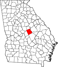 | |
| Towns | ||
| Ghost town | ||
| Footnotes | ‡This populated place also has portions in an adjacent county or counties | |