Tol (island)
 Location of Tol within Micronesia | |
| Geography | |
|---|---|
| Location | Pacific Ocean |
| Archipelago | Faichuk |
| Highest elevation | 439 m (1,440 ft) |
| Highest point | Mount Winipat |
| Administration | |
|
Federated States of Micronesia | |
| State | Chuuk |

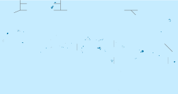
Topographic map sheet 1:25,000 of Tol and surroundings, Chuuk Lagoon, Chuuk State, Federated States of Micronesia, Pacific Ocean
Tol is the largest and most populous island in the Faichuk group of islands in Chuuk State, Federated States of Micronesia. Located in the west of Truk Lagoon, it is surrounded by the smaller islands of Paata (Pata), Polle, Wonei (Onei), Fata Beguets, and Ulalu.
The highest point on Tol, Mount Winipat, is the highest point in Chuuk State, at an elevation of 439 metres (1,440 ft). The high jungle forest which surrounds this peak is the sole habitat of the endemic great Truk white-eye.
Coordinates: 7°20′35″N 151°37′12″E / 7.34306°N 151.62°E
This article is issued from
Wikipedia.
The text is licensed under Creative Commons - Attribution - Sharealike.
Additional terms may apply for the media files.