Todtnau
| Todtnau | ||
|---|---|---|
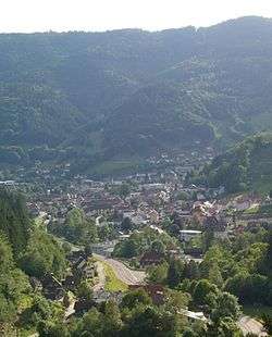 2005 panoramic view | ||
| ||
 Todtnau Location of Todtnau in Lörrach District  | ||
| Coordinates: 47°50′N 07°57′E / 47.833°N 7.950°ECoordinates: 47°50′N 07°57′E / 47.833°N 7.950°E | ||
| Country | Germany | |
| State | Baden-Württemberg | |
| Admin. region | Freiburg | |
| District | Lörrach | |
| Government | ||
| • Mayor | Andreas Wießner | |
| Area | ||
| • Total | 69.60 km2 (26.87 sq mi) | |
| Elevation | 659 m (2,162 ft) | |
| Population (2017-12-31)[1] | ||
| • Total | 4,908 | |
| • Density | 71/km2 (180/sq mi) | |
| Time zone | CET/CEST (UTC+1/+2) | |
| Postal codes | 79674 | |
| Dialling codes | 07671 | |
| Vehicle registration | LÖ | |
| Website | Official website | |

Todtnau is a town in the district of Lörrach in Baden-Württemberg, Germany. As of 2009 its population was of 4,932.
Geography
It is situated in the Black Forest, on the river Wiese, 20 km southeast of Freiburg.
The municipality counts 8 civil parishes (Ortsteil):


Personalities
- Karl Nessler, inventor of the permanent wave was born here.
- Martin Heidegger, had a chalet in Todtnauberg
Photogallery
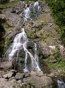 Todtnau waterfall
 The church of Geschwend
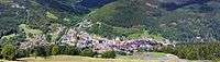 Panoramic view of Todtnau
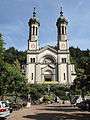 Todtnau, church: die Sankt Johannes der Täuferkirche
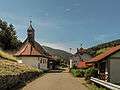 Schlechtnau, chapel in the street
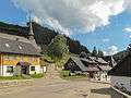 Muggenbrunn, church (die Sankt Cornelius Kirche) in the street
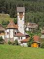 Aftersteg, church: die Sankt Anna Kirche
References
- ↑ "Bevölkerung nach Nationalität und Geschlecht am 31. Dezember 2017". Statistisches Landesamt Baden-Württemberg (in German). 2018.
External links
![]()
- (in German) www.todtnau.de Todtnau official website
- (in German) Information about and images
Important cities and tourist sites in | |||||||
|---|---|---|---|---|---|---|---|
| Major cities | |||||||
| Other tourist destinations | |||||||
| Landscapes | |||||||
| Neighbouring areas |
| ||||||
This article is issued from
Wikipedia.
The text is licensed under Creative Commons - Attribution - Sharealike.
Additional terms may apply for the media files.