Canalul Timiș
| Canalul Timiș | |
| (Timiș Canal) | |
| River | |
 | |
| Countries | Romania |
|---|---|
| Counties | Braşov County |
| Tributaries | |
| - left | Gorganu, Şipot, Aluniş, Valea Cetăţii, Scheiu |
| Source | Timiş |
| - location | Dârste |
| - elevation | 646 m (2,119 ft) |
| - coordinates | 45°36′45″N 25°39′29″E / 45.61250°N 25.65806°E |
| Mouth | Ghimbăşel |
| - location | Stupini |
| - elevation | 525 m (1,722 ft) |
| - coordinates | 45°41′26″N 25°33′56″E / 45.69056°N 25.56556°ECoordinates: 45°41′26″N 25°33′56″E / 45.69056°N 25.56556°E |
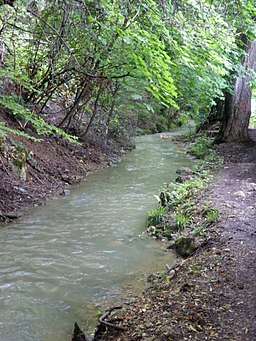
The Canalul Timiș (Timiș Canal) is a canal linking the Timiş and the Ghimbăşel in Romania. It starts in the proximity of Dârste and roughly follows the southern limit of the city of Braşov. The canal intercepts the rivers flowing towards the city from the Postăvarul Massif and diverts them into the Ghimbăşel, on many reaches using the river beds of previous rivers. In the city the canal is covered.
References
- Administrația Națională Apelor Române - Cadastrul Apelor - București
- Institutul de Meteorologie și Hidrologie - Rîurile României - București 1971
Maps
This article is issued from
Wikipedia.
The text is licensed under Creative Commons - Attribution - Sharealike.
Additional terms may apply for the media files.