Hinter Tierberg
| Hinter Tierberg | |
|---|---|
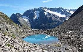 View from the west side | |
| Highest point | |
| Elevation | 3,445 m (11,302 ft) |
| Prominence | 185 m (607 ft) [1] |
| Parent peak | Dammastock |
| Coordinates | 46°41′2.5″N 8°23′50.7″E / 46.684028°N 8.397417°ECoordinates: 46°41′2.5″N 8°23′50.7″E / 46.684028°N 8.397417°E |
| Geography | |
 Hinter Tierberg Location in Switzerland | |
| Location | Bern/Uri |
| Country | Switzerland |
| Parent range | Uri Alps |
| Topo map | Swiss Federal Office of Topography swisstopo |
The Hinter Tierberg is a 3,445 metres high mountain in the Uri Alps, located on the border between the cantons of Bern and Uri. It overlooks the Trift Glacier on its west side and the Chelen Glacier on its east side.
The massif of the Tierberg consists of several mountains, they are (from north to south): Vorder Tierberg (3,091 metres), Mittler Tierberg (3,418 metres) and Hinter Tierberg.
The Hinter Tierberg is connected to the south to the higher Dammastock by a ridge whose lowest point is approximately 3,260 metres.
In August 2016, a Swiss Air Force F/A-18 fighter crashed close to the mountain.[2]
References
- ↑ Swisstopo maps, Google maps (key col is Südliches Maasplanggjoch at about 3,260 metres)
- ↑ Flückiger, Jan (30 August 2016). "F/A-18-Absturz: «Schwer zu verstehen und zu ertragen»". Neue Zürcher Zeitung (in German). Retrieved 30 August 2016.
External links
This article is issued from
Wikipedia.
The text is licensed under Creative Commons - Attribution - Sharealike.
Additional terms may apply for the media files.