Lugwardine
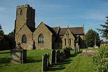
Lugwardine is a village and civil parish in Herefordshire, England, to the east of Hereford. It lies on the northeast bank of the River Lugg, which gives the village its name. The population of the civil parish taken at the 2011 Census was 1,721.[1]
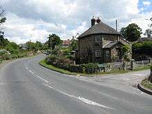
The village lies on the A438 road; Lugwardine Bridge takes this road across the Lugg. There is a public house in the village, called the "Crown and Anchor".[2]
St Mary's Roman Catholic High School is in the village.[3] There is also a primary school, shared with neighbouring Bartestree.[4]
Parish
The parish contains the village of Lugwardine as well as the following hamlets:[5]
- Hagley - situated on the A438 to the east of Lugwardine, now part of the village of Bartestree.
- Tidnor - a very small place, situated to the southeast of Lugwardine; there are several orchards at Tidnor Wood.
- Longworth - situated to the southeast of Lugwardine, slightly further than Tidnor; Longworth Hall is a notable listed building.[6]
Lugwardine, Hagley and Bartestree effectively form a continuous linear settlement along the A438 road.
Parish council
The parish council covers both Lugwardine and the neighbouring parish of Bartestree.[7]
References
- ↑ "Civil Parish population 2011". Retrieved 30 October 2015.
- ↑ Crown and Anchor
- ↑ St Mary's RC High School official website
- ↑ Lugwardine Primary Academy
- ↑ Ordnance Survey mapping
- ↑ Geograph SO5639 : Longworth Hall
- ↑ Bartestree with Lugwardine Parish Council Archived 2013-06-30 at the Wayback Machine.
External links
![]()
Coordinates: 52°03′58″N 2°39′36″W / 52.066°N 2.66°W