Les Saintes Airport
| Les Saintes Airport Aérodrome de Terre-de-Haut | |||||||||||
|---|---|---|---|---|---|---|---|---|---|---|---|
 | |||||||||||
| Summary | |||||||||||
| Airport type | Public | ||||||||||
| Operator | Conseil Général de la Guadeloupe | ||||||||||
| Serves | Terre-de-Haut, Îles des Saintes | ||||||||||
| Elevation AMSL | 42 ft / 13 m | ||||||||||
| Coordinates | 15°51′52″N 061°34′50″W / 15.86444°N 61.58056°WCoordinates: 15°51′52″N 061°34′50″W / 15.86444°N 61.58056°W | ||||||||||
| Map | |||||||||||
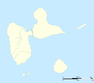 TFFS Location in Guadeloupe | |||||||||||
| Runways | |||||||||||
| |||||||||||
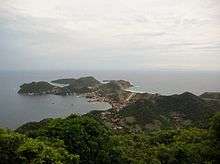
Les Saintes Airport (IATA: LSS, ICAO: TFFS) is an airport serving the archipelago of Îles des Saintes, French West Indies.[1] It is on an isthmus in the middle of Terre-de-Haut Island, a dependency of Guadeloupe.
A special pilot license endorsement is required to land here.[1]
See also
.svg.png)

- Transport in Guadeloupe
- List of airports in Guadeloupe
References
- 1 2 3 TFFS – Les Saintes. AIP from French Service d'information aéronautique, effective 11 October 2018.
- ↑ Airport information for LSS at Great Circle Mapper.
- ↑ Google Maps - Les Saintes
External links
This article is issued from
Wikipedia.
The text is licensed under Creative Commons - Attribution - Sharealike.
Additional terms may apply for the media files.