Mount Tenakourou
| Mount Tenakourou | |
|---|---|
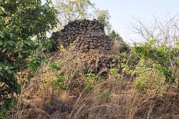 stones at the top of the Tenakourou | |
| Highest point | |
| Elevation | 747 m (2,451 ft) [1] |
| Listing | Country high point |
| Coordinates | 10°45′00″N 5°25′00″W / 10.75000°N 5.41667°WCoordinates: 10°45′00″N 5°25′00″W / 10.75000°N 5.41667°W |
| Geography | |
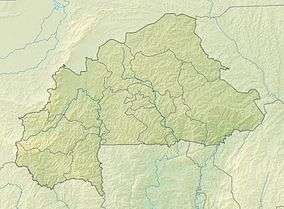 Mount Tenakourou Location in Burkina Faso (on the border with Mali) | |
| Location | Burkina Faso – Mali border |
| Geology | |
| Mountain type | Hill |
Mount Tenakourou is the highest point in Burkina Faso. It is a hill located on the border of the Cascades Region of Burkina Faso and the Sikasso Region of the country of Mali. Tenakourou has an elevation of 747 metres (2,451 ft).
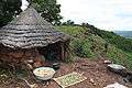 A hut near the summit of Tenakourou
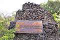 Stones at the top of the Tenakourou
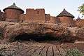 Village on the side of Mount Tenakourou
References
- ↑ "Téna Kourou" on Peakbagger.com Retrieved 30 September 2011
This article is issued from
Wikipedia.
The text is licensed under Creative Commons - Attribution - Sharealike.
Additional terms may apply for the media files.