Purerua Peninsula
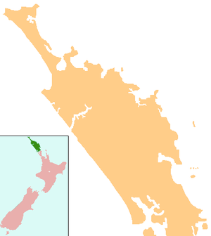
Purerua Peninsula is a peninsula on the northwest side of the Bay of Islands in Northland, New Zealand. Te Puna Inlet lies to the south of the peninsula. Communities on the peninsula are Purerua, Te Tii and Taronui Bay.[1][2] Rangihoua Bay is at the southern end of the peninsula.
Education
Bay of Islands International Academy is a state-funded Year 1-8 New Zealand primary school which opened in January 2013 in the existing buildings and grounds of the former Te Tii School on the Purerua Peninsula, about 17 km north of Kerikeri township. A Purerua Public School had been in existence since 1906, with a ferry service from Te Tii.[3][4] and also, there was a Purerua Public School with a ferry service for pupils from Te Tii.[5] The academy's Māori name is Te Whare Mātauranga o Te Tii.
The academy is an authorised IB World School offering the International Baccalaureate Primary Years Programme. The program emphasises academic achievement, inquiry-style learning and an international, multicultural curriculum.[6] All students are required to learn a second language. The school serves the Kerikeri/Waipapa/Purerua area of New Zealand's Far North District and has capacity for about 100 students. Its role was 117 as of December 2015.[7] An enrolment zone is in effect.
Bay of Islands International Academy is sited on two hectares (five acres) of grounds. Facilities include four classrooms, a library, a resource room, administrative space, a swimming pool, and play areas. The school is connected to the internet via 100Mbit/s fibre optic ultra-fast broadband, and all learning spaces have WiFi coverage. Following the 2013 national census the school shifted from decile 3 to decile 6, indicating a substantial shift in the population of attending students.[8]
Notable people
- Glenn Colquhoun, poet[9]
References
- ↑ Peter Dowling (editor) (2004). Reed New Zealand Atlas. Reed Books. pp. map 5. ISBN 0-7900-0952-8.
- ↑ Roger Smith, GeographX (2005). The Geographic Atlas of New Zealand. Robbie Burton. pp. map 21. ISBN 1-877333-20-4.
- ↑ New Zealand Department of Education (1906). Report. p. 27.
- ↑ Te Kete Ipurangi schools database: Bay of Islands International Academy
- ↑ New Zealand Department of Education (1906). Report. p. 27.
- ↑ International Baccalaureate Organisation website
- ↑ Molloy, Keri (2012-07-26). "New School Planned". The Bay Chronicle.
- ↑ Bay of Islands International Academy website
- ↑ "Northland - Creative Life". Te Ara: The Encyclopedia of New Zealand.