Tarcău Mountains
| Tarcău Mountains | |
|---|---|
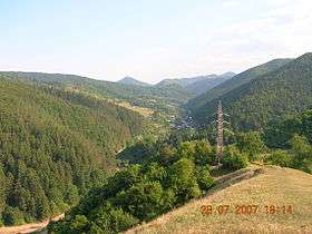 The Tarcău Mountains. View towards the Doamna River valley | |
| Highest point | |
| Peak | Mount Grindușu |
| Elevation | 1,664 m (5,459 ft) |
| Dimensions | |
| Length | 65 km (40 mi) |
| Width | 40 km (25 mi) |
| Area | 1,810 km2 (700 sq mi) |
| Geography | |
| Country | Romania |
| State/Province | Moldavia |
| Range coordinates | 46°46′N 26°16′E / 46.767°N 26.267°ECoordinates: 46°46′N 26°16′E / 46.767°N 26.267°E |
The Tarcău Mountains are a mountain range, part of the Moldavian-Muntenian Carpathians of the Outer Eastern Carpathians.
The range is located between the latitudes 46025 and 46057 N and between the longitudes 25052 and 26028 E. The range is bordered by the following rivers:
- the Bicaz and the Bistriţa to the north
- the Dămuc and Valea Rece to the west
- the Trotuş to the south
To the east they are limited by the subcarpathian hills along a line running approximately from Piatra Neamţ to Moinești. The highest point is Tar-havas at 1663 meters.
References
This article is issued from
Wikipedia.
The text is licensed under Creative Commons - Attribution - Sharealike.
Additional terms may apply for the media files.