Tambre (river)
| Tambre (Río Tambre ) | |
 River Tambre | |
| Country | Spain |
|---|---|
| State | Galicia (Spain) |
| Tributaries | |
| - left | Mera, Sionlla |
| - right | Maruzo, Samo, Lengüelle, Dubra, Barcala |
| Source | Montes de Bocelo |
| - location | Sobrado, A Coruña |
| Length | 134 km (83 mi) |
| Basin | 1,531 km2 (591 sq mi) |
| Discharge | for Ponte Nafonso |
| - average | 54.1[1] m3/s (1,911 cu ft/s) |
| - max | 1,160 m3/s (40,965 cu ft/s) 12 December 1989 |
 Tambre river basin (dark blue) | |
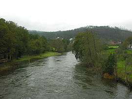
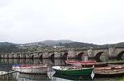
The Tambre is a coastal river that crosses Galicia, in northwestern Spain. Its basin covers 1,531 square kilometres (591 sq mi).
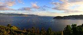
The river flows through the province of A Coruña; the municipalities along its course are Sobrado, Curtis, Vilasantar, Boimorto, Mesía, Frades, Arzúa, O Pino, Oroso, Ordes, Trazo, Tordoia, Santiago de Compostela, Val do Dubra, Ames, A Baña, Brion, Negreira, Outes, Mazaricos, Noia and Lousame. Its mouth forms the Ría de Muros e Noia estuary.
It has been designated a Site of Community Importance.
In ancient times it was called "Támaris", its name being related to that of the River Tamar in Cornwall. It was from the lands north of this river that the Spanish House of Trastámara derived its name (Tras-Támara - "across the Tamara".)
Gallery

See also
References
| Wikimedia Commons has media related to Río Tambre. |