Walls of Tallinn
| Walls of Tallinn (Tallinn City Wall) | |
|---|---|
|
Native name Estonian: Tallinna linnamüür | |
 Tallinn City Wall | |
| Location | Tallinn, Estonia |
| Founded | 13th century |
| Built for | Defense for the City of Tallinn |
| Architectural style(s) | Medieval city wall |
| Official name: Historic Centre (Old Town) of Tallinn | |
| Type | Cultural |
| Criteria | ii, iv |
| Designated | 1997 (21st session) |
| Reference no. | 822 |
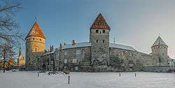
The Walls of Tallinn are the medieval defensive walls constructed around the city of Tallinn in Estonia.
History
The first wall around Tallinn was ordered to be constructed by Margaret Sambiria in 1265 and for that reason, it was known as the Margaret Wall. This wall was less than 5 metres (16 ft) tall and about 1.5 metres (4.9 ft) thick at its base.[1] Since that time it has been enlarged and strengthened. The walls and the many gates are still largely extant today. This is one of the reasons that Tallinn's old town became a World Heritage Site. The walls were enlarged in the fourteenth century, and citizens of Tallinn were required to turn out for guard duty, which meant to wear their armour and demonstrate their readiness to face off invaders.[2]
Objects in the city wall
| Name | Image | Notes | Location | Coordinates |
|---|---|---|---|---|
| Long Leg Gate Tower (Pika jala väravatorn) | 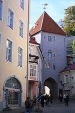 | Pikk jalg | 59°26′15.87″N 24°44′34.33″E / 59.4377417°N 24.7428694°E | |
| Tower behind Almshouse (Seegitagune torn) | destroyed | Nunne | ||
| Tower behind Sauna (Saunatagune torn) | partially extant | Nunne 9 | ||
| Nun's Gate (Nunnavärav) | 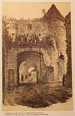 | Demolished in 1868. | Nunne | |
| Nun's Tower (Nunnatorn) | 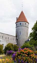 | Väike-Kloostri 1 | 59°26′21.41″N 24°44′32.55″E / 59.4392806°N 24.7423750°E | |
| Monastery Gate (Kloostrivärav) | 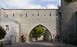 | end of 19th century | Suur-Kloostri | 59°26′22.01″N 24°44′32.51″E / 59.4394472°N 24.7423639°E |
| Sauna Tower (Saunatorn) | 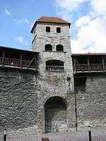 | Suur-Kloostri 18 | 59°26′22.63″N 24°44′32.49″E / 59.4396194°N 24.7423583°E | |
| Golden Leg Tower (Kuldjala torn) | 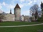 | Gümnaasiumi 3 | 59°26′24.11″N 24°44′33.25″E / 59.4400306°N 24.7425694°E | |
| Tower behind Nuns (Nunnadetagune torn) | 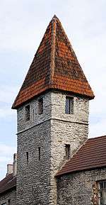 | Kooli 1/3 | 59°26′25.39″N 24°44′34.27″E / 59.4403861°N 24.7428528°E | |
| Loewenschede Tower (Loewenschede torn) | 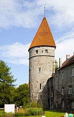 | Kooli 7 | 59°26′26.18″N 24°44′35.99″E / 59.4406056°N 24.7433306°E | |
| Lippe Tower (Lippe torn) | destroyed | Kooli 9 | ||
| passage beside Lippe Tower | 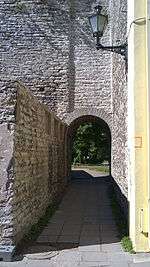 | Built 1933 | Laboratooriumi 21 | 59°26′26.5″N 24°44′38.85″E / 59.440694°N 24.7441250°E |
| Rope Hill Tower (Köismäe torn) | 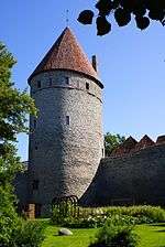 | Laboratooriumi 27 | 59°26′27.4″N 24°44′41.67″E / 59.440944°N 24.7449083°E | |
| breakthrough of Suurtüki street | 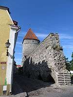 | 19th century | Suurtüki | 59°26′28.24″N 24°44′43.48″E / 59.4411778°N 24.7454111°E |
| Plate Tower (Plate torn) | 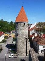 | Laboratooriumi 29 | 59°26′28.63″N 24°44′43.98″E / 59.4412861°N 24.7455500°E | |
| Epping Tower (Eppingi torn) | 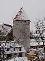 | Laboratooriumi 31 | 59°26′29.82″N 24°44′46.2″E / 59.4416167°N 24.746167°E | |
| Tower behind Grusbeke (Grusbeke-tagune torn) | 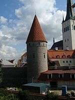 | Laboratooriumi 33 | 59°26′31.22″N 24°44′48.62″E / 59.4420056°N 24.7468389°E | |
| Renten Tower (Renteni torn) | lower part extant inside a later building | Lai 49 | ||
| Tower behind Wulfard (Wulfardi-tagune torn) | lower part extant | Tolli 4 | 59°26′32.3″N 24°44′53.97″E / 59.442306°N 24.7483250°E} | |
| Great Coastal Gate (Suur Rannavärav) | 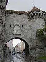 | Pikk 70 | 59°26′33.23″N 24°44′57.44″E / 59.4425639°N 24.7492889°E | |
| Fat Margaret (Paks Margareeta) | 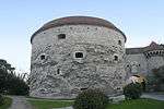 | Pikk 70 | 59°26′33.3″N 24°44′58.72″E / 59.442583°N 24.7496444°E | |
| Stolting Tower (Stoltingi torn) |  | Pikk 68 | 59°26′31.78″N 24°44′58.62″E / 59.4421611°N 24.7496167°E} | |
| Tower behind Hattorpe (Hattorpe-tagune torn) | 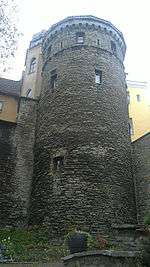 | Pikk 62 | 59°26′29.5″N 24°44′57.6″E / 59.441528°N 24.749333°E | |
| tower near the former Russian church | destroyed | Sulevimägi | ||
| Small Coastal Gate (Väike Rannavärav) | destroyed | |||
| Bremen Tower (Bremeni torn) | 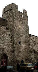 | Vene 28 | 59°26′21.86″N 24°44′57″E / 59.4394056°N 24.74917°E | |
| Bremen Passage (Bremeni käik) | 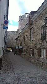 | 19th century | Bremeni käik | 59°26′21.54″N 24°44′57.15″E / 59.4393167°N 24.7492083°E |
| Tower behind Monks (Munkadetagune torn) | 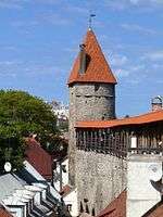 | Müürivahe 58 | 59°26′18.46″N 24°44′58.89″E / 59.4384611°N 24.7496917°E | |
| Helleman Tower (Hellemani torn) | 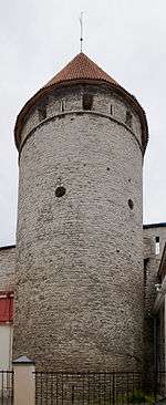 | Müürivahe 48 / Uus 1 | 59°26′15.15″N 24°44′59.82″E / 59.4375417°N 24.7499500°E | |
| Viru Gate (Viru värav) | 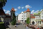 | Viru | 59°26′11.87″N 24°45′1.31″E / 59.4366306°N 24.7503639°E | |
| Hinke Tower (Hinke torn) | 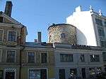 | Pärnu mnt 2 / Müürivahe 32 | 59°26′9.55″N 24°44′57.98″E / 59.4359861°N 24.7494389°E | |
| Düvelsmoder Tower / Devil's Mother's Tower (Düvelsmoderi torn / Kuradiema torn) |  | demolished in 1882 | Väike-Karja/Müürivahe | |
| Lurenburg Artillery Tower (Lurenburgi suurtükitorn) | Built 1538–1554, demolished in 1767 during the expansion of the bastion systems. | Pärnu mnt 7 | ||
| Cattle Gate (Karjavärav) | Built 1456, demolished in 1849 to widen the streets. Was used to transport cattle between the city and pastures. | |||
| Assauwe Tower (Assauwe torn) | 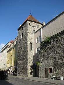 | Müürivahe 12 | 59°26′5.61″N 24°44′43.33″E / 59.4348917°N 24.7453694°E | |
| Harju Gate (Harju värav) |  The main gate after the demolition of the front gates. | Mentioned in 1361, 1448–1453 the second front gate was built. In 1862 the front gates were demolished and in 1875 the main gate. | Harju | 59°26′4.74″N 24°44′37.53″E / 59.4346500°N 24.7437583°E |
| Goat Tower (Kitsetorn) | Rüütli | |||
| Kiek in de Kök | 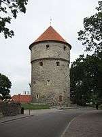 | Komandandi tee 2 | 59°26′5.14″N 24°44′29″E / 59.4347611°N 24.74139°E | |
| Maiden's Tower (Neitsitorn) | 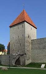 | Lossi plats 11 / Lühike jalg 9A | 59°26′6.8″N 24°44′27.51″E / 59.435222°N 24.7409750°E | |
| Stable Tower (Tallitorn) | 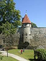 | Lossi plats 11 / Lühike jalg 9A | 59°26′8.43″N 24°44′26.91″E / 59.4356750°N 24.7408083°E | |
| breakthrough from Toompea to Danish King's Garden | 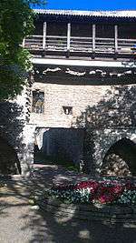 | Lühike jalg | 59°26′8.9″N 24°44′27.14″E / 59.435806°N 24.7408722°E | |
| Short Leg Gate Tower (Lühikese jala väravatorn) | 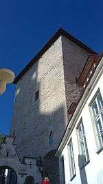 | Lühike jalg 9 | 59°26′10.01″N 24°44′28.15″E / 59.4361139°N 24.7411528°E | |
| Dome Gate (Toomvärav) | 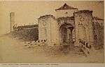 | demolished in 1860. |
Notes
| Wikimedia Commons has media related to City walls of Tallinn. |
- ↑ Andriy Ksenofontov, = Wall Street ... Estonian Times, 15 August 2002
- ↑ Bousfield, Jonathon (2011). The Rough Guide to Estonia, Latvia & Lithuania p.71. p. 392. ISBN 9781848368880.