Takev Point
| Takev Point | |
|---|---|
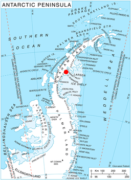 Location of Heros Peninsula in Graham Land, Antarctic Peninsula. | |
 | |
| Location | Graham Land |
| Coordinates | 66°36′17″S 63°54′04″W / 66.60472°S 63.90111°WCoordinates: 66°36′17″S 63°54′04″W / 66.60472°S 63.90111°W |
| Area | Antarctica |
Takev Point (Bulgarian: Такев нос, ‘Takev Nos’ \'ta-kev 'nos\) is the rocky point forming the south extremity of Heros Peninsula on Foyn Coast, Antarctic Peninsula.
The feature is named after Vasiliy Takev, participant in the 1996/97 Bulgarian Antarctic campaign, for his support for the Bulgarian Antarctic programme.
Location
Takev Point is located 4.65 km west-southwest of Spur Point and 8.17 km east-northeast of Varad Point. British mapping in 1974.
Maps
- British Antarctic Territory: Graham Land. Scale 1:250000 topographic map. BAS 250 Series, Sheet SQ 19-20. London, 1974.
- Antarctic Digital Database (ADD). Scale 1:250000 topographic map of Antarctica. Scientific Committee on Antarctic Research (SCAR). Since 1993, regularly upgraded and updated.
References
- Takev Point. SCAR Composite Antarctic Gazetteer.
- Bulgarian Antarctic Gazetteer. Antarctic Place-names Commission. (details in Bulgarian, basic data in English)
This article includes information from the Antarctic Place-names Commission of Bulgaria which is used with permission.
This article is issued from
Wikipedia.
The text is licensed under Creative Commons - Attribution - Sharealike.
Additional terms may apply for the media files.