Swoszowice (Kraków)
| Swoszowice | |
|---|---|
| Dzielnica of Kraków | |
 | |
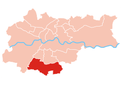 Location of Swoszowice within Kraków | |
| Coordinates: 49°59′10.96″N 19°57′24.73″E / 49.9863778°N 19.9568694°ECoordinates: 49°59′10.96″N 19°57′24.73″E / 49.9863778°N 19.9568694°E | |
| Country |
|
| Voivodeship | Lesser Poland |
| County/City | Kraków |
| Government | |
| • President | Maciej Nazimek |
| Area | |
| • Total | 25.6 km2 (9.9 sq mi) |
| Population (2014) | |
| • Total | 25,608 |
| • Density | 1,000/km2 (2,600/sq mi) |
| Time zone | UTC+1 (CET) |
| • Summer (DST) | UTC+2 (CEST) |
| Area code(s) | +48 12 |
| Website | http://www.dzielnica10.krakow.pl |
Swoszowice is one of 18 districts of Kraków, located in the southern part of the city. The name Swoszowice comes from a village of same name that is now a part of the district.
According to the Central Statistical Office data, the district's area is 25.6 square kilometres (9.88 square miles) and 25 608 people inhabit Swoszowice.[1]
Subdivisions of Swoszowice
Swoszowice is divided into smaller subdivisions (osiedles). Here's a list of them.
- Bania
- Barycz
- Jugowice
- Kliny Borkowskie
- Kosocice
- Lusina
- Łysa Góra
- Opatkowice
- Rajsko
- Siarczana Góra
- Soboniowice
- Swoszowice
- Wróblowice
- Zbydniowice
References
- ↑ "Information about Swoszowice district". Biuletyn Informacji Publicznej. Retrieved 30 August 2017.
External links
| Wikimedia Commons has media related to Swoszowice. |
This article is issued from
Wikipedia.
The text is licensed under Creative Commons - Attribution - Sharealike.
Additional terms may apply for the media files.