Sulu Range
| Sulu Range | |
|---|---|
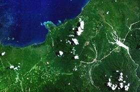 Forested volcanoes of the Sulu Range, NASA Landsat image. | |
| Highest point | |
| Elevation | 610 m (2,000 ft) |
| Prominence | 610 m (2,000 ft) |
| Coordinates | 5°30′S 150°56′E / 5.500°S 150.933°E |
| Geography | |
| Location | New Britain, Papua New Guinea |
| Geology | |
| Mountain type | Stratovolcanoes |
| Last eruption | unknown |
The Sulu Range consists of a group of overlapping small stratovolcanos on the island of New Britain in Papua New Guinea. The highest point in Mount Malopu at the south-western end of the complex. Eruptions from a new vent began in July 2006.
See also
References
"Sulu Range". Global Volcanism Program. Smithsonian Institution.
This article is issued from
Wikipedia.
The text is licensed under Creative Commons - Attribution - Sharealike.
Additional terms may apply for the media files.