Suan Luang District
| Suan Luang สวนหลวง | |
|---|---|
| Khet | |
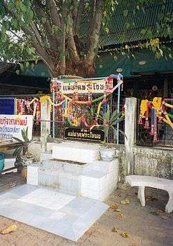 Outer perimeter of the shrine to Mae Nak Phra Khanong at Wat Mahabut. | |
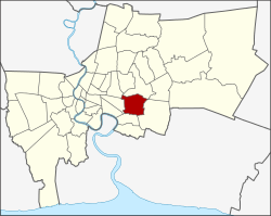 Khet location in Bangkok | |
| Coordinates: 13°43′49″N 100°39′5″E / 13.73028°N 100.65139°ECoordinates: 13°43′49″N 100°39′5″E / 13.73028°N 100.65139°E | |
| Country |
|
| Province | Bangkok |
| Seat | Phatthanakan |
| Khwaeng | 3 |
| Khet established | 14 Jan 1994 |
| Area | |
| • Total | 23.678 km2 (9.142 sq mi) |
| Population (2017) | |
| • Total | 122,534[1] |
| • Density | 5,175.01/km2 (13,403.2/sq mi) |
| Time zone | UTC+7 (ICT) |
| Postal code | 10250 |
| Geocode | 1034 |
Suan Luang (Thai: สวนหลวง, pronounced [sǔa̯n lǔa̯ŋ]) is one of the 50 districts (khet) of Bangkok, Thailand. It is bounded by other Bangkok districts (from north clockwise): Bang Kapi, Saphan Sung, Prawet, Phra Khanong, and Watthana.
History
Suan Luang was a sub-district of Phra Khanong district. When Phra Khanong district was split into smaller districts on 9 November 1989, Suan Luang became part of the new Prawet district. On 14 January 1994 (based on announcement 8 October 1993) Suan Luang was elevated to a district, merging the area once belong to Suan Luang sub-district with additional land from Prawet and Khlong Toei. The combined area is still called Suan Luang sub-district, and it is the only sub-district within Suan Luang district.
Administration
The district has three sub-districts (khwaeng).
| 1. | Suan Luang | สวนหลวง | |
| 2. | On Nut | อ่อนนุช | |
| 3. | Phatthanakan | พัฒนาการ |
Places
Education
References
- ↑ "Population and House Report for Year 2017 (see page 2 for data of this district)". Department of Provincial Administration, Ministry of Internal Affairs. Retrieved 2018-04-01. (Search page)
- ↑ "Contact." St. Mark's International School Bangkok. Retrieved on 6 Mar 2013. "St. Mark's International School 900 New Rama 9 Rd, Suan Luang, Bangkok 10250"
External links
.svg.png)