Stromberg (landscape)
| Stromberg | |
|---|---|
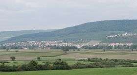 Stromberg main chain with the Hohenhaslach in the Kirbach valley and the Brackenheim 1 transmission tower (on the horizon) from the south | |
| Highest point | |
| Peak | Baiselsberg |
| Elevation | 476.6 m above NN |
| Geography | |
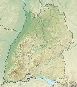 | |
| State | counties of Enzkreis, Karlsruhe, Heilbronn and Ludwigsburg, Baden-Württemberg, Germany |
| Range coordinates | 49°00′14″N 8°59′19″E / 49.003750°N 8.98861°ECoordinates: 49°00′14″N 8°59′19″E / 49.003750°N 8.98861°E |
| Parent range | South German Scarplands |
| Geology | |
| Orogeny | Schichtstufe |
| Type of rock | Keuper, Reed sandstone, Lower Bunter Marl, Upper Bunter Marl, Stubensandstein |
The Stromberg is a heavily forested hill ridge up to 476.6 m above sea level (NN) in the northern part of the German state of Baden-Württemberg.
Literature
- Dieter Buck (2006) (in German), Das große Buch vom Stromberg-Heuchelberg. Natur, Kultur, Geschichte, Orte (1. ed.), Tübingen: Silberburg-Verlag, ISBN 3-87407-704-7
- Karl Eduard Paulus: Beschreibung des Oberamts Brackenheim. Hrsg. von dem Königlichen statistisch-topographischen Bureau. H. Lindemann, Stuttgart 1873, Wikisource
- Karl Eduard Paulus: Beschreibung des Oberamts Vaihingen. Hrsg. von dem Königlichen statistisch-topographischen Bureau. Hallberger, Stuttgart 1856. Wikisource
References
External links
- Natural region fact file Strom- und Heuchelberg (124) – LUBW (pdf, 7,3 MB)
- Map of the Stromberg at: Map services of the Baden-Württemberg State Office for the Environment, Survey and Conservation (Landesanstalt für Umwelt, Messungen und Naturschutz Baden-Württemberg)
- Website of the nature park with information on its geology
- Nature in the Stromberg
This article is issued from
Wikipedia.
The text is licensed under Creative Commons - Attribution - Sharealike.
Additional terms may apply for the media files.