Steventon Island
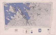
Steventon Island (77°15′S 148°15′W / 77.250°S 148.250°WCoordinates: 77°15′S 148°15′W / 77.250°S 148.250°W) is a broad ice-covered island about 39 km (24 mi) long off of Antarctica, lying west of Court Ridge in the Sulzberger Ice Shelf. It is 45 km (28 mi) long and 27 km (16.8 mi) wide, and covers an area of around 780 km² (301 sq mi). It was mapped from surveys by the United States Geological Survey (USGS) and U.S. Navy air photos (1959–65), and named by the Advisory Committee on Antarctic Names (US-ACAN) for Richard F. Steventon, USN, Petty Officer in charge of Eights Station, 1963.
![]()