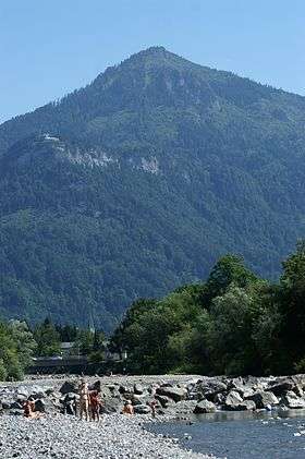
Staufen, Austria
| Staufen | |
|---|---|
 | |
| Highest point | |
| Elevation | 1,465 m (4,806 ft) |
| Prominence | 320 metres (1,050 ft) |
| Isolation | 1.8 kilometres (1.1 mi) |
| Coordinates | 47°22′33.97″N 9°45′16.15″E / 47.3761028°N 9.7544861°ECoordinates: 47°22′33.97″N 9°45′16.15″E / 47.3761028°N 9.7544861°E |
| Geography | |
| Location | Vorarlberg, Austria |
The Staufen is a 1465 meter high mountain in the very western part of Austria. The mountaintop splits the two bordering cities, Dornbirn and Hohenems. The Staufen is connected to the Karren, which belongs to the city of Dornbirn.
This article is issued from
Wikipedia.
The text is licensed under Creative Commons - Attribution - Sharealike.
Additional terms may apply for the media files.