California State Route 259
| ||||
|---|---|---|---|---|
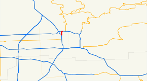 SR 259 highlighted in red | ||||
| Route information | ||||
| Defined by Streets and Highways Code § 559 | ||||
| Maintained by Caltrans | ||||
| Length | 1.48 mi[1] (2.38 km) | |||
| Major junctions | ||||
| South end |
| |||
| North end |
| |||
| Location | ||||
| Counties | San Bernardino | |||
| Highway system | ||||
| ||||

State Route 259 is a very short and unsigned freeway connector that connects Interstate 215 with State Route 210 (former SR 30) in the U.S. state of California. The short freeway has one complete exit (Highland Avenue) and one partial exit (E Street, northbound only), and was previously unsigned for many years. Presently, two shields appear (one in each direction) near the Highland Ave exit as of July 2007. As of January 29, 2008, the northbound sign is no longer in place.
Route description
SR 259 splits off from I-215 as a full freeway and continues north, interchanging with Highland Avenue. SR 259 then turns east and has a partial interchange with E Street before merging with SR 210. SR 259 thus provides a route for traffic to move between I-215 northbound and SR 210 eastbound as well as from SR 210 westbound to I-215 southbound; the interchange between SR 210 and I-215 does not provide these movements.[2]
SR 259 is part of the California Freeway and Expressway System,[3] and is a freeway for its entire length,[2] and is part of the National Highway System,[4] a network of highways that are considered essential to the country's economy, defense, and mobility by the Federal Highway Administration.[5]
History
The portion of SR 30 between I-215 and SR 259 did not exist in the 1960s-1970's, and traffic used SR 259, which was then designated as SR 30.
Exit list
The entire route is in San Bernardino, San Bernardino County.
| mi[6] | km | Exit[6] | Destinations | Notes | |
|---|---|---|---|---|---|
| 0.00 | 0.00 | Southbound exit and northbound entrance; former I-15E south; south end of SR 259; I-215 north exit 45A | |||
| 0.00 | 0.00 | 1A | Base Line Street | Southbound left exit and northbound entrance | |
| 1.45 | 2.33 | 1A | Signed as exit 1B southbound; I-215 south via exit 46B | ||
| 1.50 | 2.41 | 1B | Northbound exit and southbound entrance; former SR 206; I-210 east exit 75 | ||
| 1.50 | 2.41 | Northbound exit and southbound entrance; north end of SR 259; former SR 30 east; I-210 west exit 75B | |||
| 1.000 mi = 1.609 km; 1.000 km = 0.621 mi | |||||
See also

References
- ↑ California Department of Transportation (July 2007). "Log of Bridges on State Highways". Sacramento: California Department of Transportation.
- 1 2 San Bernardino County Road Atlas (Map). Thomas Brothers. 2008.
- ↑ California State Legislature. "Section 250–257". Streets and Highways Code. Sacramento: California State Legislature. Retrieved June 9, 2017.
- ↑ Federal Highway Administration (March 25, 2015). National Highway System: Riverside–San Bernardino, CA (PDF) (Map). Scale not given. Washington, DC: Federal Highway Administration. Retrieved September 3, 2017.
- ↑ Natzke, Stefan; Neathery, Mike & Adderly, Kevin (June 20, 2012). "What is the National Highway System?". National Highway System. Washington, DC: Federal Highway Administration. Retrieved July 1, 2012.
- 1 2 Warring, KS (January 12, 2009). "State Route 259 Freeway Interchanges" (PDF). California Numbered Exit Uniform System. California Department of Transportation. Retrieved September 1, 2014.
External links
| Wikimedia Commons has media related to California State Route 259. |
Route map: